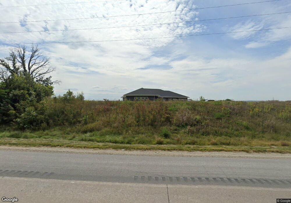
2605 Highway 22 Riverside, IA 52327
Estimated Value: $507,000 - $836,736
6
Beds
3
Baths
2,754
Sq Ft
$244/Sq Ft
Est. Value
About This Home
This home is located at 2605 Highway 22, Riverside, IA 52327 and is currently estimated at $671,868, approximately $243 per square foot. 2605 Highway 22 is a home located in Washington County with nearby schools including Highland High School.
Ownership History
Date
Name
Owned For
Owner Type
Purchase Details
Closed on
Mar 22, 2024
Sold by
Yoder Eric David
Bought by
Brenneman Nicholas R and Brenneman Jocelyn D
Current Estimated Value
Purchase Details
Closed on
Jan 26, 2021
Sold by
Jirsa Tom and Jirsa Martha L
Bought by
Brenneman Nicholas R and Brenneman Jocelyn D
Purchase Details
Closed on
Dec 24, 2009
Sold by
Brenneman Dale M and Brenneman Idelia
Bought by
Brenneman Nicholas R
Home Financials for this Owner
Home Financials are based on the most recent Mortgage that was taken out on this home.
Original Mortgage
$0
Interest Rate
4.78%
Mortgage Type
Undefined Multiple Amounts
Purchase Details
Closed on
Jan 19, 2007
Sold by
Brenneman Dale M and Brenneman Idela
Bought by
Brenneman Nicholas R
Home Financials for this Owner
Home Financials are based on the most recent Mortgage that was taken out on this home.
Original Mortgage
$56,250
Interest Rate
6.22%
Mortgage Type
Purchase Money Mortgage
Create a Home Valuation Report for This Property
The Home Valuation Report is an in-depth analysis detailing your home's value as well as a comparison with similar homes in the area
Purchase History
| Date | Buyer | Sale Price | Title Company |
|---|---|---|---|
| Brenneman Nicholas R | -- | None Listed On Document | |
| Brenneman Nicholas R | $102,000 | None Available | |
| Brenneman Nicholas R | $330,000 | -- | |
| Brenneman Nicholas R | $125,000 | -- |
Source: Public Records
Mortgage History
| Date | Status | Borrower | Loan Amount |
|---|---|---|---|
| Previous Owner | Brenneman Nicholas R | $0 | |
| Previous Owner | Brenneman Nicholas R | $165,689 | |
| Previous Owner | Brenneman Nicholas R | $56,250 |
Source: Public Records
Tax History
| Year | Tax Paid | Tax Assessment Tax Assessment Total Assessment is a certain percentage of the fair market value that is determined by local assessors to be the total taxable value of land and additions on the property. | Land | Improvement |
|---|---|---|---|---|
| 2025 | $6,244 | $893,800 | $25,900 | $867,900 |
| 2024 | $6,244 | $414,600 | $22,700 | $391,900 |
| 2023 | $2,838 | $248,800 | $22,700 | $226,100 |
| 2022 | $2,354 | $159,100 | $16,400 | $142,700 |
| 2021 | $2,354 | $145,600 | $17,700 | $127,900 |
| 2020 | $1,778 | $115,500 | $17,500 | $98,000 |
| 2019 | $1,806 | $115,500 | $17,500 | $98,000 |
| 2018 | $1,692 | $123,800 | $23,900 | $99,900 |
| 2017 | $1,592 | $120,300 | $23,900 | $96,400 |
| 2016 | $1,710 | $114,900 | $0 | $0 |
| 2015 | $1,710 | $101,600 | $0 | $0 |
| 2014 | $1,600 | $101,600 | $0 | $0 |
Source: Public Records
Map
Nearby Homes
- 1122 Pelican Dr
- 0.64 Acres M/L Boise St
- 281 Washington St
- 1159 Tulip Ave
- 410 Ella St
- 445 Galileo Dr
- 433 Galileo Dr
- 114 Cherry Ln
- Lot 45 Kleopfer Ave Unit 45 HIGHLAND HGTS ADD
- 11 Windmill Ct
- 608 5th St
- Lot 2 Windmill View Ct
- Lot 82 Timberline Terrace
- Lot 7 N Ridge Place
- 220 A Ave Unit 3
- 834 1st Place
- Lot 68 Timberline Estates
- Lot 67 Timberline Estates
- Lot 70 Timberline Estates
- Lot 66 Timberline Estates
- 2590 Highway 22
- 2620 Highway 22
- 2620 Highway 22
- 2626 Highway 22
- 2616 Highway 22
- 2630 Highway 22
- 2556 Highway 22
- 2640 Highway 22
- 2646 Highway 22
- 2542 Highway 22
- 2510 Highway 22
- 2540 Highway 22
- 2528 Highway 22
- 2527 Highway 22
- 2524 Highway 22
- 2673 Highway 22
- 2673 Highway 22
- 1105 Redwood Ave
- 1153 Redwood Ave
- 2690 Highway 22
Your Personal Tour Guide
Ask me questions while you tour the home.