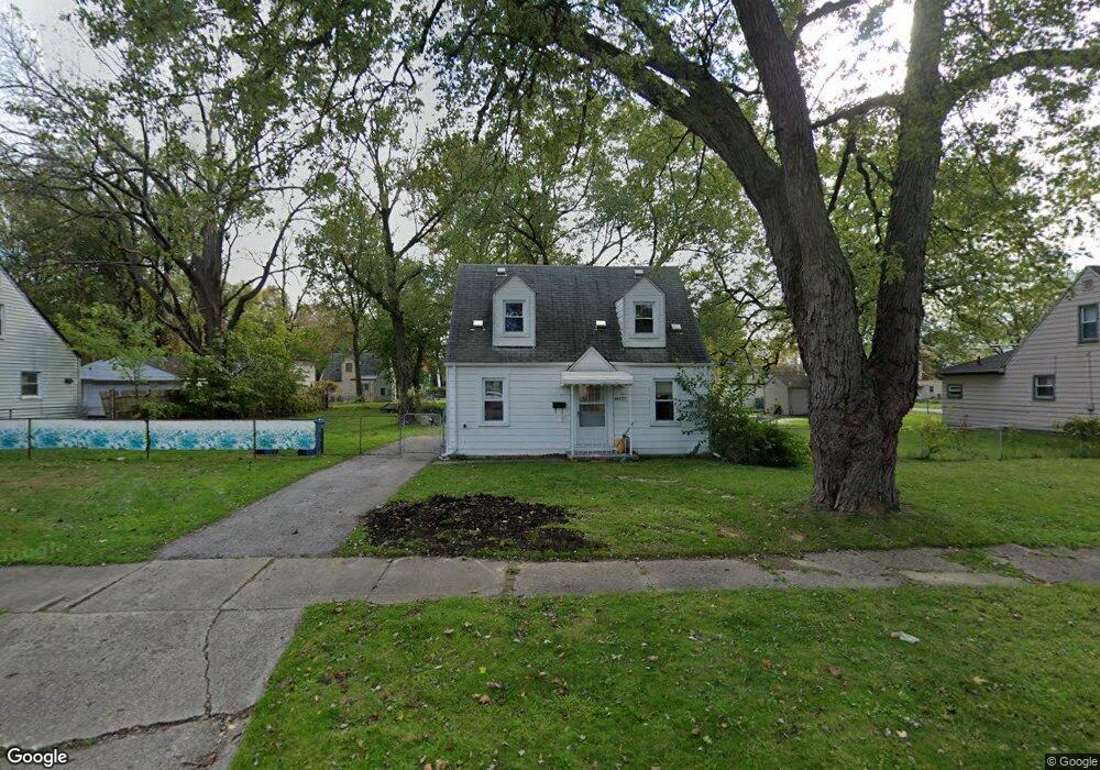
26055 Powers Ave Dearborn Heights, MI 48125
Estimated Value: $128,000 - $145,403
2
Beds
1
Bath
715
Sq Ft
$193/Sq Ft
Est. Value
About This Home
This home is located at 26055 Powers Ave, Dearborn Heights, MI 48125 and is currently estimated at $138,101, approximately $193 per square foot. 26055 Powers Ave is a home located in Wayne County with nearby schools including Quest Charter Academy, West Village Academy, and Peterson-Warren Academy.
Ownership History
Date
Name
Owned For
Owner Type
Purchase Details
Closed on
Jul 23, 2009
Sold by
Koths Diane and Cousins Michael C
Bought by
Dixon Nancy
Current Estimated Value
Home Financials for this Owner
Home Financials are based on the most recent Mortgage that was taken out on this home.
Original Mortgage
$17,297
Interest Rate
5.43%
Mortgage Type
FHA
Purchase Details
Closed on
Apr 5, 2008
Sold by
Cousins Michael C
Bought by
Koths Diane
Create a Home Valuation Report for This Property
The Home Valuation Report is an in-depth analysis detailing your home's value as well as a comparison with similar homes in the area
Home Values in the Area
Average Home Value in this Area
Purchase History
| Date | Buyer | Sale Price | Title Company |
|---|---|---|---|
| Dixon Nancy | -- | Chicago Title | |
| Koths Diane | -- | None Available | |
| Koths Diane | -- | None Available |
Source: Public Records
Mortgage History
| Date | Status | Borrower | Loan Amount |
|---|---|---|---|
| Closed | Dixon Nancy | $17,297 |
Source: Public Records
Tax History Compared to Growth
Tax History
| Year | Tax Paid | Tax Assessment Tax Assessment Total Assessment is a certain percentage of the fair market value that is determined by local assessors to be the total taxable value of land and additions on the property. | Land | Improvement |
|---|---|---|---|---|
| 2025 | $1,555 | $63,100 | $0 | $0 |
| 2024 | $1,555 | $52,400 | $0 | $0 |
| 2023 | $1,651 | $45,000 | $0 | $0 |
| 2022 | $1,794 | $37,900 | $0 | $0 |
| 2021 | $1,716 | $33,400 | $0 | $0 |
| 2019 | $1,575 | $26,500 | $0 | $0 |
| 2018 | $1,344 | $25,000 | $0 | $0 |
| 2017 | $644 | $24,300 | $0 | $0 |
| 2016 | $1,618 | $24,700 | $0 | $0 |
| 2015 | $2,300 | $23,000 | $0 | $0 |
| 2013 | $2,500 | $26,100 | $0 | $0 |
| 2010 | -- | $27,800 | $0 | $0 |
Source: Public Records
Map
Nearby Homes
- 26106 Powers Ave
- 25926 Powers Ave
- 25965 Currier St
- 26225 McDonald St
- 25628 Powers Ave
- 25895 Annapolis St
- 26532 Powers Ave
- 5845 Beech Daly Rd
- 5961 Marvin St
- 5842 Janet St
- 5961 Beech Daly Rd
- 4863 Glenis St
- 26439 Hopkins St
- 25474 McDonald St
- 5904 Janet St
- 26159 Stanford St
- 5118 Michael St
- 26458 Hopkins St
- 6075 Duncan St
- 5993 John Daly St
- 26095 Powers Ave
- 26037 Powers Ave
- 26015 Powers Ave
- 25975 Powers Ave
- 26056 Powers Ave
- 26038 Powers Ave
- 26076 Powers Ave
- 26096 Currier St
- 26096 Powers Ave
- 26105 Powers Ave
- 26022 Currier St
- 26066 Currier St
- 25963 Powers Ave
- 26014 Currier St
- 26115 Powers Ave
- 25951 Powers Ave
- 25986 Currier St
- 26125 Powers Ave
- 26116 Powers Ave
- 25941 Powers Ave