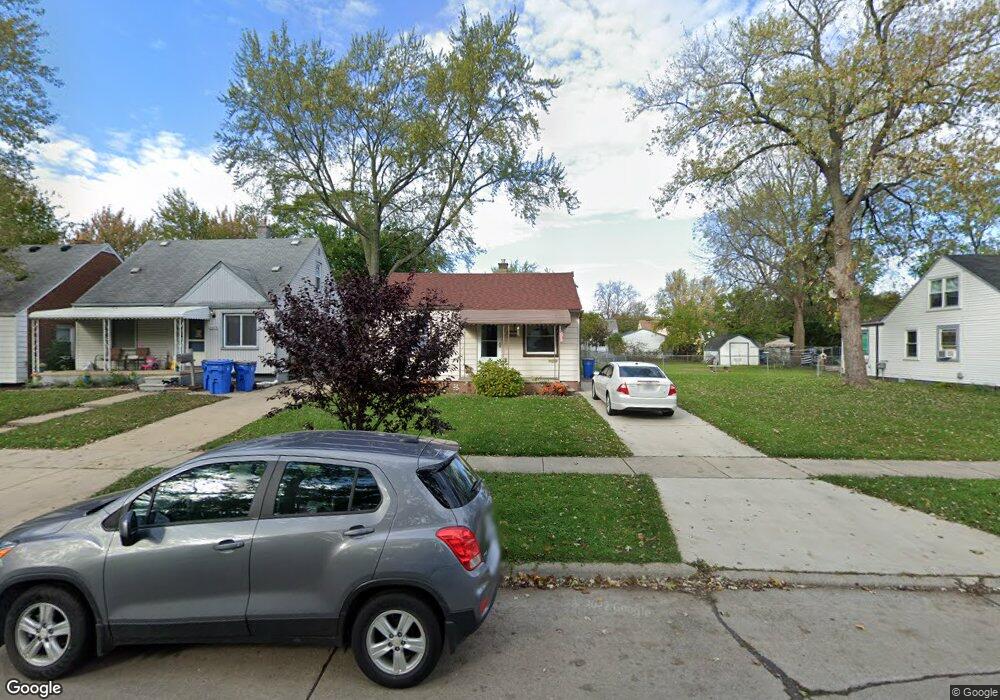
26056 Powers Ave Dearborn Heights, MI 48125
Estimated Value: $135,029 - $147,000
3
Beds
1
Bath
967
Sq Ft
$146/Sq Ft
Est. Value
About This Home
This home is located at 26056 Powers Ave, Dearborn Heights, MI 48125 and is currently estimated at $141,507, approximately $146 per square foot. 26056 Powers Ave is a home located in Wayne County with nearby schools including Quest Charter Academy, West Village Academy, and Peterson-Warren Academy.
Ownership History
Date
Name
Owned For
Owner Type
Purchase Details
Closed on
Jun 18, 2010
Sold by
Meyers Rodney
Bought by
Meyers Ralph and Meyers Reba
Current Estimated Value
Purchase Details
Closed on
Jan 6, 2009
Sold by
Preston Steven C
Bought by
Meyers Rodney
Purchase Details
Closed on
Mar 12, 2008
Sold by
Everhome Mortgage Co
Bought by
Hud
Purchase Details
Closed on
Sep 5, 2007
Sold by
Dudzinski Michelle and Dudzinski Michelle H
Bought by
Everhome Mortgage Co
Purchase Details
Closed on
May 1, 2000
Sold by
Mckeel Keith B
Bought by
Dudzinski Michell H
Purchase Details
Closed on
Sep 2, 1997
Sold by
Mckeel Kenneth H
Bought by
Mckeel Keith B
Create a Home Valuation Report for This Property
The Home Valuation Report is an in-depth analysis detailing your home's value as well as a comparison with similar homes in the area
Home Values in the Area
Average Home Value in this Area
Purchase History
| Date | Buyer | Sale Price | Title Company |
|---|---|---|---|
| Meyers Ralph | -- | None Available | |
| Meyers Rodney | $15,500 | None Available | |
| Hud | -- | None Available | |
| Everhome Mortgage Co | $92,401 | None Available | |
| Dudzinski Michell H | $74,900 | -- | |
| Mckeel Keith B | -- | -- |
Source: Public Records
Tax History Compared to Growth
Tax History
| Year | Tax Paid | Tax Assessment Tax Assessment Total Assessment is a certain percentage of the fair market value that is determined by local assessors to be the total taxable value of land and additions on the property. | Land | Improvement |
|---|---|---|---|---|
| 2025 | $880 | $55,000 | $0 | $0 |
| 2024 | $880 | $45,100 | $0 | $0 |
| 2023 | $790 | $38,700 | $0 | $0 |
| 2022 | $1,073 | $32,800 | $0 | $0 |
| 2021 | $1,074 | $29,200 | $0 | $0 |
| 2019 | $979 | $22,900 | $0 | $0 |
| 2018 | $684 | $21,100 | $0 | $0 |
| 2017 | $538 | $20,400 | $0 | $0 |
| 2016 | $930 | $20,700 | $0 | $0 |
| 2015 | $1,920 | $19,200 | $0 | $0 |
| 2013 | $2,060 | $21,600 | $0 | $0 |
| 2010 | -- | $26,200 | $0 | $0 |
Source: Public Records
Map
Nearby Homes
- 26106 Powers Ave
- 25926 Powers Ave
- 26225 McDonald St
- 25965 Currier St
- 25895 Annapolis St
- 26532 Powers Ave
- 25628 Powers Ave
- 26439 Hopkins St
- 26159 Stanford St
- 4863 Glenis St
- 26458 Hopkins St
- 25474 McDonald St
- 5845 Beech Daly Rd
- 26202 Colgate St
- 26231 Andover St
- 5961 Marvin St
- 5842 Janet St
- 5118 Michael St
- 5961 Beech Daly Rd
- 25866 Andover St
- 26076 Powers Ave
- 26096 Powers Ave
- 26038 Powers Ave
- 26047 Pennie St
- 26073 Pennie St
- 26055 Powers Ave
- 26039 Pennie St
- 26063 Pennie St
- 26037 Powers Ave
- 26095 Powers Ave
- 25975 Pennie St
- 26116 Powers Ave
- 26015 Powers Ave
- 26105 Pennie St
- 25950 Powers Ave
- 25963 Pennie St
- 25975 Powers Ave
- 26126 Powers Ave
- 26115 Pennie St
- 26105 Powers Ave