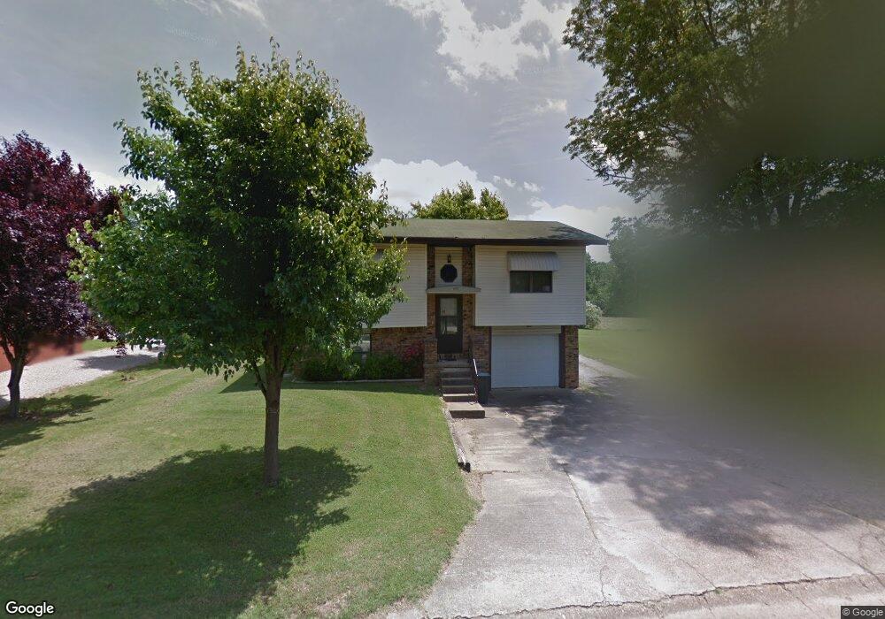
2606 National Ave Poplar Bluff, MO 63901
Estimated Value: $98,772 - $145,000
--
Bed
--
Bath
1,227
Sq Ft
$104/Sq Ft
Est. Value
About This Home
This home is located at 2606 National Ave, Poplar Bluff, MO 63901 and is currently estimated at $127,443, approximately $103 per square foot. 2606 National Ave is a home with nearby schools including Eugene Field Elementary School, Poplar Bluff Fifth & Sixth Grade Center, and Poplar Bluff Junior High School.
Ownership History
Date
Name
Owned For
Owner Type
Purchase Details
Closed on
Feb 10, 2023
Sold by
Darnell Jeffery A and Darnell Monda J
Bought by
Jeffery A Darnell And Monda J Darnell Revocab
Current Estimated Value
Purchase Details
Closed on
Oct 27, 2017
Sold by
Conley Claude and Conley Carol J
Bought by
Darnell Jeffrey A and Darnell Monda J
Home Financials for this Owner
Home Financials are based on the most recent Mortgage that was taken out on this home.
Original Mortgage
$45,000
Interest Rate
3.78%
Mortgage Type
Future Advance Clause Open End Mortgage
Create a Home Valuation Report for This Property
The Home Valuation Report is an in-depth analysis detailing your home's value as well as a comparison with similar homes in the area
Home Values in the Area
Average Home Value in this Area
Purchase History
| Date | Buyer | Sale Price | Title Company |
|---|---|---|---|
| Jeffery A Darnell And Monda J Darnell Revocab | -- | -- | |
| Darnell Jeffrey A | -- | None Available |
Source: Public Records
Mortgage History
| Date | Status | Borrower | Loan Amount |
|---|---|---|---|
| Previous Owner | Darnell Jeffrey A | $45,000 |
Source: Public Records
Tax History Compared to Growth
Tax History
| Year | Tax Paid | Tax Assessment Tax Assessment Total Assessment is a certain percentage of the fair market value that is determined by local assessors to be the total taxable value of land and additions on the property. | Land | Improvement |
|---|---|---|---|---|
| 2024 | $6 | $11,970 | $0 | $0 |
| 2023 | $578 | $11,970 | $0 | $0 |
| 2022 | $558 | $11,580 | $0 | $0 |
| 2021 | $559 | $11,580 | $0 | $0 |
| 2020 | $541 | $11,060 | $0 | $0 |
| 2019 | $540 | $11,060 | $0 | $0 |
| 2018 | $540 | $11,060 | $0 | $0 |
| 2017 | -- | $11,060 | $0 | $0 |
| 2016 | -- | $11,060 | $0 | $0 |
| 2015 | -- | $11,060 | $0 | $0 |
| 2014 | -- | $10,320 | $0 | $0 |
| 2012 | $440 | $10,320 | $0 | $0 |
Source: Public Records
Map
Nearby Homes
- 2024 Glendale Rd
- 2801 Bedoll Ave
- 2925 Wayne Ave
- 1110 Commerce St
- 2121 Pike St
- 1039 Franklin St
- 1025 Delano St
- 1315 S 11th St
- 2335 Cheshire Blvd
- 1000 W Victor St
- 712 Nickey St
- 622 Nickey St
- 912 Adam St
- 1905 Kentucky Ave
- 163 Fairway Dr
- 0 County Road 301
- 1708 Kentucky Ave
- 112 Kaylee Cir
- 2011 Arkansas Ave
- 813 Kendall Dr
- 2600 National Ave
- 2613 National Ave
- 2614 National Ave
- 1906 Glendale Rd
- 2518 National Ave
- 1901 Fernwood Rd
- 2512 National Ave
- 1905 Glendale Rd
- 1912 Glendale Rd
- 2513 National Ave
- 1911 Fernwood Rd
- 1902 Fernwood Rd
- 1911 Glendale Rd
- 2507 National Ave
- 1917 Glendale Rd
- 1912 Fernwood Rd
- 1919 Fernwood Rd
- 1918 Glendale Rd
- 1924 Glendale Rd
- 1908 Brentwood Rd