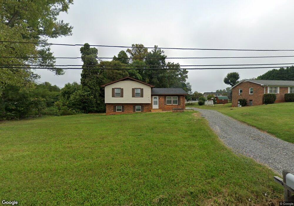
2607 Westfield Rd Mount Airy, NC 27030
Estimated Value: $178,000 - $230,000
3
Beds
2
Baths
1,561
Sq Ft
$131/Sq Ft
Est. Value
About This Home
This home is located at 2607 Westfield Rd, Mount Airy, NC 27030 and is currently estimated at $205,210, approximately $131 per square foot. 2607 Westfield Rd is a home with nearby schools including Bruce H. Tharrington Elementary School, Mount Airy Middle School, and Mount Airy High School.
Ownership History
Date
Name
Owned For
Owner Type
Purchase Details
Closed on
Dec 31, 2013
Sold by
Goins Bobby Dale and Goins Dana L
Bought by
Goins Franklin Dale and Goins Kayla Lynn
Current Estimated Value
Purchase Details
Closed on
Nov 10, 2011
Sold by
Davis Joseph M and Davis Betsy H
Bought by
Goins Bobby D and Goins Dana L
Purchase Details
Closed on
Nov 12, 2010
Sold by
Hiatt Don W and Hiatt Betty W
Bought by
Davis Joseph M and Davis Betsy H
Purchase Details
Closed on
Jul 1, 1977
Create a Home Valuation Report for This Property
The Home Valuation Report is an in-depth analysis detailing your home's value as well as a comparison with similar homes in the area
Home Values in the Area
Average Home Value in this Area
Purchase History
| Date | Buyer | Sale Price | Title Company |
|---|---|---|---|
| Goins Franklin Dale | -- | None Available | |
| Goins Bobby D | $23,500 | None Available | |
| Davis Joseph M | -- | None Available | |
| -- | -- | -- |
Source: Public Records
Tax History Compared to Growth
Tax History
| Year | Tax Paid | Tax Assessment Tax Assessment Total Assessment is a certain percentage of the fair market value that is determined by local assessors to be the total taxable value of land and additions on the property. | Land | Improvement |
|---|---|---|---|---|
| 2025 | $656 | $89,320 | $10,000 | $79,320 |
| 2024 | $600 | $75,830 | $10,000 | $65,830 |
| 2023 | $591 | $75,830 | $10,000 | $65,830 |
| 2022 | $591 | $75,830 | $10,000 | $65,830 |
| 2021 | $600 | $75,830 | $10,000 | $65,830 |
| 2020 | $583 | $71,090 | $10,000 | $61,090 |
| 2019 | $580 | $71,090 | $10,000 | $61,090 |
| 2018 | $579 | $71,090 | $0 | $0 |
| 2017 | $577 | $71,090 | $0 | $0 |
| 2016 | $570 | $71,090 | $0 | $0 |
| 2013 | -- | $72,230 | $0 | $0 |
Source: Public Records
Map
Nearby Homes
- 2384 Westfield Rd
- 2326 Westfield Rd
- 200 Englewood Trail
- 280 Burke Rd
- 124 Rocky Ln
- 1513 Pittman St
- 00 Paynetown Rd
- 00 S Andy Griffith Pkwy
- TBD S Andy Griffith Pkwy
- 226 Hamburg St
- 177 Janice Dr
- 208 Holly Ave
- 845 Linville Rd
- 201 Circle View Rd
- Tbd Farmbrook Rd
- 01 Farmbrook Rd
- 000000 Farmbrook Rd
- 00000 Farmbrook Rd
- 02 Farmbrook Rd
- 00 Farmbrook Rd
- 2591 Westfield Rd
- 123 Brenda Dr
- 2598 Westfield Rd
- 2614 Westfield Rd
- 2588 Westfield Rd
- 2583 Westfield Rd
- 112 Brenda Dr
- 131 Brenda Dr
- 121 Scenic View Dr
- 2563 Westfield Rd
- 141 Brenda Dr
- 2564 Westfield Rd
- 141 Scenic View Dr
- 122 Rolling Hill Dr
- 112 Ezra Trail
- 2641 Westfield Rd
- 153 Scenic View Dr
- 148 Brenda Dr
- 128 Rolling Hill Dr
- 142 Rolling Hill Dr