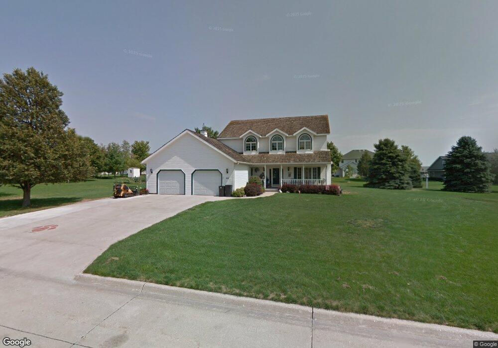
2608 Ashwood Dr Carroll, IA 51401
Estimated Value: $483,000 - $578,000
4
Beds
4
Baths
2,762
Sq Ft
$187/Sq Ft
Est. Value
About This Home
This home is located at 2608 Ashwood Dr, Carroll, IA 51401 and is currently estimated at $517,310, approximately $187 per square foot. 2608 Ashwood Dr is a home with nearby schools including Fairview Elementary School, Adams Elementary School, and Carroll Middle School.
Ownership History
Date
Name
Owned For
Owner Type
Purchase Details
Closed on
Jul 1, 2009
Sold by
Onken Dean R and Onken Lori L
Bought by
Cheney Ronald A and Cheney Karla K
Current Estimated Value
Home Financials for this Owner
Home Financials are based on the most recent Mortgage that was taken out on this home.
Original Mortgage
$297,000
Interest Rate
4.86%
Mortgage Type
Future Advance Clause Open End Mortgage
Create a Home Valuation Report for This Property
The Home Valuation Report is an in-depth analysis detailing your home's value as well as a comparison with similar homes in the area
Home Values in the Area
Average Home Value in this Area
Purchase History
| Date | Buyer | Sale Price | Title Company |
|---|---|---|---|
| Cheney Ronald A | $330,000 | None Available |
Source: Public Records
Mortgage History
| Date | Status | Borrower | Loan Amount |
|---|---|---|---|
| Closed | Cheney Ronald A | $297,000 |
Source: Public Records
Tax History Compared to Growth
Tax History
| Year | Tax Paid | Tax Assessment Tax Assessment Total Assessment is a certain percentage of the fair market value that is determined by local assessors to be the total taxable value of land and additions on the property. | Land | Improvement |
|---|---|---|---|---|
| 2025 | $5,608 | $499,080 | $61,200 | $437,880 |
| 2024 | $5,498 | $427,650 | $61,200 | $366,450 |
| 2023 | $6,059 | $427,650 | $61,200 | $366,450 |
| 2022 | $6,054 | $396,800 | $50,400 | $346,400 |
| 2021 | $5,752 | $396,800 | $50,400 | $346,400 |
| 2020 | $5,876 | $396,800 | $50,400 | $346,400 |
| 2019 | $5,974 | $396,800 | $50,400 | $346,400 |
| 2018 | $5,626 | $396,800 | $50,400 | $346,400 |
| 2017 | $5,624 | $392,775 | $58,550 | $334,225 |
| 2016 | $5,254 | $367,080 | $0 | $0 |
| 2015 | $5,254 | $333,070 | $0 | $0 |
| 2014 | $4,712 | $333,070 | $0 | $0 |
Source: Public Records
Map
Nearby Homes
- 2340 Skyline Dr
- 219 Windwood Dr
- 265 Perch St
- 746 Granada Rd
- 1546 Olive St
- 1550 Edgewood Dr
- 611 W 21st St
- 1601 N Main St
- 711 W 21st St
- 1515 N Main St
- 1852 Quint Ave
- 638 Capistrano Ave
- 1509 Birch St
- 641 Alta Vista Dr
- 1320 N Adams St
- 631 W 17th St
- 1810 Crestview Dr
- 1608 Salinger Ave
- 1137 High Ridge Rd
- 1108 N Main St
- 2530 Ashwood Dr
- 2628 Ashwood Dr
- 2605 Forest St
- 2615 Ashwood Dr
- 2615 Forest St
- 2605 Ashwood Dr
- 2529 Forest St
- 2529 Ashwood Dr
- 2625 Forest St
- 2625 Ashwood Dr
- 2520 Ashwood Dr
- 2517 Forest St
- 2608 Forest St
- 2706 Ashwood Dr
- 2528 Forest St
- 2626 Forest St
- 2707 Forest St
- 2532 N Grant Rd
- 2614 N Grant Rd
- 2506 Ashwood Dr