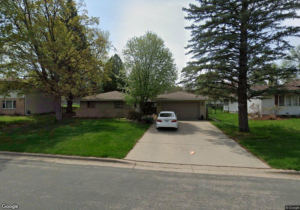
2609 Hayes Dr Burnsville, MN 55337
Estimated Value: $421,000 - $442,394
4
Beds
3
Baths
1,862
Sq Ft
$231/Sq Ft
Est. Value
About This Home
This home is located at 2609 Hayes Dr, Burnsville, MN 55337 and is currently estimated at $430,599, approximately $231 per square foot. 2609 Hayes Dr is a home located in Dakota County with nearby schools including Burnsville High School, Gateway STEM Academy, and Sunrise International Montessori School.
Ownership History
Date
Name
Owned For
Owner Type
Purchase Details
Closed on
Apr 30, 1998
Sold by
Langdon James K and Langdon Kathryn R
Bought by
Roscoe Andrew G and Roscoe Nancy A
Current Estimated Value
Create a Home Valuation Report for This Property
The Home Valuation Report is an in-depth analysis detailing your home's value as well as a comparison with similar homes in the area
Home Values in the Area
Average Home Value in this Area
Purchase History
| Date | Buyer | Sale Price | Title Company |
|---|---|---|---|
| Roscoe Andrew G | $140,750 | -- |
Source: Public Records
Tax History Compared to Growth
Tax History
| Year | Tax Paid | Tax Assessment Tax Assessment Total Assessment is a certain percentage of the fair market value that is determined by local assessors to be the total taxable value of land and additions on the property. | Land | Improvement |
|---|---|---|---|---|
| 2024 | $4,614 | $437,600 | $91,900 | $345,700 |
| 2023 | $4,600 | $435,600 | $92,000 | $343,600 |
| 2022 | $3,886 | $428,400 | $91,700 | $336,700 |
| 2021 | $3,882 | $362,900 | $79,800 | $283,100 |
| 2020 | $3,870 | $344,800 | $72,800 | $272,000 |
| 2019 | $3,682 | $332,200 | $69,300 | $262,900 |
| 2018 | $3,672 | $302,600 | $66,000 | $236,600 |
| 2017 | $3,461 | $293,400 | $62,900 | $230,500 |
| 2016 | $3,688 | $267,500 | $59,900 | $207,600 |
| 2015 | $3,428 | $260,221 | $55,401 | $204,820 |
| 2014 | -- | $251,501 | $54,212 | $197,289 |
| 2013 | -- | $225,014 | $48,912 | $176,102 |
Source: Public Records
Map
Nearby Homes
- 11115 Carver Ct
- 11017 27th Ave S
- 3108 Foxpoint Cir
- 3113 Chandler Ct
- 11036 27th Ave S
- 10934 Southview Dr
- 2001 Woods Ln
- 4165 Old Sibley Hwy
- 11311 W River Hills Dr
- 2177 Cool Stream Cir
- 2007 E 115th St
- 1601 Raleigh Dr
- 11459 Galtier Dr
- 4413 Slater Rd
- 3017 Mcleod St
- 4427 Cinnamon Ridge Cir
- 4425 Cinnamon Ridge Cir
- 4463 Cinnamon Ridge Cir
- 4370 Nicols Rd
- 10325 10th Avenue Cir S
- 2605 Hayes Dr
- 2613 Hayes Dr
- 10823 Hayes Dr
- 2601 Hayes Dr
- 2604 Hayes Dr
- 10804 27th Ave S
- 10819 Hayes Dr
- 2600 Hayes Dr
- 10827 Hayes Dr
- 2513 Hayes Dr
- 10716 27th Ave S
- 10801 27th Ave S
- 10815 Hayes Dr
- 2700 Hayes Dr
- 10711 Prescott Ct
- 10723 27th Ave S
- 10808 27th Ave S
- 10719 27th Ave S
- 10831 Hayes Dr
- 2509 Hayes Dr