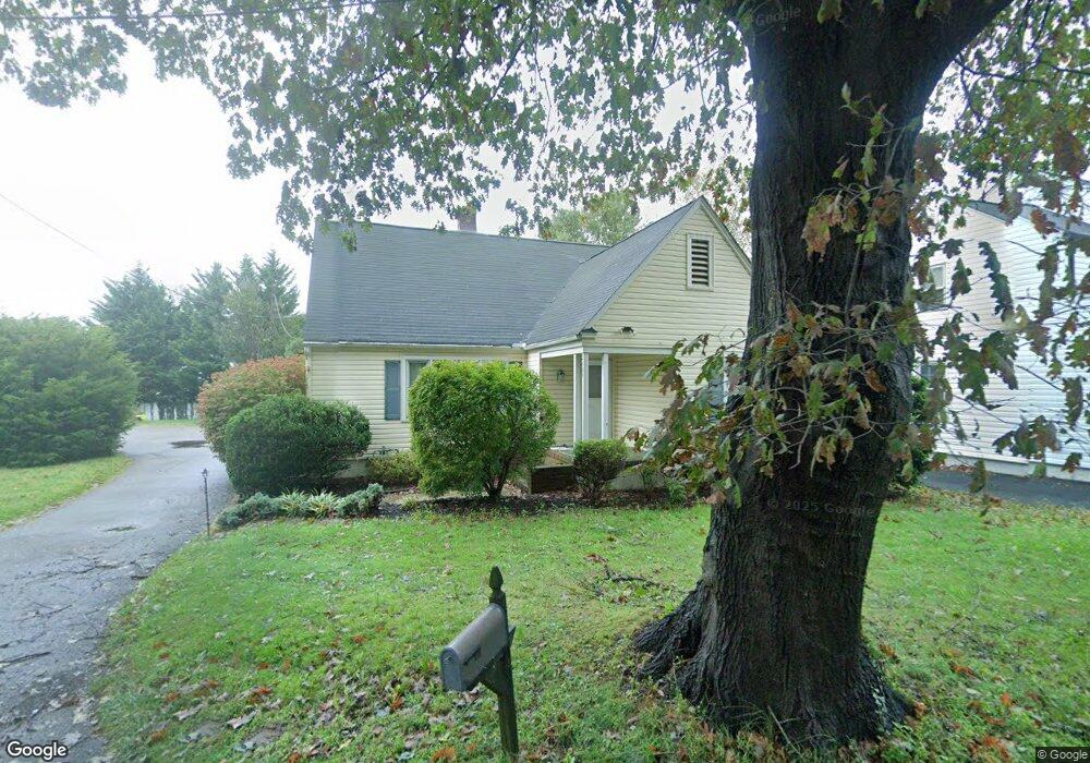
2609 State Route 33 Neptune, NJ 07753
Estimated Value: $573,000 - $601,000
4
Beds
2
Baths
1,715
Sq Ft
$342/Sq Ft
Est. Value
About This Home
This home is located at 2609 State Route 33, Neptune, NJ 07753 and is currently estimated at $585,889, approximately $341 per square foot. 2609 State Route 33 is a home located in Monmouth County with nearby schools including Neptune High School.
Ownership History
Date
Name
Owned For
Owner Type
Purchase Details
Closed on
Sep 12, 2016
Bought by
Loughran Ryan J
Current Estimated Value
Home Financials for this Owner
Home Financials are based on the most recent Mortgage that was taken out on this home.
Original Mortgage
$273,200
Outstanding Balance
$218,292
Interest Rate
3.44%
Estimated Equity
$367,597
Purchase Details
Closed on
Feb 23, 2002
Sold by
Lehmann Gloria
Bought by
Arauz Anthony and Arauz Elaine
Home Financials for this Owner
Home Financials are based on the most recent Mortgage that was taken out on this home.
Original Mortgage
$134,400
Interest Rate
7.01%
Create a Home Valuation Report for This Property
The Home Valuation Report is an in-depth analysis detailing your home's value as well as a comparison with similar homes in the area
Home Values in the Area
Average Home Value in this Area
Purchase History
| Date | Buyer | Sale Price | Title Company |
|---|---|---|---|
| Loughran Ryan J | -- | -- | |
| Arauz Anthony | $168,000 | -- |
Source: Public Records
Mortgage History
| Date | Status | Borrower | Loan Amount |
|---|---|---|---|
| Open | Loughran Ryan J | $273,200 | |
| Closed | Loughran Ryan J | -- | |
| Previous Owner | Arauz Anthony | $134,400 |
Source: Public Records
Tax History Compared to Growth
Tax History
| Year | Tax Paid | Tax Assessment Tax Assessment Total Assessment is a certain percentage of the fair market value that is determined by local assessors to be the total taxable value of land and additions on the property. | Land | Improvement |
|---|---|---|---|---|
| 2025 | $9,145 | $612,200 | $341,600 | $270,600 |
| 2024 | $7,907 | $522,300 | $294,400 | $227,900 |
| 2023 | $7,907 | $437,800 | $215,200 | $222,600 |
| 2022 | $7,402 | $410,500 | $210,200 | $200,300 |
| 2021 | $6,092 | $350,300 | $196,300 | $154,000 |
| 2020 | $6,206 | $293,000 | $147,100 | $145,900 |
| 2019 | $6,092 | $284,000 | $147,100 | $136,900 |
| 2018 | $6,141 | $283,000 | $147,100 | $135,900 |
| 2017 | $5,334 | $236,100 | $110,300 | $125,800 |
| 2016 | $5,153 | $227,500 | $109,100 | $118,400 |
| 2015 | $4,547 | $215,400 | $99,900 | $115,500 |
| 2014 | $5,211 | $201,600 | $91,800 | $109,800 |
Source: Public Records
Map
Nearby Homes
- 2505 Highway 33
- 2607 State Route 33
- 2605 State Route 33
- 406 Tilton Place
- 2613 State Route 33
- 410 Tilton Place
- 404 Tilton Place
- 412 Tilton Place
- 417 Prospect Place
- 219 Victor Place
- 400 Tilton Place
- 411 Prospect Place
- 2601 Highway 33
- 2617 State Route 33
- 2601 State Route 33
- 2616 State Route 33
- 2601 Corlies Ave
- 2616 New Jersey 33
- 409 Tilton Place
- 405 Tilton Place