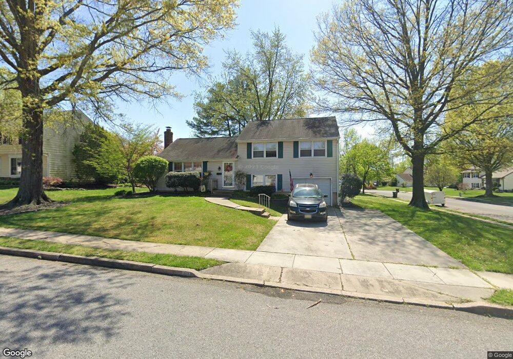
261 Burning Tree Rd Delran, NJ 08075
Tenby Chase NeighborhoodEstimated Value: $336,612 - $451,000
Studio
--
Bath
1,464
Sq Ft
$285/Sq Ft
Est. Value
About This Home
This home is located at 261 Burning Tree Rd, Delran, NJ 08075 and is currently estimated at $416,903, approximately $284 per square foot. 261 Burning Tree Rd is a home located in Burlington County with nearby schools including Millbridge Elementary School, Delran Intermediate School, and Delran Middle School.
Ownership History
Date
Name
Owned For
Owner Type
Purchase Details
Closed on
Nov 4, 2002
Sold by
Catrambone Gary A
Bought by
Catrambone Gary A and Catrambone Julie K
Current Estimated Value
Home Financials for this Owner
Home Financials are based on the most recent Mortgage that was taken out on this home.
Original Mortgage
$16,000
Interest Rate
6.16%
Mortgage Type
Unknown
Create a Home Valuation Report for This Property
The Home Valuation Report is an in-depth analysis detailing your home's value as well as a comparison with similar homes in the area
Home Values in the Area
Average Home Value in this Area
Purchase History
| Date | Buyer | Sale Price | Title Company |
|---|---|---|---|
| Catrambone Gary A | -- | Fidelity Title Abstract Co |
Source: Public Records
Mortgage History
| Date | Status | Borrower | Loan Amount |
|---|---|---|---|
| Closed | Catrambone Gary A | $16,000 | |
| Closed | Catrambone Gary A | $144,000 |
Source: Public Records
Tax History
| Year | Tax Paid | Tax Assessment Tax Assessment Total Assessment is a certain percentage of the fair market value that is determined by local assessors to be the total taxable value of land and additions on the property. | Land | Improvement |
|---|---|---|---|---|
| 2025 | $8,159 | $205,200 | $65,000 | $140,200 |
| 2024 | $8,085 | $205,200 | $65,000 | $140,200 |
| 2023 | $8,085 | $205,200 | $65,000 | $140,200 |
| 2022 | $7,980 | $205,200 | $65,000 | $140,200 |
| 2021 | $7,984 | $205,200 | $65,000 | $140,200 |
| 2020 | $7,968 | $205,200 | $65,000 | $140,200 |
| 2019 | $7,894 | $205,200 | $65,000 | $140,200 |
| 2018 | $7,763 | $205,200 | $65,000 | $140,200 |
| 2017 | $7,640 | $205,200 | $65,000 | $140,200 |
| 2016 | $7,527 | $205,200 | $65,000 | $140,200 |
| 2015 | $7,402 | $205,200 | $65,000 | $140,200 |
| 2014 | $7,079 | $205,200 | $65,000 | $140,200 |
Source: Public Records
Map
Nearby Homes
- 247 Southview Dr
- 139 Coopers Kill Rd
- 101 Tarlton Ct
- 207 Farmington Rd
- 124 Coopers Kill Rd
- 120 Coopers Kill Rd
- 2211 Chestnut Hill Dr
- 98 Red Stone Ridge
- 123 Shelly Ln
- 154 Fox Chase Dr
- 2209 New Albany Rd
- 51 Suburban Blvd
- 715 Willow Dr
- 115 Haines Mill Rd
- 70 Suburban Blvd
- 709 Dartmouth Ave
- 608 Fountain Ave
- 100 Diane Ave
- 23 Lehigh Dr
- 323 Parry Rd
- 263 Burning Tree Rd
- 260 Southview Dr
- 262 Southview Dr
- 237 Sharrow Vale Rd
- 239 Sharrow Vale Rd
- 265 Burning Tree Rd
- 260 Burning Tree Rd
- 235 Sharrow Vale Rd
- 262 Burning Tree Rd
- 241 Sharrow Vale Rd
- 264 Southview Dr
- 264 Burning Tree Rd
- 267 Burning Tree Rd
- 233 Sharrow Vale Rd
- 266 Southview Dr
- 238 Aqua Ln
- 240 Aqua Ln
- 236 Borton Mill Ct
- 263 Southview Dr
- 266 Burning Tree Rd
Your Personal Tour Guide
Ask me questions while you tour the home.