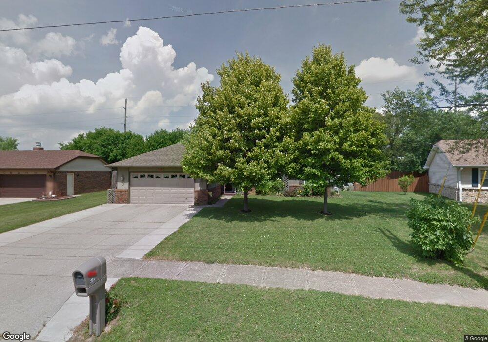
261 Center St Whiteland, IN 46184
Estimated Value: $242,270 - $260,000
3
Beds
2
Baths
1,448
Sq Ft
$172/Sq Ft
Est. Value
About This Home
This home is located at 261 Center St, Whiteland, IN 46184 and is currently estimated at $249,318, approximately $172 per square foot. 261 Center St is a home located in Johnson County with nearby schools including Whiteland Elementary School, Clark-Pleasant Middle School, and Whiteland Community High School.
Ownership History
Date
Name
Owned For
Owner Type
Purchase Details
Closed on
Jul 8, 2022
Sold by
Warren Boltz William
Bought by
Boltz Nathaniel W and Boltz Allison M
Current Estimated Value
Home Financials for this Owner
Home Financials are based on the most recent Mortgage that was taken out on this home.
Original Mortgage
$156,000
Outstanding Balance
$148,429
Interest Rate
5.1%
Mortgage Type
New Conventional
Estimated Equity
$100,889
Purchase Details
Closed on
May 13, 2010
Sold by
Loewen Rudy and Loewen Karen S
Bought by
Boltz William W
Create a Home Valuation Report for This Property
The Home Valuation Report is an in-depth analysis detailing your home's value as well as a comparison with similar homes in the area
Home Values in the Area
Average Home Value in this Area
Purchase History
| Date | Buyer | Sale Price | Title Company |
|---|---|---|---|
| Boltz Nathaniel W | -- | Anderson & Gray Llc | |
| Boltz William W | -- | None Available |
Source: Public Records
Mortgage History
| Date | Status | Borrower | Loan Amount |
|---|---|---|---|
| Open | Boltz Nathaniel W | $156,000 |
Source: Public Records
Tax History Compared to Growth
Tax History
| Year | Tax Paid | Tax Assessment Tax Assessment Total Assessment is a certain percentage of the fair market value that is determined by local assessors to be the total taxable value of land and additions on the property. | Land | Improvement |
|---|---|---|---|---|
| 2025 | $1,758 | $221,500 | $31,200 | $190,300 |
| 2024 | $1,758 | $178,200 | $31,200 | $147,000 |
| 2023 | $1,967 | $189,400 | $31,200 | $158,200 |
| 2022 | $1,791 | $172,000 | $27,900 | $144,100 |
| 2021 | $1,521 | $145,800 | $27,900 | $117,900 |
| 2020 | $1,395 | $133,100 | $27,900 | $105,200 |
| 2019 | $1,278 | $122,100 | $27,900 | $94,200 |
| 2018 | $1,207 | $122,800 | $15,600 | $107,200 |
| 2017 | $1,137 | $111,900 | $15,600 | $96,300 |
| 2016 | $1,017 | $107,300 | $15,600 | $91,700 |
| 2014 | $1,059 | $105,000 | $21,300 | $83,700 |
| 2013 | $1,059 | $105,600 | $19,900 | $85,700 |
Source: Public Records
Map
Nearby Homes
- 630 Walnut St
- 5503 N 125 E
- 249 Lori Ann Dr
- 650 E Pearl St
- 657 Whiteland Rd
- 545 Whiteland Rd
- 0 N 200 (Honey Creek Rd ) W Unit MBR21845718
- 400 S U S Highway 31
- 257 Creekway Ct
- 320 Briar Hill Dr
- Henley Plan at Saddlebrook Farms
- Fairfax Plan at Saddlebrook Farms - North
- 841 E Pearl St
- Henley Plan at Saddlebrook Farms - North
- Freeport Plan at Saddlebrook Farms - North
- Johnstown Plan at Saddlebrook Farms - North
- Dayton Plan at Saddlebrook Farms - North
- Chatham Plan at Saddlebrook Farms - North
- Dayton Plan at Saddlebrook Farms
- Harmony Plan at Saddlebrook Farms - North