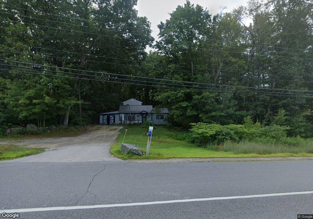
261 Clinton St Concord, NH 03301
South End NeighborhoodEstimated Value: $336,000 - $501,000
4
Beds
2
Baths
1,690
Sq Ft
$249/Sq Ft
Est. Value
About This Home
This home is located at 261 Clinton St, Concord, NH 03301 and is currently estimated at $420,323, approximately $248 per square foot. 261 Clinton St is a home located in Merrimack County with nearby schools including Abbot-Downing School, Rundlett Middle School, and Concord High School.
Ownership History
Date
Name
Owned For
Owner Type
Purchase Details
Closed on
Nov 1, 2018
Sold by
Dyment Anna B and Dyment Cariann
Bought by
Blodgett Jayne and Blodgett Jeffrey
Current Estimated Value
Home Financials for this Owner
Home Financials are based on the most recent Mortgage that was taken out on this home.
Original Mortgage
$149,246
Outstanding Balance
$130,692
Interest Rate
4.6%
Mortgage Type
FHA
Estimated Equity
$289,631
Purchase Details
Closed on
Aug 20, 2012
Sold by
Dyment Ft and Dyment
Bought by
Dyment Anna B and Dyment Cariann E
Create a Home Valuation Report for This Property
The Home Valuation Report is an in-depth analysis detailing your home's value as well as a comparison with similar homes in the area
Home Values in the Area
Average Home Value in this Area
Purchase History
| Date | Buyer | Sale Price | Title Company |
|---|---|---|---|
| Blodgett Jayne | $152,000 | -- | |
| Dyment Anna B | -- | -- |
Source: Public Records
Mortgage History
| Date | Status | Borrower | Loan Amount |
|---|---|---|---|
| Open | Blodgett Jayne | $149,246 |
Source: Public Records
Tax History Compared to Growth
Tax History
| Year | Tax Paid | Tax Assessment Tax Assessment Total Assessment is a certain percentage of the fair market value that is determined by local assessors to be the total taxable value of land and additions on the property. | Land | Improvement |
|---|---|---|---|---|
| 2024 | $6,499 | $234,700 | $135,500 | $99,200 |
| 2023 | $5,955 | $221,700 | $135,500 | $86,200 |
| 2022 | $5,740 | $221,700 | $135,500 | $86,200 |
| 2021 | $5,175 | $206,000 | $135,100 | $70,900 |
| 2020 | $4,442 | $166,000 | $106,800 | $59,200 |
| 2019 | $4,495 | $161,800 | $100,000 | $61,800 |
| 2018 | $5,029 | $178,400 | $92,200 | $86,200 |
| 2017 | $4,877 | $172,700 | $92,200 | $80,500 |
| 2016 | $4,723 | $170,700 | $92,200 | $78,500 |
| 2015 | $4,145 | $151,600 | $76,800 | $74,800 |
| 2014 | $4,064 | $151,600 | $76,800 | $74,800 |
| 2013 | $3,921 | $153,300 | $76,800 | $76,500 |
| 2012 | $3,599 | $147,700 | $72,900 | $74,800 |
Source: Public Records
Map
Nearby Homes
- 27 Brushwood Dr
- 6 Woodland Cir
- 22 Wilson Ave
- 15 Wilson Ave
- 289 South St
- 0 South St Unit 4969509
- 1 Kensington Rd
- 2 Kensington Rd
- 122 South St
- 5 Holly Cir
- 53 Heather Ln
- 12 Avon St
- 167 Branch Londonderry Turnpike
- 376 S Main St
- 7 Currier Rd
- 105 S Main St
- 47 South St
- 0 Spruce St Unit 88
- 33 Spruce St
- 490 Page Rd
- 262 Clinton St
- 265 Clinton St
- 110 Silk Farm Rd
- 269 Clinton St
- 266 Clinton St
- 264 Clinton St
- 114 Silk Farm Rd
- 272 Clinton St
- 273 Clinton St
- 118 Silk Farm Rd
- 95 Silk Farm Rd
- 93 Silk Farm Rd
- 240 Clinton St
- 285 Clinton St
- 126 Silk Farm Rd
- 287 Clinton St
- 127 Silk Farm Rd
- 84 Silk Farm Rd
- 5 Lewis Ln
- 137 Silk Farm Rd