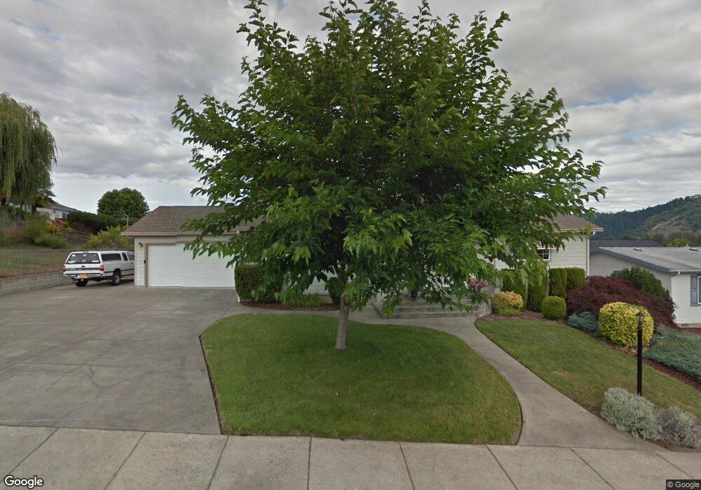
261 Timothy Ave Winston, OR 97496
Estimated Value: $334,000 - $367,000
2
Beds
2
Baths
1,568
Sq Ft
$228/Sq Ft
Est. Value
About This Home
This home is located at 261 Timothy Ave, Winston, OR 97496 and is currently estimated at $356,841, approximately $227 per square foot. 261 Timothy Ave is a home located in Douglas County with nearby schools including Douglas High School.
Ownership History
Date
Name
Owned For
Owner Type
Purchase Details
Closed on
Oct 15, 2010
Sold by
Watson David and Watson Theresa
Bought by
Bernhardt Richard J
Current Estimated Value
Home Financials for this Owner
Home Financials are based on the most recent Mortgage that was taken out on this home.
Original Mortgage
$145,000
Interest Rate
4.26%
Mortgage Type
VA
Purchase Details
Closed on
Mar 1, 2003
Sold by
Gallop Lloyd O and Gallop Nancy A
Bought by
Watson David and Watson Theresa
Home Financials for this Owner
Home Financials are based on the most recent Mortgage that was taken out on this home.
Original Mortgage
$145,000
Interest Rate
7.15%
Mortgage Type
Purchase Money Mortgage
Create a Home Valuation Report for This Property
The Home Valuation Report is an in-depth analysis detailing your home's value as well as a comparison with similar homes in the area
Home Values in the Area
Average Home Value in this Area
Purchase History
| Date | Buyer | Sale Price | Title Company |
|---|---|---|---|
| Bernhardt Richard J | $145,000 | First American Title Ins Co | |
| Watson David | $145,000 | First American Title Ins Co |
Source: Public Records
Mortgage History
| Date | Status | Borrower | Loan Amount |
|---|---|---|---|
| Previous Owner | Bernhardt Richard J | $145,000 | |
| Previous Owner | Watson David | $145,000 |
Source: Public Records
Tax History Compared to Growth
Tax History
| Year | Tax Paid | Tax Assessment Tax Assessment Total Assessment is a certain percentage of the fair market value that is determined by local assessors to be the total taxable value of land and additions on the property. | Land | Improvement |
|---|---|---|---|---|
| 2025 | $3,148 | $189,453 | -- | -- |
| 2024 | $3,060 | $183,935 | -- | -- |
| 2023 | $2,973 | $178,579 | $0 | $0 |
| 2022 | $2,885 | $173,375 | $0 | $0 |
| 2021 | $2,807 | $168,324 | $0 | $0 |
| 2020 | $2,726 | $163,425 | $0 | $0 |
| 2019 | $3,105 | $185,102 | $0 | $0 |
| 2018 | $2,590 | $154,041 | $0 | $0 |
| 2017 | $2,512 | $149,557 | $0 | $0 |
| 2016 | $2,399 | $145,206 | $0 | $0 |
| 2015 | $2,261 | $137,280 | $0 | $0 |
| 2014 | $2,187 | $131,841 | $0 | $0 |
| 2013 | -- | $123,442 | $0 | $0 |
Source: Public Records
Map
Nearby Homes
- 364 NW Teal St
- 210 NW Timothy Ave
- 841 NW Lori St
- 222 NW Broc Dr
- 13224 Lookingglass Rd
- 109 Citation Ct
- 0 NW Galaxy Dr
- 139 Teresa Ln
- 0 Danielle Dr Unit 122251646
- 165 Danielle Dr
- 102 Sarah Bear Ln
- 635 Wil Way
- 308 NW Civil Bend Ave
- 0 Wil Way Unit 24292479
- 0 Wil Way Unit 24094727
- 0 Wil Way Unit 24278136
- 150 Wil Way
- 160 Wil Way
- 301 NW Midway St
- 2414 Brockway Rd
- 261 NW Timothy Ave
- 190 NW Woodduck St
- 251 NW Timothy Ave
- 190 Woodduck St
- 251 Timothy Ave
- 186 Woodduck St
- 1090 NW Matthew St
- 1100 NW Matthew St
- 1080 NW Matthew St
- 1111 Mark Ct
- 182 Woodduck St
- 1100 Matthew Ct
- 241 Timothy Ave Unit 1
- 187 NW Woodduck St
- 176 Woodduck St
- 1121 Mark Ct
- 1110 Matthew Ct
- 187 Woodduck St
- 185 Woodduck St
- 177 NW Woodduck St