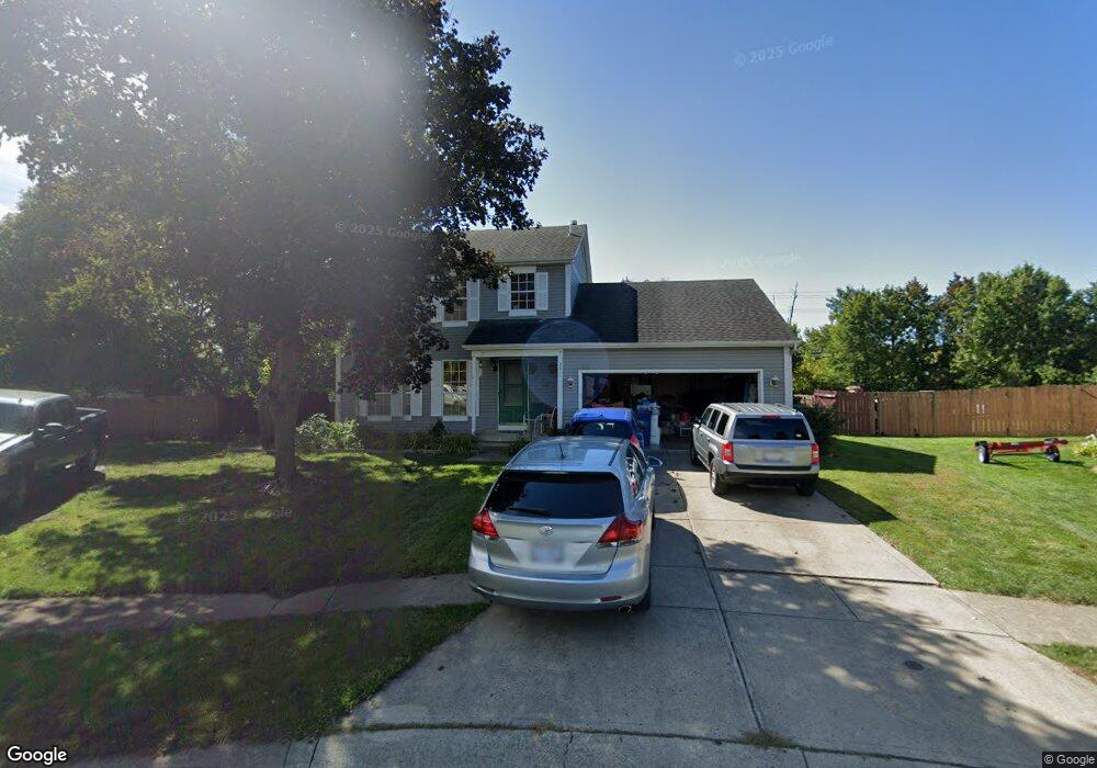
2611 Amberwick Place Hilliard, OH 43026
Westbrooke NeighborhoodEstimated Value: $385,000 - $397,000
3
Beds
3
Baths
1,516
Sq Ft
$258/Sq Ft
Est. Value
About This Home
This home is located at 2611 Amberwick Place, Hilliard, OH 43026 and is currently estimated at $390,681, approximately $257 per square foot. 2611 Amberwick Place is a home located in Franklin County with nearby schools including Alton Darby Elementary School, Hilliard Station Sixth Grade Elementary School, and Hilliard Memorial Middle School.
Ownership History
Date
Name
Owned For
Owner Type
Purchase Details
Closed on
Sep 21, 2007
Sold by
Hamilton Clifford A and Hamilton Tina M
Bought by
Torkornoo Eric S and Torkornoo Faustine
Current Estimated Value
Home Financials for this Owner
Home Financials are based on the most recent Mortgage that was taken out on this home.
Original Mortgage
$121,200
Outstanding Balance
$76,657
Interest Rate
6.55%
Mortgage Type
Purchase Money Mortgage
Estimated Equity
$314,024
Purchase Details
Closed on
Mar 2, 1992
Bought by
Hamilton Clifford A
Create a Home Valuation Report for This Property
The Home Valuation Report is an in-depth analysis detailing your home's value as well as a comparison with similar homes in the area
Home Values in the Area
Average Home Value in this Area
Purchase History
| Date | Buyer | Sale Price | Title Company |
|---|---|---|---|
| Torkornoo Eric S | $151,500 | Attorney | |
| Hamilton Clifford A | $95,800 | -- |
Source: Public Records
Mortgage History
| Date | Status | Borrower | Loan Amount |
|---|---|---|---|
| Open | Torkornoo Eric S | $121,200 |
Source: Public Records
Tax History Compared to Growth
Tax History
| Year | Tax Paid | Tax Assessment Tax Assessment Total Assessment is a certain percentage of the fair market value that is determined by local assessors to be the total taxable value of land and additions on the property. | Land | Improvement |
|---|---|---|---|---|
| 2024 | $6,247 | $110,610 | $40,430 | $70,180 |
| 2023 | $5,412 | $110,600 | $40,425 | $70,175 |
| 2022 | $4,601 | $75,290 | $17,500 | $57,790 |
| 2021 | $4,596 | $75,290 | $17,500 | $57,790 |
| 2020 | $4,583 | $75,290 | $17,500 | $57,790 |
| 2019 | $4,257 | $59,710 | $14,000 | $45,710 |
| 2018 | $4,091 | $59,710 | $14,000 | $45,710 |
| 2017 | $4,239 | $59,710 | $14,000 | $45,710 |
| 2016 | $4,206 | $54,880 | $13,510 | $41,370 |
| 2015 | $3,942 | $54,880 | $13,510 | $41,370 |
| 2014 | $3,950 | $54,880 | $13,510 | $41,370 |
| 2013 | $1,906 | $52,290 | $12,880 | $39,410 |
Source: Public Records
Map
Nearby Homes
- 2618 Copperwood Rd
- 2657 Amberwick Place
- 2650 Brittany Oaks Blvd
- 2654 Brittany Oaks Blvd
- 5686 Moonpenny Ln
- 2735 Quailview Ln
- 2603 Westrock Dr
- 5488 Whispering Oak Blvd
- 2643 Westrock Dr
- 5459 Red Wynne Ln
- 2657 Village Pier Ln Unit 2657
- 6056 Glade Run Rd
- 5763 Nike Dr
- 2886 Wynneleaf St
- 2880 Wynneleaf St
- 5757 Nike Dr
- 2195 Jeffey Dr
- 2161 Jeffey Dr
- 2145 Jeffey Dr
- 5824 Brinkwater Blvd
- 2617 Amberwick Place
- 2610 Amberwick Place
- 2625 Amberwick Place
- 2616 Amberwick Place
- 2638 Beacon Ct
- 2600 Cowall Dr
- 2592 Cowall Dr
- 2624 Amberwick Place
- 2633 Amberwick Place
- 2586 Cowall Dr
- 2646 Beacon Ct
- 2601 Copperwood Rd
- 2632 Amberwick Place
- 2580 Cowall Dr
- 2609 Copperwood Rd
- 2583 Punderson Dr
- 2641 Amberwick Place
- 2615 Copperwood Rd
- 2574 Cowall Dr
- 2640 Amberwick Place