Estimated Value: $406,000 - $598,137
--
Bed
2
Baths
2,356
Sq Ft
$219/Sq Ft
Est. Value
About This Home
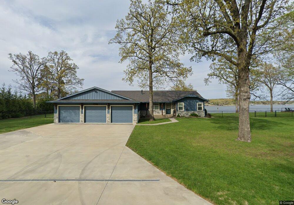
This home is located at 2611 Wyant Rd, Grove, OK 74344 and is currently estimated at $515,034, approximately $218 per square foot. 2611 Wyant Rd is a home located in Delaware County with nearby schools including Grove Lower Elementary School, Grove Upper Elementary School, and Grove Middle School.
Ownership History
Date
Name
Owned For
Owner Type
Purchase Details
Closed on
Mar 26, 2021
Sold by
Rogers Scot D and Rogers Cheri L
Bought by
Rogers Scot D and Rogers Cheri L
Current Estimated Value
Home Financials for this Owner
Home Financials are based on the most recent Mortgage that was taken out on this home.
Original Mortgage
$250,000
Outstanding Balance
$186,405
Interest Rate
3%
Mortgage Type
New Conventional
Estimated Equity
$328,629
Purchase Details
Closed on
May 29, 2015
Sold by
Wilson Herman Lynn
Bought by
Rogers Scot D and Rogers Cheri L
Home Financials for this Owner
Home Financials are based on the most recent Mortgage that was taken out on this home.
Original Mortgage
$225,000
Interest Rate
3.71%
Mortgage Type
New Conventional
Purchase Details
Closed on
Sep 28, 1995
Sold by
Wilson Austin H
Create a Home Valuation Report for This Property
The Home Valuation Report is an in-depth analysis detailing your home's value as well as a comparison with similar homes in the area
Home Values in the Area
Average Home Value in this Area
Purchase History
| Date | Buyer | Sale Price | Title Company |
|---|---|---|---|
| Rogers Scot D | -- | Allegiance T&E Llc | |
| Rogers Scot D | -- | Allegiance T&E Llc | |
| Rogers Scot D | -- | None Available | |
| -- | -- | -- |
Source: Public Records
Mortgage History
| Date | Status | Borrower | Loan Amount |
|---|---|---|---|
| Open | Rogers Scot D | $250,000 | |
| Closed | Rogers Scot D | $225,000 |
Source: Public Records
Tax History Compared to Growth
Tax History
| Year | Tax Paid | Tax Assessment Tax Assessment Total Assessment is a certain percentage of the fair market value that is determined by local assessors to be the total taxable value of land and additions on the property. | Land | Improvement |
|---|---|---|---|---|
| 2025 | $3,857 | $50,020 | $16,646 | $33,374 |
| 2024 | $3,857 | $47,638 | $16,093 | $31,545 |
| 2023 | $3,857 | $45,370 | $15,893 | $29,477 |
| 2022 | $3,608 | $45,370 | $15,898 | $29,472 |
| 2021 | $2,933 | $36,965 | $15,832 | $21,133 |
| 2020 | $2,841 | $33,529 | $15,196 | $18,333 |
| 2019 | $2,810 | $33,046 | $15,196 | $17,850 |
| 2018 | $2,759 | $32,516 | $15,196 | $17,320 |
| 2017 | $2,741 | $32,195 | $15,196 | $16,999 |
| 2016 | $2,649 | $31,137 | $15,196 | $15,941 |
| 2015 | $1,781 | $21,635 | $10,001 | $11,634 |
| 2014 | -- | $21,005 | $9,499 | $11,506 |
Source: Public Records
Map
Nearby Homes
- 61112 E 310 Rd
- 61113 E 310 Rd
- 2720 Thompson Rd
- 1619 Pine Dr
- 3111 Old Dyke Rd
- 3110 Old Dyke Rd
- 3101 Shore Dr Unit 5
- 3112 Shore Dr
- 25101 S 613
- 1629 Dilar Dr
- 1307 W 16th St
- 1303 W 16th St
- 3402 Callie Dr
- 1709 Cardiac Cove Rd
- 31283 S 618 Rd
- 1325 Marina Dr
- 1621 Rockwood Dr
- 1628 Battle Dr
- 0 Scenic Dr
- 0 Moffat St
- 61070 E 310 Rd
- 2609 Wyant Rd
- 0 E 310 Rd
- 000 E 310 Rd
- 61084 E 310 Rd
- 61057 E 310 Rd
- 61098 E 310 Rd
- 2607 Thompson Rd
- 61099 E 310 Rd
- 61085 E 310 Rd
- 61182 E 310 Rd
- 2605 Thompson Rd
- 61016 E 310 Rd
- 61128 E 310 Rd
- 61140 E 310 Rd
- 61169 E 310 Rd
- 61127 E 310 Rd
- 2606 Thompson Rd
- 2603 Thompson Rd
- 61155 E 310 Rd