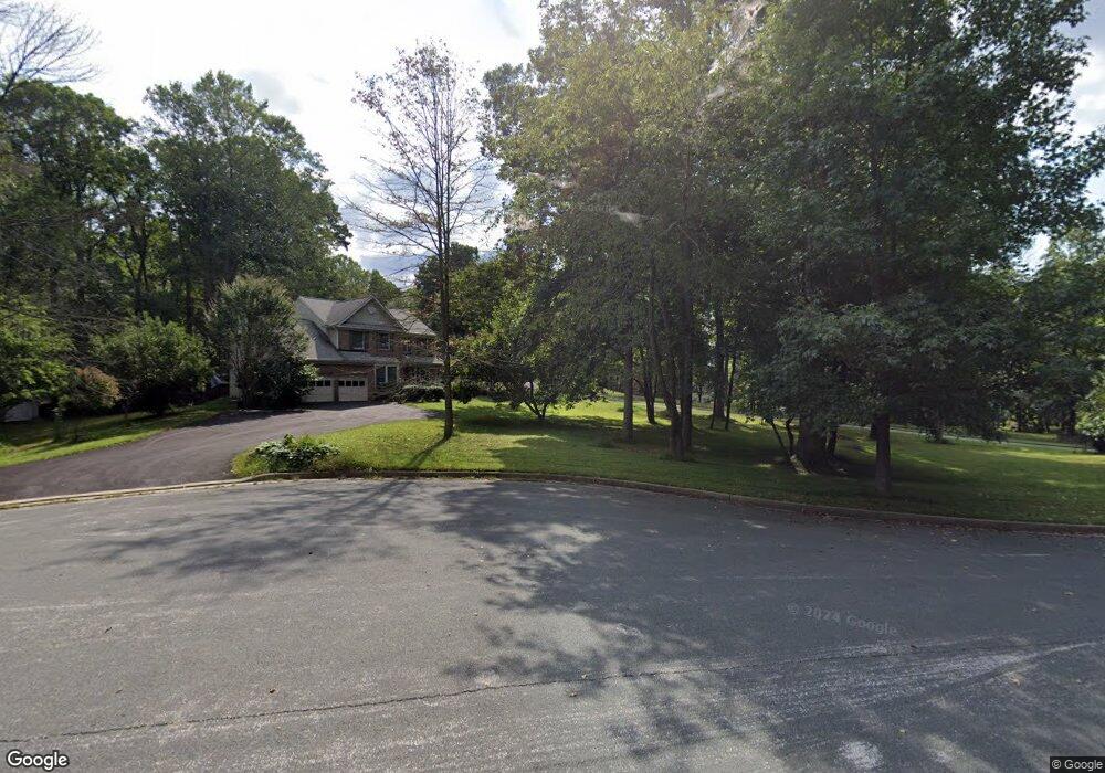
2612 Amanda Ct Woodstock, MD 21163
Estimated Value: $689,000 - $794,000
--
Bed
4
Baths
3,470
Sq Ft
$214/Sq Ft
Est. Value
About This Home
This home is located at 2612 Amanda Ct, Woodstock, MD 21163 and is currently estimated at $743,924, approximately $214 per square foot. 2612 Amanda Ct is a home located in Baltimore County with nearby schools including Randallstown Elementary School, Windsor Mill Middle School, and Randallstown High School.
Ownership History
Date
Name
Owned For
Owner Type
Purchase Details
Closed on
Jan 17, 2003
Sold by
Glen Doris M
Bought by
Glenn Doris M and Glenn Terrance A
Current Estimated Value
Purchase Details
Closed on
Feb 28, 2002
Sold by
Jackson Reginald
Bought by
Glen Doris M
Purchase Details
Closed on
Jun 12, 1995
Sold by
Grp Ryland
Bought by
Jackson Reginald
Home Financials for this Owner
Home Financials are based on the most recent Mortgage that was taken out on this home.
Original Mortgage
$203,150
Interest Rate
8.21%
Purchase Details
Closed on
Aug 31, 1994
Sold by
Offutt Ridge Ltd Prtnship
Bought by
Ryland Group Inc
Create a Home Valuation Report for This Property
The Home Valuation Report is an in-depth analysis detailing your home's value as well as a comparison with similar homes in the area
Home Values in the Area
Average Home Value in this Area
Purchase History
| Date | Buyer | Sale Price | Title Company |
|---|---|---|---|
| Glenn Doris M | -- | -- | |
| Glen Doris M | $340,000 | -- | |
| Jackson Reginald | $298,178 | -- | |
| Ryland Group Inc | $94,000 | -- |
Source: Public Records
Mortgage History
| Date | Status | Borrower | Loan Amount |
|---|---|---|---|
| Previous Owner | Ryland Group Inc | $203,150 |
Source: Public Records
Tax History Compared to Growth
Tax History
| Year | Tax Paid | Tax Assessment Tax Assessment Total Assessment is a certain percentage of the fair market value that is determined by local assessors to be the total taxable value of land and additions on the property. | Land | Improvement |
|---|---|---|---|---|
| 2025 | $7,280 | $660,333 | -- | -- |
| 2024 | $7,280 | $623,100 | $100,500 | $522,600 |
| 2023 | $3,518 | $601,400 | $0 | $0 |
| 2022 | $6,709 | $579,700 | $0 | $0 |
| 2021 | $6,264 | $558,000 | $100,500 | $457,500 |
| 2020 | $6,264 | $535,767 | $0 | $0 |
| 2019 | $6,023 | $513,533 | $0 | $0 |
| 2018 | $5,791 | $491,300 | $100,500 | $390,800 |
| 2017 | $5,515 | $467,100 | $0 | $0 |
| 2016 | $5,039 | $442,900 | $0 | $0 |
| 2015 | $5,039 | $418,700 | $0 | $0 |
| 2014 | $5,039 | $418,700 | $0 | $0 |
Source: Public Records
Map
Nearby Homes
- 3517 Kings Point Rd
- 9605 Mendoza Rd
- 3525 Cabot Rd
- 3200 Peddicoat Ct
- 3618 Granite Rd
- 10301 Marriottsville Rd
- 2508 Offutt Rd
- 3538 Corn Stream Rd
- 9804 Marriottsville Rd
- 3518 Orchard Shade Rd
- 10520 Marriottsville Rd
- 30 Sheraton Rd
- 3803 Marriottsville Rd
- 9311 Colorado Ave
- 3903 Innerdale Ct
- 9302 Silver Charm Dr
- 3827 Rayton Rd
- 3903 Red Deer Cir
- 9401 Summer Squal Dr
- 4129 Holbrook Rd