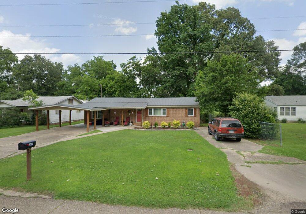
2614 Old Tillar Hwy Mc Gehee, AR 71654
Estimated Value: $56,906 - $137,000
--
Bed
2
Baths
1,430
Sq Ft
$72/Sq Ft
Est. Value
About This Home
This home is located at 2614 Old Tillar Hwy, Mc Gehee, AR 71654 and is currently estimated at $103,477, approximately $72 per square foot. 2614 Old Tillar Hwy is a home located in Desha County with nearby schools including McGehee Elementary School, Conner Middle School, and McGehee High School.
Ownership History
Date
Name
Owned For
Owner Type
Purchase Details
Closed on
May 31, 2016
Sold by
Stokes Leah N
Bought by
Stokes Willie
Current Estimated Value
Purchase Details
Closed on
Mar 7, 2016
Sold by
Shirakbari Betty Kay
Bought by
Stokes Leah
Home Financials for this Owner
Home Financials are based on the most recent Mortgage that was taken out on this home.
Original Mortgage
$8,000
Interest Rate
3.61%
Mortgage Type
Commercial
Purchase Details
Closed on
Mar 8, 2011
Bought by
Stokes Leah N
Purchase Details
Closed on
Jun 6, 1979
Bought by
Jack and Betty Seamans
Create a Home Valuation Report for This Property
The Home Valuation Report is an in-depth analysis detailing your home's value as well as a comparison with similar homes in the area
Home Values in the Area
Average Home Value in this Area
Purchase History
| Date | Buyer | Sale Price | Title Company |
|---|---|---|---|
| Stokes Willie | -- | Attorney | |
| Stokes Leah | $20,000 | Attorney | |
| Stokes Leah N | $20,000 | -- | |
| Jack | $8,000 | -- |
Source: Public Records
Mortgage History
| Date | Status | Borrower | Loan Amount |
|---|---|---|---|
| Previous Owner | Stokes Leah | $8,000 |
Source: Public Records
Tax History Compared to Growth
Tax History
| Year | Tax Paid | Tax Assessment Tax Assessment Total Assessment is a certain percentage of the fair market value that is determined by local assessors to be the total taxable value of land and additions on the property. | Land | Improvement |
|---|---|---|---|---|
| 2025 | $199 | $3,760 | $1,500 | $2,260 |
| 2024 | $199 | $3,760 | $1,500 | $2,260 |
| 2023 | $199 | $3,760 | $1,500 | $2,260 |
| 2022 | $111 | $7,170 | $1,500 | $5,670 |
| 2021 | $109 | $7,140 | $1,500 | $5,640 |
| 2020 | $109 | $7,140 | $1,500 | $5,640 |
| 2019 | $109 | $7,140 | $1,500 | $5,640 |
| 2018 | $134 | $7,140 | $1,500 | $5,640 |
| 2017 | $478 | $7,140 | $1,500 | $5,640 |
| 2015 | -- | $7,870 | $1,500 | $6,370 |
| 2014 | -- | $7,870 | $1,500 | $6,370 |
| 2013 | -- | $7,870 | $1,500 | $6,370 |
Source: Public Records
Map
Nearby Homes
- 1608 N 3rd St
- 1108 N 2nd St
- 1 Shannon Dr
- 32 Shannon Dr
- 110 S Adams Ave
- 205 S 2nd St
- 0 Masonville Rd Unit 25037306
- 209 Sherwood St
- Lot 2 S 1st St
- Lot 1 S 1st St
- Lots 6-7 Bush St
- Lot 2 Cypress Gardens
- 109 Ashcraft St
- 604 Highway 65 S
- Vacant land Cater Ln
- 6 Paul St
- 22 Orlando Dr
- 475 S 2nd
- Lot 7 W Matthews St
- 0 N Hardy St
- 2612 Old Tillar Hwy
- 2610 Old Tillar Hwy
- 2611 Old Tillar Hwy
- 2404 Old Tillar Hwy
- 2609 Old Tillar Hwy
- 9 Bayou Cove Cir
- 2804 Old Tillar Hwy
- 8 Bayou Cove Cir
- 10 Bayou Cove Cir
- 2302 Old Tillar Hwy
- 2802 Old Tillar Hwy
- 11 Bayou Cove Cir
- 7 Bayou Cove Cir
- 2906 Old Tillar Hwy
- 12 Bayou Cove Cir
- 2208 Old Tillar Hwy
- 13 Bayou Cove Cir
- 2202 Old Tillar Hwy
- 42 Wolfe Dr
- 45 Wolfe Dr