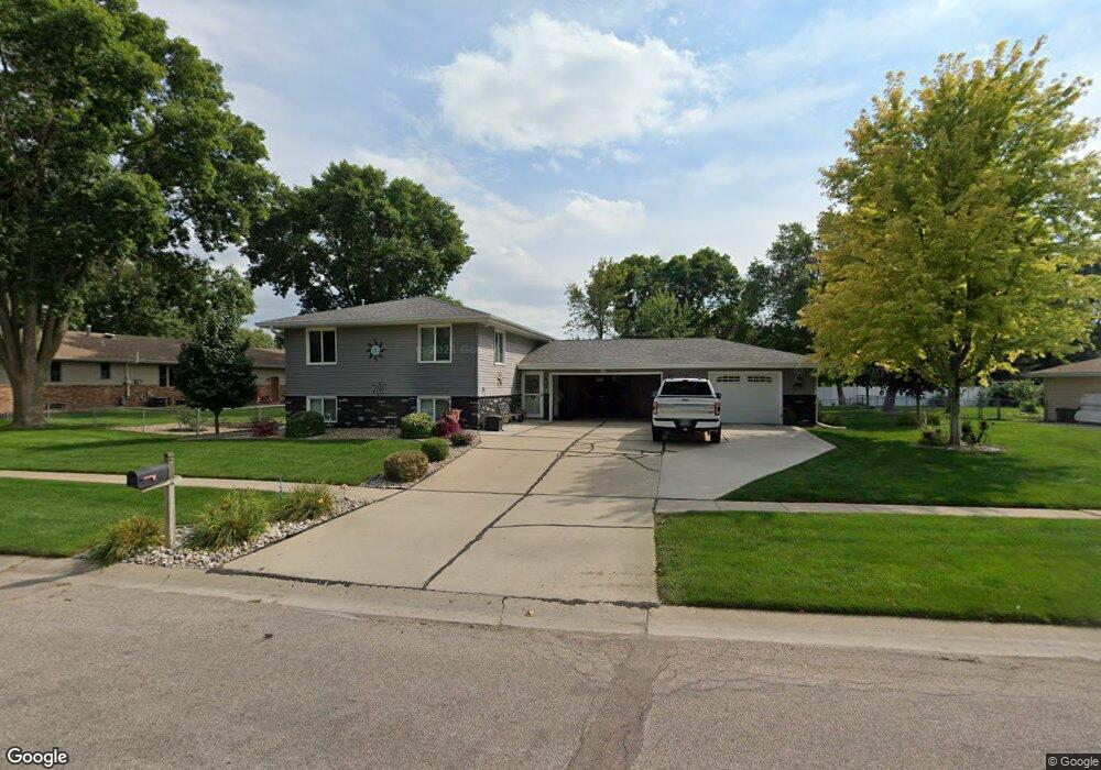
2614 Wilde St Sergeant Bluff, IA 51054
Estimated Value: $355,000 - $389,000
4
Beds
3
Baths
2,137
Sq Ft
$173/Sq Ft
Est. Value
About This Home
This home is located at 2614 Wilde St, Sergeant Bluff, IA 51054 and is currently estimated at $369,939, approximately $173 per square foot. 2614 Wilde St is a home located in Woodbury County with nearby schools including Sergeant Bluff-Luton Primary School, Sergeant Bluff-Luton Elementary School, and Sergeant Bluff-Luton Middle School.
Ownership History
Date
Name
Owned For
Owner Type
Purchase Details
Closed on
Oct 30, 2024
Sold by
Maxfield Kenneth L and Maxfield Valerie
Bought by
Jones Michael Ryan
Current Estimated Value
Home Financials for this Owner
Home Financials are based on the most recent Mortgage that was taken out on this home.
Original Mortgage
$302,500
Outstanding Balance
$299,160
Interest Rate
6.09%
Mortgage Type
New Conventional
Estimated Equity
$70,779
Create a Home Valuation Report for This Property
The Home Valuation Report is an in-depth analysis detailing your home's value as well as a comparison with similar homes in the area
Home Values in the Area
Average Home Value in this Area
Purchase History
| Date | Buyer | Sale Price | Title Company |
|---|---|---|---|
| Jones Michael Ryan | $365,000 | None Listed On Document |
Source: Public Records
Mortgage History
| Date | Status | Borrower | Loan Amount |
|---|---|---|---|
| Open | Jones Michael Ryan | $302,500 |
Source: Public Records
Tax History Compared to Growth
Tax History
| Year | Tax Paid | Tax Assessment Tax Assessment Total Assessment is a certain percentage of the fair market value that is determined by local assessors to be the total taxable value of land and additions on the property. | Land | Improvement |
|---|---|---|---|---|
| 2025 | $3,880 | $328,370 | $26,770 | $301,600 |
| 2024 | $3,880 | $269,870 | $23,170 | $246,700 |
| 2023 | $3,526 | $269,870 | $23,170 | $246,700 |
| 2022 | $3,494 | $209,530 | $23,170 | $186,360 |
| 2021 | $3,494 | $209,530 | $23,170 | $186,360 |
| 2020 | $3,222 | $191,350 | $24,790 | $166,560 |
| 2019 | $3,138 | $190,230 | $24,790 | $165,440 |
| 2018 | $2,940 | $182,710 | $24,790 | $157,920 |
| 2017 | $2,940 | $176,010 | $24,790 | $151,220 |
| 2016 | $2,982 | $163,360 | $0 | $0 |
| 2015 | $2,907 | $151,600 | $23,170 | $128,430 |
| 2014 | $2,742 | $145,490 | $23,170 | $122,320 |
Source: Public Records
Map
Nearby Homes
- 2407 Carlisle Rd
- 2092 Roundtable Rd
- TBD Old Lakeport Rd
- 1302 Clairmont Cir
- 306 Prairie Bluff Dr
- 200 Prairie Bluff Dr
- 504 Colfax Ct
- 106 Port Neal Rd
- 614 Jamie Ln
- 721 Jax Ct
- 722 Jax Ct
- 723 Jax Ct
- 716 Jax Ct
- 718 Jax Ct
- 720 Jax Ct
- 1308 Warrior Rd
- 1301 Serenity Ln
- 1221 Serenity Ln
- 407 Zach Rd
- 409 Zach Rd
- 2035 Roundtable Rd
- 2612 Wilde St
- 2615 Wilde St
- 2521 Canterbury Rd
- 2519 Canterbury Rd
- 2039 Roundtable Rd
- 2610 Wilde St
- 2611 Wilde St
- 2517 Canterbury Rd
- 2034 Roundtable Rd
- 2036 Roundtable Rd
- 2038 Roundtable Rd
- 2032 Roundtable Rd
- 2609 Wilde St
- 2515 Canterbury Rd
- 2608 Wilde St
- 2712 Ivanhoe Dr
- 2714 Ivanhoe Dr
- 2516 Canterbury Rd
- 2029 Roundtable Rd