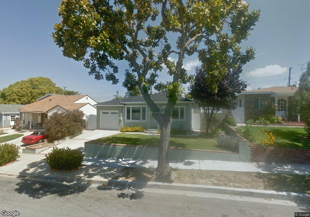
2615 Alvord Ln Redondo Beach, CA 90278
North Redondo Beach NeighborhoodEstimated Value: $1,039,000 - $1,505,000
3
Beds
2
Baths
1,263
Sq Ft
$1,037/Sq Ft
Est. Value
About This Home
This home is located at 2615 Alvord Ln, Redondo Beach, CA 90278 and is currently estimated at $1,309,552, approximately $1,036 per square foot. 2615 Alvord Ln is a home located in Los Angeles County with nearby schools including Washington Elementary School, Adams Middle School, and Redondo Union High School.
Ownership History
Date
Name
Owned For
Owner Type
Purchase Details
Closed on
Aug 10, 2020
Sold by
Vorndran Neal Patrick and Vorndran Patricia Lee
Bought by
Vorndran Neal and Vorndran Patricia
Current Estimated Value
Home Financials for this Owner
Home Financials are based on the most recent Mortgage that was taken out on this home.
Original Mortgage
$308,000
Outstanding Balance
$218,699
Interest Rate
3%
Mortgage Type
New Conventional
Estimated Equity
$1,090,853
Purchase Details
Closed on
Oct 17, 1995
Sold by
Fioravanti Janet
Bought by
Vorndran Neal Patrick and Vorndran Patricia Lee
Home Financials for this Owner
Home Financials are based on the most recent Mortgage that was taken out on this home.
Original Mortgage
$165,750
Interest Rate
7.42%
Create a Home Valuation Report for This Property
The Home Valuation Report is an in-depth analysis detailing your home's value as well as a comparison with similar homes in the area
Home Values in the Area
Average Home Value in this Area
Purchase History
| Date | Buyer | Sale Price | Title Company |
|---|---|---|---|
| Vorndran Neal | -- | North American Title | |
| Vorndran Neal Patrick | $174,500 | Title Land Company |
Source: Public Records
Mortgage History
| Date | Status | Borrower | Loan Amount |
|---|---|---|---|
| Open | Vorndran Neal | $308,000 | |
| Closed | Vorndran Neal Patrick | $165,750 |
Source: Public Records
Tax History Compared to Growth
Tax History
| Year | Tax Paid | Tax Assessment Tax Assessment Total Assessment is a certain percentage of the fair market value that is determined by local assessors to be the total taxable value of land and additions on the property. | Land | Improvement |
|---|---|---|---|---|
| 2025 | $4,705 | $352,124 | $231,898 | $120,226 |
| 2024 | $4,705 | $345,220 | $227,351 | $117,869 |
| 2023 | $4,627 | $338,452 | $222,894 | $115,558 |
| 2022 | $4,524 | $331,817 | $218,524 | $113,293 |
| 2021 | $4,394 | $325,312 | $214,240 | $111,072 |
| 2019 | $4,269 | $315,666 | $207,887 | $107,779 |
| 2018 | $4,120 | $309,477 | $203,811 | $105,666 |
| 2016 | $3,980 | $297,462 | $195,898 | $101,564 |
| 2015 | $3,912 | $292,995 | $192,956 | $100,039 |
| 2014 | $3,859 | $287,257 | $189,177 | $98,080 |
Source: Public Records
Map
Nearby Homes
- 2617 Alvord Ln
- 2600 Alvord Ln
- 2708 184th St
- 2708 183rd St
- 907 Lilienthal Ln
- 1300 Firmona Ave
- 2420 Ives Ln Unit B
- 2420 Ives Ln Unit A
- 2617 182nd St
- 4549 186th St
- 18406 Kingsdale Ave
- 2905 Spreckels Ct
- 2407 Ripley Ave
- 2345 190th St Unit 42
- 2345 190th St Unit 24
- 18204 Kingsdale Ave
- 2345 W 190th St Unit 77
- 18801 Hawthorne Blvd Unit 19
- 18801 Hawthorne Blvd Unit 59
- 2400 Marshallfield Ln
- 2613 Alvord Ln
- 2611 Alvord Ln
- 2614 Ralston Ln
- 2619 Alvord Ln
- 2616 Ralston Ln
- 2612 Ralston Ln
- 2610 Ralston Ln
- 2618 Ralston Ln
- 2609 Alvord Ln
- 2614 Alvord Ln
- 2616 Alvord Ln
- 2610 Alvord Ln
- 2618 Alvord Ln
- 2608 Ralston Ln
- 2607 Alvord Ln
- 2608 Alvord Ln
- 2605 Alvord Ln
- 2606 Alvord Ln
- 2615 Fisk Ln
- 2613 Fisk Ln