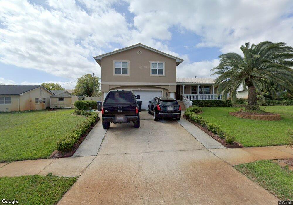
2615 Hemlock Ct Unit 4 Titusville, FL 32780
Estimated Value: $466,000 - $545,000
5
Beds
3
Baths
3,900
Sq Ft
$129/Sq Ft
Est. Value
About This Home
This home is located at 2615 Hemlock Ct Unit 4, Titusville, FL 32780 and is currently estimated at $501,855, approximately $128 per square foot. 2615 Hemlock Ct Unit 4 is a home located in Brevard County with nearby schools including Apollo Elementary School, Titusville High School, and Andrew Jackson Middle School.
Ownership History
Date
Name
Owned For
Owner Type
Purchase Details
Closed on
Aug 10, 2022
Sold by
Stirling Michael D and Stirling Marie P
Bought by
Stirling Family Trust
Current Estimated Value
Purchase Details
Closed on
Oct 30, 2003
Sold by
Gulick Jesse R and Gulick Ruth M
Bought by
Stirling Michael D
Home Financials for this Owner
Home Financials are based on the most recent Mortgage that was taken out on this home.
Original Mortgage
$122,000
Interest Rate
4.12%
Create a Home Valuation Report for This Property
The Home Valuation Report is an in-depth analysis detailing your home's value as well as a comparison with similar homes in the area
Home Values in the Area
Average Home Value in this Area
Purchase History
| Date | Buyer | Sale Price | Title Company |
|---|---|---|---|
| Stirling Family Trust | $100 | Allender & Allender Pa | |
| Stirling Michael D | $152,500 | Gulfatlantic Title |
Source: Public Records
Mortgage History
| Date | Status | Borrower | Loan Amount |
|---|---|---|---|
| Previous Owner | Stirling Michael D | $122,000 |
Source: Public Records
Tax History Compared to Growth
Tax History
| Year | Tax Paid | Tax Assessment Tax Assessment Total Assessment is a certain percentage of the fair market value that is determined by local assessors to be the total taxable value of land and additions on the property. | Land | Improvement |
|---|---|---|---|---|
| 2025 | $2,199 | $159,120 | -- | -- |
| 2024 | $2,148 | $154,640 | -- | -- |
| 2023 | $2,148 | $150,140 | $0 | $0 |
| 2022 | $1,999 | $145,770 | $0 | $0 |
| 2021 | $2,041 | $141,530 | $0 | $0 |
| 2020 | $2,036 | $139,580 | $0 | $0 |
| 2019 | $2,063 | $136,450 | $0 | $0 |
| 2018 | $2,071 | $133,910 | $0 | $0 |
| 2017 | $2,028 | $131,160 | $0 | $0 |
| 2016 | $1,961 | $128,470 | $25,000 | $103,470 |
| 2015 | $2,020 | $127,580 | $20,000 | $107,580 |
| 2014 | $2,008 | $126,570 | $20,000 | $106,570 |
Source: Public Records
Map
Nearby Homes
- 2653 Driftwood Dr
- 2648 Hemlock Ct
- 2575 Indian Hills Ct
- 4230 Grovewood Ln
- 2559 Christopher Dr
- 2510 White Oak Ln
- 4491 Derbyshire Dr
- 2564 Christopher Dr
- 4541 Derbyshire Dr
- 2950 Guinevere Dr
- 0 Unknown Hwy Unit 1059313
- 0000 Cheney Hwy
- 2510 Saint Pauls Dr
- 3855 Cottonwood Dr
- 2280 Saint Andrews Dr
- 4875 Winchester Dr
- 2370 Saint Andrews Dr
- 3745 Canberra Ct
- 4640 Calle Corto
- 4980 Winchester Dr
- 2623 Hemlock Ct
- 4260 Hemlock Ln
- 4270 Hemlock Ln
- 2616 White Oak Ln
- 2624 White Oak Ln
- 2631 Hemlock Ct
- 2608 White Oak Ln
- 2616 Hemlock Ct
- 2632 White Oak Ln
- 2624 Hemlock Ct
- 2608 Hemlock Ct
- 2632 Hemlock Ct
- 2640 White Oak Ln
- 4261 Hemlock Ln
- 4271 Hemlock Ln
- 4251 Hemlock Ln
- 2639 Hemlock Ct
- 4281 Hemlock Ln
- 2607 White Oak Dr
- 2615 White Oak Ln