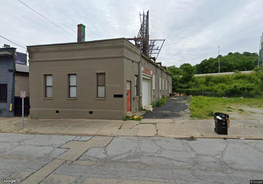
2616 Colerain Ave Unit 2618 Cincinnati, OH 45214
Camp Washington NeighborhoodEstimated Value: $369,317
--
Bed
--
Bath
2,670
Sq Ft
$138/Sq Ft
Est. Value
About This Home
This home is located at 2616 Colerain Ave Unit 2618, Cincinnati, OH 45214 and is currently estimated at $369,317, approximately $138 per square foot. 2616 Colerain Ave Unit 2618 is a home located in Hamilton County with nearby schools including Ethel M. Taylor Academy, Robert A. Taft Information Technology High School, and Gilbert A. Dater High School.
Ownership History
Date
Name
Owned For
Owner Type
Purchase Details
Closed on
May 20, 2024
Sold by
Cincy Sites Llc
Bought by
1033 St Gregory Llc
Current Estimated Value
Purchase Details
Closed on
Mar 3, 2020
Sold by
Baum Bernard S
Bought by
Cincy Sites Llc
Purchase Details
Closed on
Dec 1, 2016
Sold by
2616 Colerain Llc
Bought by
Baum Bernard S
Home Financials for this Owner
Home Financials are based on the most recent Mortgage that was taken out on this home.
Original Mortgage
$60,000
Interest Rate
3.52%
Mortgage Type
Commercial
Purchase Details
Closed on
Jan 2, 2003
Sold by
Sandler Leslie M and Sandler Renee
Bought by
2616 Colerain Llc
Create a Home Valuation Report for This Property
The Home Valuation Report is an in-depth analysis detailing your home's value as well as a comparison with similar homes in the area
Home Values in the Area
Average Home Value in this Area
Purchase History
| Date | Buyer | Sale Price | Title Company |
|---|---|---|---|
| 1033 St Gregory Llc | $350,000 | None Listed On Document | |
| Cincy Sites Llc | $80,000 | None Available | |
| Baum Bernard S | $30,000 | -- | |
| 2616 Colerain Llc | -- | -- | |
| 2616 Colerain Llc | -- | -- |
Source: Public Records
Mortgage History
| Date | Status | Borrower | Loan Amount |
|---|---|---|---|
| Previous Owner | Baum Bernard S | $60,000 |
Source: Public Records
Tax History Compared to Growth
Tax History
| Year | Tax Paid | Tax Assessment Tax Assessment Total Assessment is a certain percentage of the fair market value that is determined by local assessors to be the total taxable value of land and additions on the property. | Land | Improvement |
|---|---|---|---|---|
| 2024 | $2,190 | $26,401 | $3,248 | $23,153 |
| 2023 | $2,185 | $26,401 | $3,248 | $23,153 |
| 2022 | $2,777 | $30,468 | $3,021 | $27,447 |
| 2021 | $2,724 | $28,001 | $3,021 | $24,980 |
| 2020 | $2,507 | $28,001 | $3,021 | $24,980 |
| 2019 | $2,713 | $28,000 | $2,905 | $25,095 |
| 2018 | $2,714 | $28,000 | $2,905 | $25,095 |
| 2017 | $2,628 | $28,000 | $2,905 | $25,095 |
| 2016 | $1,377 | $14,326 | $2,888 | $11,438 |
| 2015 | $1,266 | $14,326 | $2,888 | $11,438 |
| 2014 | $1,270 | $14,326 | $2,888 | $11,438 |
| 2013 | $1,353 | $15,243 | $3,073 | $12,170 |
Source: Public Records
Map
Nearby Homes
- 2502 Halstead St
- 2432 Halstead St
- 1052 Marshall Ave
- 1044 Marshall Ave
- 762 Straight St
- 760 Straight St
- 507 Tafel St
- 660 Straight St
- 521 Tafel St
- 2355 W McMicken Ave
- 2523 Valley View Ct
- 2411 Fairview Ave
- 2528 Valley View Ct
- 632 Straight St
- 2367 Fairview Ave
- 513 Tafel St
- 426 Southview Ave
- 2735 Wagner St
- 2317 Muriel Ct
- 596 de Votie Ave
- 2620 Colerain Ave
- 2620 Colerain Ave Unit 2624
- 2618 Colerain Ave
- 2624 Colerain Ave
- 1037 Straight St
- 1035 Straight St
- 1110 Alfred St
- 2620 Cook St
- 2534 Cook St
- 2609 Cook St
- 2607 Cook St
- 2647 Colerain Ave
- 2603 Cook St
- 2522 Cook St
- 1106 Kottmann St
- 2514 Cook St
- 1104 Kottmann St
- 1104 Kottmann St
- 1104 Kottmann St Unit 3
- 1104 Kottmann St Unit 2