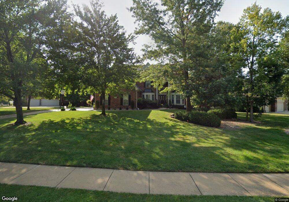
2617 NW Ashurst Ln Lees Summit, MO 64081
Estimated Value: $647,000 - $954,000
4
Beds
4
Baths
3,949
Sq Ft
$199/Sq Ft
Est. Value
About This Home
This home is located at 2617 NW Ashurst Ln, Lees Summit, MO 64081 and is currently estimated at $786,409, approximately $199 per square foot. 2617 NW Ashurst Ln is a home located in Jackson County with nearby schools including Cedar Creek Elementary School, Pleasant Lea Middle School, and Lee's Summit Senior High School.
Ownership History
Date
Name
Owned For
Owner Type
Purchase Details
Closed on
Mar 4, 2021
Sold by
Garrison Darren M and Garrison Shelley J
Bought by
Garrison Darren M and Garrison Shelley J
Current Estimated Value
Purchase Details
Closed on
Jan 28, 2021
Sold by
Garrison Darren M and Garrison Shelley J
Bought by
Garrison Darren M and Garrison Shelley J
Purchase Details
Closed on
Jul 18, 2000
Sold by
L R Wyss Construction Inc
Bought by
Garrison Darren M and Garrison Shelley J
Home Financials for this Owner
Home Financials are based on the most recent Mortgage that was taken out on this home.
Original Mortgage
$252,700
Outstanding Balance
$91,257
Interest Rate
8.36%
Mortgage Type
Purchase Money Mortgage
Estimated Equity
$695,152
Purchase Details
Closed on
Jan 12, 2000
Sold by
Ruf Lands Llc
Bought by
L R Wyss Construction Inc
Home Financials for this Owner
Home Financials are based on the most recent Mortgage that was taken out on this home.
Original Mortgage
$325,700
Interest Rate
7.84%
Mortgage Type
Purchase Money Mortgage
Create a Home Valuation Report for This Property
The Home Valuation Report is an in-depth analysis detailing your home's value as well as a comparison with similar homes in the area
Home Values in the Area
Average Home Value in this Area
Purchase History
| Date | Buyer | Sale Price | Title Company |
|---|---|---|---|
| Garrison Darren M | -- | None Available | |
| Garrison Darren M | -- | None Available | |
| Garrison Darren M | -- | Chicago Title Co | |
| L R Wyss Construction Inc | -- | Chicago Title Co | |
| Ruf Lands Llc | -- | Chicago Title Co |
Source: Public Records
Mortgage History
| Date | Status | Borrower | Loan Amount |
|---|---|---|---|
| Open | Garrison Darren M | $252,700 | |
| Previous Owner | L R Wyss Construction Inc | $325,700 |
Source: Public Records
Tax History
| Year | Tax Paid | Tax Assessment Tax Assessment Total Assessment is a certain percentage of the fair market value that is determined by local assessors to be the total taxable value of land and additions on the property. | Land | Improvement |
|---|---|---|---|---|
| 2025 | $8,182 | $130,313 | $20,457 | $109,856 |
| 2024 | $8,123 | $113,316 | $14,364 | $98,952 |
| 2023 | $8,123 | $113,316 | $17,115 | $96,201 |
| 2022 | $8,865 | $109,820 | $13,680 | $96,140 |
| 2021 | $9,049 | $109,820 | $13,680 | $96,140 |
| 2020 | $9,777 | $117,502 | $15,410 | $102,092 |
| 2019 | $9,510 | $117,502 | $15,410 | $102,092 |
| 2018 | $1,420,084 | $102,265 | $13,412 | $88,853 |
| 2017 | $8,919 | $102,265 | $13,412 | $88,853 |
| 2016 | $8,441 | $95,798 | $15,865 | $79,933 |
Source: Public Records
Map
Nearby Homes
- 2635 NW Ashurst Ln
- 507 NW Ashurst Ct
- 336 NW Thoreau Cir
- 321 NW Nutall Dr
- 2430 NW Windwood Dr
- 2809 NW Audubon Ln
- 129 NW Morton Dr
- 334 NW Ambersham Dr
- 317 NW Lovins
- 316 NW Lovins
- 320 NW Lovins
- 321 NW Lovins
- 321 NW Earle Ln
- 3104 NW Berkebile Ln
- 205 NW Lovins
- 2214 NW Killarney Ln
- 2224 NW Summerfield Dr
- 316 NW Earle Ln
- 308 NW Earle Ln
- 325 NW Earle Ln
- 2621 NW Ashurst Ln
- 2613 NW Ashurst Ln
- 2625 NW Ashurst Ln
- 2609 NW Ashurst Ln
- 2616 NW Ashurst Ln
- 2629 NW Ashurst Ln
- 2632 NW Ashurst Ln
- 2608 NW Ashurst Ln
- 2628 NW Ashurst Ln
- 2605 NW Ashurst Ln
- 2636 NW Ashurst Ln
- 592 NW Riven Rock Trail
- 2620 NW Ashurst Ln
- 2624 NW Ashurst Ln
- 596 NW Riven Rock Trail
- 2640 NW Ashurst Ln
- 2644 NW Ashurst Ln
- 2648 NW Ashurst Ln
- 2599 NW Ashurst Dr
- 593 NW Riven Rock Trail
Your Personal Tour Guide
Ask me questions while you tour the home.