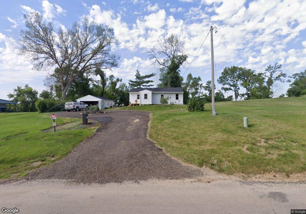
2617 Otis Rd SE Cedar Rapids, IA 52403
Cedar Valley NeighborhoodEstimated Value: $124,000 - $152,000
2
Beds
1
Bath
1,053
Sq Ft
$137/Sq Ft
Est. Value
About This Home
This home is located at 2617 Otis Rd SE, Cedar Rapids, IA 52403 and is currently estimated at $144,393, approximately $137 per square foot. 2617 Otis Rd SE is a home located in Linn County with nearby schools including Summit Elementary School, Erskine Elementary School, and McKinley STEAM Academy.
Ownership History
Date
Name
Owned For
Owner Type
Purchase Details
Closed on
Jun 21, 2006
Sold by
Toben Bonnie and Toben John
Bought by
Burger Cindy
Current Estimated Value
Create a Home Valuation Report for This Property
The Home Valuation Report is an in-depth analysis detailing your home's value as well as a comparison with similar homes in the area
Home Values in the Area
Average Home Value in this Area
Purchase History
| Date | Buyer | Sale Price | Title Company |
|---|---|---|---|
| Burger Cindy | -- | None Available |
Source: Public Records
Tax History Compared to Growth
Tax History
| Year | Tax Paid | Tax Assessment Tax Assessment Total Assessment is a certain percentage of the fair market value that is determined by local assessors to be the total taxable value of land and additions on the property. | Land | Improvement |
|---|---|---|---|---|
| 2025 | $1,734 | $136,000 | $30,500 | $105,500 |
| 2024 | $2,196 | $127,000 | $27,100 | $99,900 |
| 2023 | $2,196 | $115,500 | $23,700 | $91,800 |
| 2022 | $1,990 | $113,000 | $23,700 | $89,300 |
| 2021 | $1,974 | $105,000 | $23,700 | $81,300 |
| 2020 | $1,974 | $98,100 | $13,600 | $84,500 |
| 2019 | $1,734 | $89,000 | $13,600 | $75,400 |
| 2018 | $1,682 | $89,000 | $13,600 | $75,400 |
| 2017 | $1,887 | $93,500 | $13,600 | $79,900 |
| 2016 | $1,887 | $88,800 | $13,600 | $75,200 |
| 2015 | $1,931 | $90,720 | $13,560 | $77,160 |
| 2014 | $1,746 | $90,720 | $13,560 | $77,160 |
| 2013 | $1,704 | $90,720 | $13,560 | $77,160 |
Source: Public Records
Map
Nearby Homes
- 0 Rompot St SE
- Lot 38 Kestrel Dr SE
- Lot 51 Kestrel Dr SE
- Lot 48 Kestrel Dr SE
- Lot 43 Kestrel Dr SE
- Lot 44 Kestrel Dr SE
- Lot 46 Kestrel Dr SE
- Lot 53 Kestrel Dr SE
- Lot 49 Kestrel Dr SE
- Lot 50 Kestrel Dr SE
- Lot 52 Kestrel Dr SE
- 3115 Peregrine Ct SE
- 2426 Kestrel Dr SE
- TBD Old River Rd SW
- 1521 Oak Ridge Ln SE Unit 3
- 1440 Parkwood Dr SE
- 2212 Deborah Dr SW
- 1341 Memorial Dr SE
- 3510 Pioneer Ave SE
- 1609 38th St SE
- 2633 Otis Rd SE
- 2571 Otis Rd SE
- 2544 23rd Ave SE
- 2641 Otis Rd SE
- 2520 23rd Ave SE
- 2549 Otis Rd SE
- 2506 23rd Ave SE
- 2301 Thompson St SE
- 2626 23rd Ave SE
- 2446 23rd Ave SE
- 2311 Thompson St SE
- 2300 Rompot St SE
- 2239 Rompot St SE
- 2306 Rompot St SE
- 2537 Otis Rd SE
- 2319 Thompson St SE
- 2312 Rompot St SE
- 2323 Thompson St SE
- 2436 23rd Ave SE
- 2635 23rd Ave SE