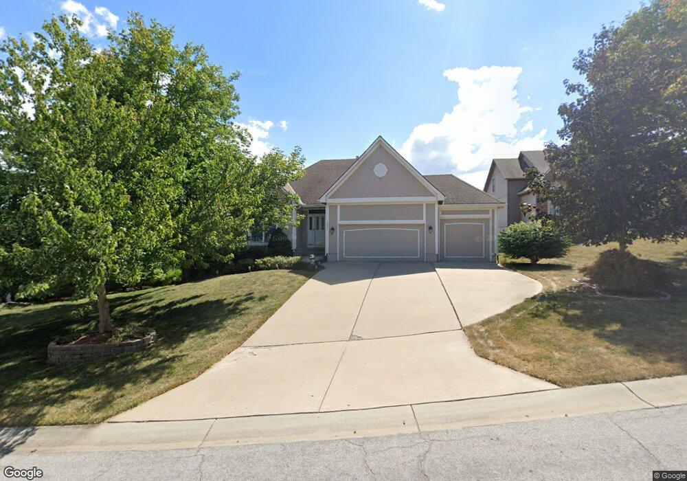
2617 SW 10th St Lees Summit, MO 64081
Estimated Value: $382,885 - $437,000
4
Beds
5
Baths
1,473
Sq Ft
$278/Sq Ft
Est. Value
About This Home
This home is located at 2617 SW 10th St, Lees Summit, MO 64081 and is currently estimated at $409,971, approximately $278 per square foot. 2617 SW 10th St is a home located in Jackson County with nearby schools including Longview Farm Elementary School, Summit Lakes Middle School, and Lee's Summit West High School.
Ownership History
Date
Name
Owned For
Owner Type
Purchase Details
Closed on
Sep 2, 1997
Sold by
Woodstone Homes Inc
Bought by
Schlotzhauer Roger L and Schlotzhauer Carol A
Current Estimated Value
Home Financials for this Owner
Home Financials are based on the most recent Mortgage that was taken out on this home.
Original Mortgage
$145,750
Outstanding Balance
$22,508
Interest Rate
7.43%
Mortgage Type
Purchase Money Mortgage
Estimated Equity
$387,463
Purchase Details
Closed on
Apr 7, 1997
Sold by
Longview Investors Llc
Bought by
Woodstone Homes Inc
Create a Home Valuation Report for This Property
The Home Valuation Report is an in-depth analysis detailing your home's value as well as a comparison with similar homes in the area
Home Values in the Area
Average Home Value in this Area
Purchase History
| Date | Buyer | Sale Price | Title Company |
|---|---|---|---|
| Schlotzhauer Roger L | -- | Security Land Title Company | |
| Woodstone Homes Inc | -- | Security Land Title Company |
Source: Public Records
Mortgage History
| Date | Status | Borrower | Loan Amount |
|---|---|---|---|
| Open | Schlotzhauer Roger L | $145,750 |
Source: Public Records
Tax History Compared to Growth
Tax History
| Year | Tax Paid | Tax Assessment Tax Assessment Total Assessment is a certain percentage of the fair market value that is determined by local assessors to be the total taxable value of land and additions on the property. | Land | Improvement |
|---|---|---|---|---|
| 2025 | $4,242 | $67,555 | $12,483 | $55,072 |
| 2024 | $4,211 | $58,744 | $8,903 | $49,841 |
| 2023 | $4,211 | $58,744 | $11,208 | $47,536 |
| 2022 | $4,249 | $52,630 | $6,658 | $45,972 |
| 2021 | $4,337 | $52,630 | $6,658 | $45,972 |
| 2020 | $4,371 | $52,532 | $6,658 | $45,874 |
| 2019 | $4,252 | $52,532 | $6,658 | $45,874 |
| 2018 | $1,011,566 | $45,720 | $5,795 | $39,925 |
| 2017 | $3,927 | $45,720 | $5,795 | $39,925 |
| 2016 | $3,927 | $44,574 | $6,574 | $38,000 |
| 2014 | $4,086 | $45,458 | $5,874 | $39,584 |
Source: Public Records
Map
Nearby Homes
- 1039 SW Fiord Dr
- 1035 SW Fiord Dr
- 1051 SW Fiord Dr
- 2644 SW 9th Terrace
- 1052 SW Argyl St
- 1106 SW Fiord Dr
- 2629 SW Wintergarden Dr
- 916 SW Sara Cir
- 2755 SW 11th Terrace
- 1216 SE Ranchland St
- 2766 SW 12 St
- 8943 SW 6th St
- Winfield Plan at Highland Meadows
- Wildflower in Highland Meadows Plan at Highland Meadows
- Sunflower Plan at Highland Meadows
- Sheffield Plan at Highland Meadows
- Riverside Plan at Highland Meadows
- Heather Plan at Highland Meadows
- Carolina Plan at Highland Meadows
- Basswood Plan at Highland Meadows
- 2621 SW 10th St
- 2613 SW 10th St
- 2620 SW 10th St
- 2616 SW 10th St
- 2625 SW 10th St
- 2612 SW 10th St
- 2609 SW 10th St
- 2629 SW 10th St
- 2624 SW 10th St
- 2612 SW 10th Ct
- 2608 SW 10th St
- 2608 SW 10th St
- 2608 SW 10th Ct
- 2616 SW 10th Ct
- 2604 SW 10th St
- 2628 SW 10th St
- 2605 SW 10th St
- 2604 SW 10th Ct
- 2620 SW 10th Ct
- 2601 SW 10th St