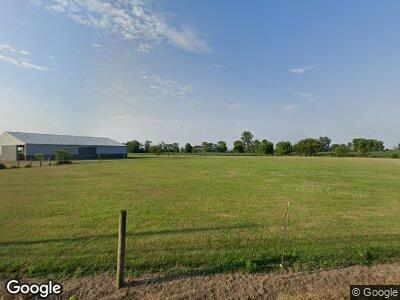
26196 Locust Grove Rd New Holland, OH 43145
Estimated Value: $134,383 - $183,000
3
Beds
1
Bath
1,186
Sq Ft
$139/Sq Ft
Est. Value
About This Home
This home is located at 26196 Locust Grove Rd, New Holland, OH 43145 and is currently estimated at $164,346, approximately $138 per square foot. 26196 Locust Grove Rd is a home located in Pickaway County with nearby schools including Westfall Elementary School, Westfall Middle School, and Westfall High School.
Ownership History
Date
Name
Owned For
Owner Type
Purchase Details
Closed on
Jan 29, 2016
Sold by
Turner Donald Rae and Estate Of Marian L Turner
Bought by
Darden Kathy Jo and The Darden Family Revocable Tr
Current Estimated Value
Purchase Details
Closed on
Feb 1, 2008
Sold by
Estate Of Noel E Wright
Bought by
Turner Marian L
Home Financials for this Owner
Home Financials are based on the most recent Mortgage that was taken out on this home.
Original Mortgage
$17,500
Interest Rate
5.79%
Mortgage Type
Credit Line Revolving
Purchase Details
Closed on
Oct 15, 1991
Sold by
Wright Orland
Bought by
Wright Noel E
Create a Home Valuation Report for This Property
The Home Valuation Report is an in-depth analysis detailing your home's value as well as a comparison with similar homes in the area
Home Values in the Area
Average Home Value in this Area
Purchase History
| Date | Buyer | Sale Price | Title Company |
|---|---|---|---|
| Darden Kathy Jo | $24,000 | Attorney | |
| Turner Marian L | -- | None Available | |
| Wright Noel E | -- | -- |
Source: Public Records
Mortgage History
| Date | Status | Borrower | Loan Amount |
|---|---|---|---|
| Previous Owner | Turner Marian L | $17,500 |
Source: Public Records
Tax History Compared to Growth
Tax History
| Year | Tax Paid | Tax Assessment Tax Assessment Total Assessment is a certain percentage of the fair market value that is determined by local assessors to be the total taxable value of land and additions on the property. | Land | Improvement |
|---|---|---|---|---|
| 2024 | -- | $34,100 | $7,070 | $27,030 |
| 2023 | $1,252 | $34,100 | $7,070 | $27,030 |
| 2022 | $1,074 | $26,860 | $5,610 | $21,250 |
| 2021 | $1,082 | $26,860 | $5,610 | $21,250 |
| 2020 | $1,084 | $26,860 | $5,610 | $21,250 |
| 2019 | $432 | $21,920 | $5,190 | $16,730 |
| 2018 | $864 | $21,920 | $5,190 | $16,730 |
| 2017 | $869 | $21,920 | $5,190 | $16,730 |
| 2016 | $746 | $19,640 | $4,660 | $14,980 |
| 2015 | $381 | $19,640 | $4,660 | $14,980 |
| 2014 | $772 | $19,640 | $4,660 | $14,980 |
| 2013 | $818 | $19,640 | $4,660 | $14,980 |
Source: Public Records
Map
Nearby Homes
- 10290 Judas Rd
- 231 S East St
- 48 S East St
- 0 Beaumont Ct
- 45 S Main St
- 215 N Main St
- 9581 Williamsport Crownover Mill Rd
- 36 Circle Ave
- 0 Us Highway 22 and 3 Unit Lot 3 224024058
- 0 Us Highway 22 and 3 Unit Lot 2 224024055
- 0 Us Highway 22 and 3 Unit Lot 1 224024051
- 16850 State Route 138
- 103 N Water St
- 25560 Chillicothe Pike
- 113 Pike St
- 25805 Chillicothe Pike
- 11744 Yankeetown Pike
- 0 Yankeetown Pike Unit 225019293
- 48 Deer Haven Ct NE
- 20360 Five Points Pike
- 26196 Locust Grove Rd
- 26155 Locust Grove Rd
- 26181 Locust Grove Rd
- 26170 Locust Grove Rd
- 26205 Locust Grove Rd
- 26176 Locust Grove Rd
- 26138 Poplar Alley
- 26135 Locust Grove Rd
- 26125 Locust Grove Rd
- 26130 Locust Grove Rd
- 26118 N Poplar St
- 26118 Poplar Alley
- 26151 Poplar Alley
- 26239 Locust Grove Rd
- 26115 Locust Grove Rd
- 26119 Poplar Alley
- 26247 Locust Grove Rd
- 26105 Locust Grove Rd
- 26098 Poplar Alley
- 26255 Locust Grove Rd
