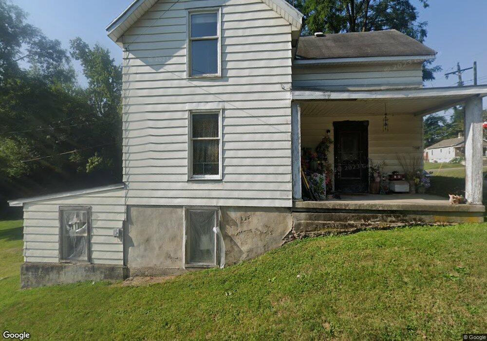
262 Allen St Franklin, OH 45005
Estimated Value: $96,000 - $172,000
2
Beds
3
Baths
1,146
Sq Ft
$117/Sq Ft
Est. Value
About This Home
This home is located at 262 Allen St, Franklin, OH 45005 and is currently estimated at $134,000, approximately $116 per square foot. 262 Allen St is a home located in Warren County with nearby schools including Franklin High School.
Ownership History
Date
Name
Owned For
Owner Type
Purchase Details
Closed on
Jul 16, 2020
Sold by
Castle Donald R and Castle Fayella
Bought by
Castle Donald R and Castle Jo Fran
Current Estimated Value
Purchase Details
Closed on
Sep 8, 2018
Sold by
Jack Hembree Inc
Bought by
Bcf Properties Llc
Purchase Details
Closed on
Jul 14, 2004
Sold by
Hamilton Kenneth L and Hamilton Pamela J
Bought by
Hamilton Kenneth L and Hamilton Pamela J
Purchase Details
Closed on
May 22, 1989
Sold by
Bostwick Gregg and Bostwick Sheryl
Bought by
Hamilton and Hamilton Kenneth L
Purchase Details
Closed on
May 2, 1986
Sold by
Welborn Welborn and Welborn Betty
Bought by
Bostwick Bostwick and Bostwick Gregg
Purchase Details
Closed on
Jul 1, 1981
Sold by
Baker Baker and Baker Dory
Create a Home Valuation Report for This Property
The Home Valuation Report is an in-depth analysis detailing your home's value as well as a comparison with similar homes in the area
Home Values in the Area
Average Home Value in this Area
Purchase History
| Date | Buyer | Sale Price | Title Company |
|---|---|---|---|
| Castle Donald R | -- | None Available | |
| Bcf Properties Llc | $20,000 | None Available | |
| Hamilton Kenneth L | -- | -- | |
| Hamilton | $16,000 | -- | |
| Bostwick Bostwick | $15,000 | -- | |
| -- | -- | -- |
Source: Public Records
Tax History
| Year | Tax Paid | Tax Assessment Tax Assessment Total Assessment is a certain percentage of the fair market value that is determined by local assessors to be the total taxable value of land and additions on the property. | Land | Improvement |
|---|---|---|---|---|
| 2025 | $1,585 | $32,940 | $8,820 | $24,120 |
| 2024 | $1,585 | $32,940 | $8,820 | $24,120 |
| 2023 | $1,321 | $24,629 | $5,001 | $19,628 |
| 2022 | $1,295 | $24,630 | $5,002 | $19,628 |
| 2021 | $1,227 | $24,630 | $5,002 | $19,628 |
| 2020 | $1,104 | $19,544 | $3,969 | $15,575 |
| 2019 | $1,007 | $19,544 | $3,969 | $15,575 |
| 2018 | $993 | $19,544 | $3,969 | $15,575 |
| 2017 | $1,042 | $18,480 | $3,815 | $14,665 |
| 2016 | $1,062 | $18,480 | $3,815 | $14,665 |
| 2015 | $1,062 | $18,480 | $3,815 | $14,665 |
| 2014 | $1,076 | $18,480 | $3,820 | $14,670 |
| 2013 | $928 | $21,370 | $4,410 | $16,960 |
Source: Public Records
Map
Nearby Homes
- 202 E 2nd St
- 0 E 4th St
- 45 W 3rd St
- 527 S Main St
- 1200 Riley Blvd
- 551 E 2nd St
- 664 David Blvd
- 5 S River St
- 11 Highridge Ct
- 614 S River St
- 747 David Blvd
- 705 Julia Dr
- 760 David Blvd
- 0 Victoria Dr Unit 942075
- 0 Victoria Dr Unit 1852824
- 409 Millard Dr
- 410 Park Ave
- 414 Lake Ave
- 853 S River St
- 926 S Main St
Your Personal Tour Guide
Ask me questions while you tour the home.