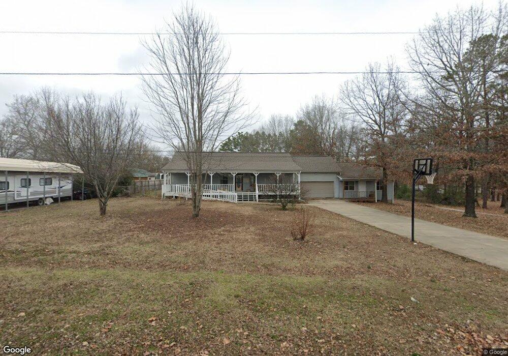
262 H St Clinton, AR 72031
Estimated Value: $208,265 - $283,000
--
Bed
2
Baths
1,920
Sq Ft
$128/Sq Ft
Est. Value
About This Home
This home is located at 262 H St, Clinton, AR 72031 and is currently estimated at $245,066, approximately $127 per square foot. 262 H St is a home located in Van Buren County with nearby schools including Clinton Elementary School, Clinton Junior High School, and Clinton High School.
Ownership History
Date
Name
Owned For
Owner Type
Purchase Details
Closed on
Mar 15, 2013
Sold by
Mcentire Ronald D and Womack Linda
Bought by
Lewis Christina
Current Estimated Value
Purchase Details
Closed on
Feb 21, 2008
Sold by
French William L and French Sandra
Bought by
Schmucker Charles F and Schmucker Eunice P
Purchase Details
Closed on
Aug 9, 2005
Sold by
Hink Todd and Hink Holly
Bought by
French William L and French Sandra
Home Financials for this Owner
Home Financials are based on the most recent Mortgage that was taken out on this home.
Original Mortgage
$22,600
Interest Rate
5.61%
Mortgage Type
Stand Alone Second
Purchase Details
Closed on
Aug 30, 2001
Bought by
Hink
Purchase Details
Closed on
May 23, 1997
Bought by
Moore
Create a Home Valuation Report for This Property
The Home Valuation Report is an in-depth analysis detailing your home's value as well as a comparison with similar homes in the area
Home Values in the Area
Average Home Value in this Area
Purchase History
| Date | Buyer | Sale Price | Title Company |
|---|---|---|---|
| Lewis Christina | $119,000 | None Available | |
| Schmucker Charles F | $122,696 | None Available | |
| French William L | $113,000 | None Available | |
| Hink | $11,000 | -- | |
| Moore | -- | -- |
Source: Public Records
Mortgage History
| Date | Status | Borrower | Loan Amount |
|---|---|---|---|
| Previous Owner | French William L | $22,600 | |
| Previous Owner | French William L | $90,400 |
Source: Public Records
Tax History Compared to Growth
Tax History
| Year | Tax Paid | Tax Assessment Tax Assessment Total Assessment is a certain percentage of the fair market value that is determined by local assessors to be the total taxable value of land and additions on the property. | Land | Improvement |
|---|---|---|---|---|
| 2024 | $1,207 | $25,680 | $1,020 | $24,660 |
| 2023 | $782 | $25,680 | $1,020 | $24,660 |
| 2022 | $832 | $25,680 | $1,020 | $24,660 |
| 2021 | $832 | $25,680 | $1,020 | $24,660 |
| 2020 | $832 | $25,680 | $1,020 | $24,660 |
| 2019 | $862 | $26,320 | $1,020 | $25,300 |
| 2018 | $887 | $26,320 | $1,020 | $25,300 |
| 2017 | $971 | $21,470 | $1,020 | $20,450 |
| 2015 | -- | $18,450 | $1,020 | $17,430 |
| 2014 | -- | $18,450 | $1,020 | $17,430 |
| 2013 | -- | $18,450 | $1,020 | $17,430 |
Source: Public Records
Map
Nearby Homes
- 579 H St
- 0 Highway 65 S Unit 20037632
- 1639 Highway 65 S
- 0000 Highway 65 S
- 936 Cemetery Rd
- 3008 Highway 65 S
- 2304 Highway 65 S
- 2234 Highway 65 S
- 2206 Highway 65 S
- 2153 S Hwy 65
- 3570 Highway 65 S
- 333 Kip Ln
- 799 Barrens Community Rd
- Lot 9 &10 Kip Ln
- 191 Cedar Crest Dr
- 1518 Highway 65 S
- 112 Cedar Crest Dr
- 4263 Highway 65 S
- TBD Highway 65
- 000 Barrens Loop Rd