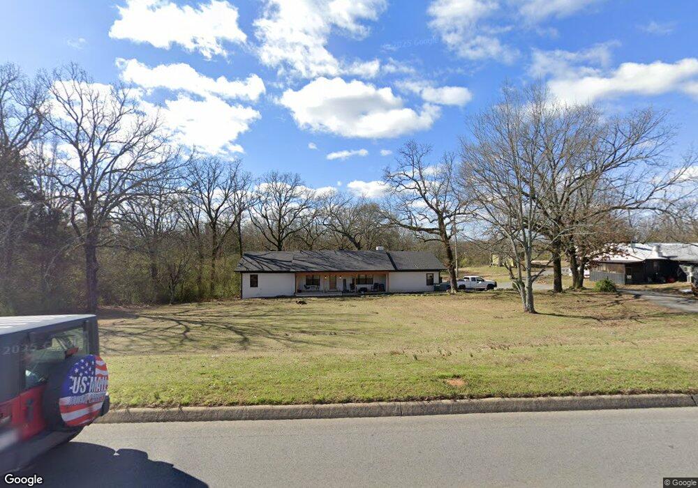
262 Highway 64 E Conway, AR 72032
Estimated Value: $257,000 - $308,671
Studio
2
Baths
2,431
Sq Ft
$116/Sq Ft
Est. Value
About This Home
This home is located at 262 Highway 64 E, Conway, AR 72032 and is currently estimated at $281,918, approximately $115 per square foot. 262 Highway 64 E is a home located in Faulkner County with nearby schools including Preston & Florence Mattison Elementary School, Bob Courtway Middle School, and Conway Junior High School.
Ownership History
Date
Name
Owned For
Owner Type
Purchase Details
Closed on
Mar 30, 2010
Sold by
Meyer Albert and Meyer Joyce
Bought by
Meyer Alan and Meyer Joyce
Current Estimated Value
Purchase Details
Closed on
Mar 10, 2010
Sold by
Baker Lisa
Bought by
Meyer Albert L and Meyer Joyce G
Purchase Details
Closed on
Mar 9, 2010
Sold by
Stancil Betty Ann
Bought by
Meyer Albert L and Meyer Joyce G
Purchase Details
Closed on
Feb 23, 2010
Sold by
Mcnair Mondell E
Bought by
Meyer Albert L and Meyer Joyce G
Purchase Details
Closed on
Apr 14, 1999
Bought by
Entergy
Purchase Details
Closed on
Feb 19, 1986
Bought by
Meyer
Purchase Details
Closed on
May 29, 1985
Bought by
Meyer and Mcnair
Purchase Details
Closed on
May 22, 1985
Bought by
Meyer and Mcnair
Purchase Details
Closed on
Jan 27, 1976
Bought by
Albert and Joyce Meyer
Purchase Details
Closed on
Sep 12, 1975
Bought by
Albert and Joyce Meyer
Create a Home Valuation Report for This Property
The Home Valuation Report is an in-depth analysis detailing your home's value as well as a comparison with similar homes in the area
Home Values in the Area
Average Home Value in this Area
Purchase History
| Date | Buyer | Sale Price | Title Company |
|---|---|---|---|
| Meyer Alan | -- | -- | |
| Meyer Albert L | -- | -- | |
| Meyer Albert L | -- | -- | |
| Meyer Albert L | -- | -- | |
| Entergy | -- | -- | |
| Meyer | -- | -- | |
| Meyer | -- | -- | |
| Meyer | -- | -- | |
| Albert | -- | -- | |
| Albert | $2,000 | -- | |
| Meyer | $2,000 | -- |
Source: Public Records
Tax History
| Year | Tax Paid | Tax Assessment Tax Assessment Total Assessment is a certain percentage of the fair market value that is determined by local assessors to be the total taxable value of land and additions on the property. | Land | Improvement |
|---|---|---|---|---|
| 2025 | $1,453 | $65,360 | $7,640 | $57,720 |
| 2024 | $1,387 | $65,360 | $7,640 | $57,720 |
| 2023 | $1,258 | $48,260 | $7,640 | $40,620 |
| 2022 | $933 | $48,260 | $7,640 | $40,620 |
| 2021 | $918 | $48,260 | $7,640 | $40,620 |
| 2020 | $918 | $38,780 | $5,730 | $33,050 |
| 2019 | $918 | $38,780 | $5,730 | $33,050 |
| 2018 | $943 | $38,780 | $5,730 | $33,050 |
| 2017 | $943 | $38,780 | $5,730 | $33,050 |
| 2016 | $943 | $27,110 | $5,730 | $21,380 |
| 2015 | $1,258 | $37,350 | $5,730 | $31,620 |
| 2014 | $943 | $37,350 | $5,730 | $31,620 |
Source: Public Records
Map
Nearby Homes
- 278-I U S Highway 64
- 278-H U S Highway 64
- 278 Hwy 64 E
- 278 C U S Highway 64 E
- 278-E Hwy 64 E
- 2415 E Oak St
- 2365 E Oak St
- 9 Olivia Ln
- 10 Starr Ln
- 30 Hazelwood Rd
- 82 Addi Ln
- 24 Lots Hays Add
- 00 Caskay Dr
- 119 Middle Rd
- 1012 Woodside Dr
- 164 Middle Rd
- 7 Ginger Dr
- 3470 Bentonville
- 3400 Perryville Dr
- 3400 Appomattox Dr
- 37 Skunk Hollow Rd E
- 268 Highway 64 E
- 259 Highway 64 E
- 259 Highway 64 E
- 259 Highway 64 E
- 273 Highway 64 E
- 0 Hwy 64 E Unit 10221322
- 0 Hwy 64 E Unit 17007809
- 0 Hwy 64 E Unit 15016801
- 0 Hwy 64 E Unit 15034253
- 0 Hwy 64 E Unit 16012241
- 0 Hwy 64 E Unit 16030333
- 0 Hwy 64 E Unit 17003926
- 0 Hwy 64 E Unit 15029596
- 0 Hwy 64 E Unit 18000043
- 0 Hwy 64 E Unit 19026233
- 0 Hwy 64 E Unit 18002837
- 0 Hwy 64 E Unit 21002911
- 1890 U S Highway 64
- 600 U S Highway 64
Your Personal Tour Guide
Ask me questions while you tour the home.