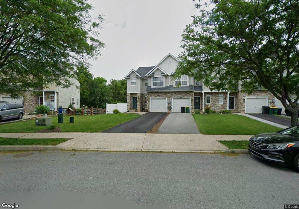
262 Maple Ct Alburtis, PA 18011
Estimated Value: $355,547 - $392,000
3
Beds
3
Baths
1,796
Sq Ft
$207/Sq Ft
Est. Value
About This Home
This home is located at 262 Maple Ct, Alburtis, PA 18011 and is currently estimated at $370,887, approximately $206 per square foot. 262 Maple Ct is a home located in Lehigh County with nearby schools including Alburtis Elementary School, Lower Macungie Middle School, and Emmaus High School.
Ownership History
Date
Name
Owned For
Owner Type
Purchase Details
Closed on
Oct 14, 2020
Sold by
Ricketts Arnett
Bought by
Ricketts Arnett and Ricketts Ray Alexander
Current Estimated Value
Home Financials for this Owner
Home Financials are based on the most recent Mortgage that was taken out on this home.
Original Mortgage
$176,125
Outstanding Balance
$156,368
Interest Rate
2.8%
Mortgage Type
New Conventional
Estimated Equity
$214,519
Purchase Details
Closed on
Apr 24, 2006
Sold by
Saucon Valley Custom Homes Inc
Bought by
Ricketts Arnett
Home Financials for this Owner
Home Financials are based on the most recent Mortgage that was taken out on this home.
Original Mortgage
$155,920
Interest Rate
6.34%
Mortgage Type
Fannie Mae Freddie Mac
Create a Home Valuation Report for This Property
The Home Valuation Report is an in-depth analysis detailing your home's value as well as a comparison with similar homes in the area
Home Values in the Area
Average Home Value in this Area
Purchase History
| Date | Buyer | Sale Price | Title Company |
|---|---|---|---|
| Ricketts Arnett | -- | Solidifi | |
| Ricketts Arnett | $194,900 | None Available |
Source: Public Records
Mortgage History
| Date | Status | Borrower | Loan Amount |
|---|---|---|---|
| Open | Ricketts Arnett | $176,125 | |
| Closed | Ricketts Arnett | $155,920 |
Source: Public Records
Tax History
| Year | Tax Paid | Tax Assessment Tax Assessment Total Assessment is a certain percentage of the fair market value that is determined by local assessors to be the total taxable value of land and additions on the property. | Land | Improvement |
|---|---|---|---|---|
| 2025 | $5,769 | $196,500 | $22,600 | $173,900 |
| 2024 | $5,622 | $196,500 | $22,600 | $173,900 |
| 2023 | $5,362 | $196,500 | $22,600 | $173,900 |
| 2022 | $5,249 | $196,500 | $173,900 | $22,600 |
| 2021 | $5,151 | $196,500 | $22,600 | $173,900 |
| 2020 | $5,107 | $196,500 | $22,600 | $173,900 |
| 2019 | $5,080 | $196,500 | $22,600 | $173,900 |
| 2018 | $5,022 | $196,500 | $22,600 | $173,900 |
| 2017 | $4,945 | $196,500 | $22,600 | $173,900 |
| 2016 | -- | $196,500 | $22,600 | $173,900 |
| 2015 | -- | $196,500 | $22,600 | $173,900 |
| 2014 | -- | $196,500 | $22,600 | $173,900 |
Source: Public Records
Map
Nearby Homes
- 195 Maple Ct
- 317 Lockridge Ln
- 7695 Barrow Dr
- 38 E 2nd St
- 428 Thomas St
- 112 Front St
- 314 Ridgeview Dr
- 0 Clauss Hunt Knight Dr Unit 10 Units
- 7264 Snowberry Ct
- 2301 Goldenrod Dr
- 7528 Buttercup Rd
- 6720 Pioneer Dr
- 7699 Catalpa Dr
- 7687 Catalpa Dr
- 2839 Donegal Dr
- 2852 Donegal Dr Unit 2852
- 2823 Sequoia Dr
- 3091 Donegal Dr Unit 3091
- 2847 Sequoia Dr
- 7501 Spring Creek Rd
Your Personal Tour Guide
Ask me questions while you tour the home.