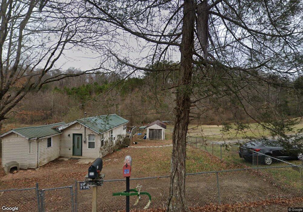
262 Mehaffey Rd Powell, TN 37849
South Clinton NeighborhoodEstimated Value: $138,167 - $172,000
--
Bed
1
Bath
610
Sq Ft
$256/Sq Ft
Est. Value
About This Home
This home is located at 262 Mehaffey Rd, Powell, TN 37849 and is currently estimated at $156,042, approximately $255 per square foot. 262 Mehaffey Rd is a home located in Anderson County.
Ownership History
Date
Name
Owned For
Owner Type
Purchase Details
Closed on
Oct 29, 2007
Sold by
Sims Joseph
Bought by
Mcmahan Samuel S
Current Estimated Value
Home Financials for this Owner
Home Financials are based on the most recent Mortgage that was taken out on this home.
Original Mortgage
$45,150
Interest Rate
5.93%
Purchase Details
Closed on
May 3, 2004
Sold by
Hickey Scott
Bought by
Emmanuel Baptist Church
Home Financials for this Owner
Home Financials are based on the most recent Mortgage that was taken out on this home.
Original Mortgage
$40,000
Interest Rate
5.49%
Purchase Details
Closed on
May 31, 1994
Bought by
Hicky Scott
Create a Home Valuation Report for This Property
The Home Valuation Report is an in-depth analysis detailing your home's value as well as a comparison with similar homes in the area
Home Values in the Area
Average Home Value in this Area
Purchase History
| Date | Buyer | Sale Price | Title Company |
|---|---|---|---|
| Mcmahan Samuel S | $56,452 | -- | |
| Emmanuel Baptist Church | $50,000 | -- | |
| Hicky Scott | $18,000 | -- |
Source: Public Records
Mortgage History
| Date | Status | Borrower | Loan Amount |
|---|---|---|---|
| Closed | Hicky Scott | $45,150 | |
| Closed | Hicky Scott | $8,450 | |
| Previous Owner | Hicky Scott | $40,000 |
Source: Public Records
Tax History Compared to Growth
Tax History
| Year | Tax Paid | Tax Assessment Tax Assessment Total Assessment is a certain percentage of the fair market value that is determined by local assessors to be the total taxable value of land and additions on the property. | Land | Improvement |
|---|---|---|---|---|
| 2024 | $576 | $21,900 | $12,625 | $9,275 |
| 2023 | $409 | $15,575 | $0 | $0 |
| 2022 | $409 | $15,575 | $8,825 | $6,750 |
| 2021 | $409 | $15,575 | $8,825 | $6,750 |
| 2020 | $377 | $15,575 | $8,825 | $6,750 |
| 2019 | $391 | $13,525 | $8,825 | $4,700 |
| 2018 | $377 | $13,525 | $8,825 | $4,700 |
| 2017 | $377 | $13,525 | $8,825 | $4,700 |
| 2016 | $377 | $13,525 | $8,825 | $4,700 |
| 2015 | -- | $13,525 | $8,825 | $4,700 |
| 2014 | -- | $13,525 | $8,825 | $4,700 |
| 2013 | -- | $18,575 | $0 | $0 |
Source: Public Records
Map
Nearby Homes
- 126 Turkey Rd
- 126 Moore Ln
- 111 Grey Dove Ln
- 309 Strader Rd
- 225 Over Mountain Ln
- 202 Moosetrail Ln
- 2215 Clinton Hwy
- 248 Norman Rd
- 5104 Cates Bend Way Unit 19
- 278 Norman Rd
- 230 Wells Rd Unit Lot 9
- 7534 Julesburg Way Unit 68
- 297 Wells Rd
- 170 Cedar Cir
- 5605 Glenlyn Dr
- 7527 Saint Baron Way Unit 11
- 7505 Blacks Ferry Rd
- 7514 Julesburg Way Unit 62
- 7512 Saint Baron Way
- 120 Oak Rd
- 254 Mehaffey Rd
- 248 Mehaffey Rd
- 249 Mehaffey Rd
- 273 Mehaffey Rd
- 228 Mehaffey Rd
- 234 Mehaffey Rd
- 265 Mehaffey Rd
- 265 Mehaffey Rd
- 232 Mehaffey Rd
- 222 Mehaffey Rd
- 101 Green Ln
- 304 Mehaffey Rd
- 111 Green Ln
- 217 Mehaffey Rd
- 115 Green Ln
- 220 Mehaffey Rd
- 117 Green Ln
- 214 Mehaffey Rd
- 313 Mehaffey Rd
- 804-06 Green St