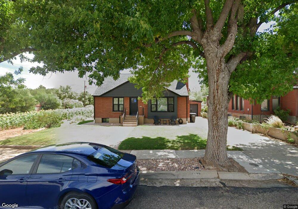
262 N 500 W Cedar City, UT 84721
Estimated Value: $331,000 - $541,000
--
Bed
1
Bath
980
Sq Ft
$414/Sq Ft
Est. Value
About This Home
This home is located at 262 N 500 W, Cedar City, UT 84721 and is currently estimated at $405,977, approximately $414 per square foot. 262 N 500 W is a home located in Iron County with nearby schools including Cedar North School, Cedar Middle School, and Cedar City High School.
Ownership History
Date
Name
Owned For
Owner Type
Purchase Details
Closed on
Jun 8, 2021
Sold by
Kent And Jean Peterson Family Trust
Bought by
Michelle Jorgenson Revocable Trust
Current Estimated Value
Purchase Details
Closed on
Jun 7, 2021
Sold by
Kent And Jean Peterson Family Trust and Peterson Kent F
Bought by
Michelle Jorgenson Revocable Trust and Jorgenson
Purchase Details
Closed on
May 21, 2021
Sold by
Anderson Geraldine P
Bought by
Anderson Julius Dean
Create a Home Valuation Report for This Property
The Home Valuation Report is an in-depth analysis detailing your home's value as well as a comparison with similar homes in the area
Home Values in the Area
Average Home Value in this Area
Purchase History
| Date | Buyer | Sale Price | Title Company |
|---|---|---|---|
| Michelle Jorgenson Revocable Trust | -- | Security Escrow & Title | |
| Michelle Jorgenson Revocable Trust | -- | Security Escrow & Title | |
| Michelle Jorgenson Revocable Trust | -- | Security Escrow & Title | |
| Anderson Julius Dean | -- | Westwood Law Pc |
Source: Public Records
Tax History Compared to Growth
Tax History
| Year | Tax Paid | Tax Assessment Tax Assessment Total Assessment is a certain percentage of the fair market value that is determined by local assessors to be the total taxable value of land and additions on the property. | Land | Improvement |
|---|---|---|---|---|
| 2025 | $2,627 | $337,691 | $121,185 | $216,506 |
| 2023 | $3,115 | $168,605 | $57,960 | $110,645 |
| 2022 | $1,476 | $160,575 | $55,195 | $105,380 |
| 2021 | $988 | $107,425 | $26,285 | $81,140 |
| 2020 | $1,075 | $103,690 | $26,285 | $77,405 |
| 2019 | $1,046 | $96,535 | $26,285 | $70,250 |
| 2018 | $1,018 | $90,850 | $26,285 | $64,565 |
| 2017 | $963 | $84,575 | $21,240 | $63,335 |
| 2016 | $915 | $74,840 | $17,245 | $57,595 |
| 2015 | $899 | $69,720 | $0 | $0 |
| 2014 | $875 | $63,490 | $0 | $0 |
Source: Public Records
Map
Nearby Homes
- 237 N 400 W
- 261 N 300 W
- 373 N 400 W
- 376 N 400 W
- 457 N 400 W Unit 7
- 4.12 Acre Water Rights
- 4883 N 10 E
- 4898 N 10 E
- 4961 N 900 W Unit lot 68
- 465 N 800 W Unit 3
- 465 N 800 W Unit 7
- 465 N 800 W Unit 2
- 3.73 ac N 100 W
- 2904 W Oak Springs Rd
- Lot 17 Parcel B-1382-0017-0000
- 1120 Bulloch Cir
- 40 shares E Extension Irrigation Co
- 40 shares Primary Water Unit East Extension Irrig
- 1918 S Oak Springs Cir
- 292 N 500 W
- 252 N 500 W
- 280 N 500 W
- 240 N 500 W
- 236 N 500 W
- 300 N 500 W
- 2 Acre Feet Water Rights (North of 56
- 466 W 200 N
- 310 N 500 W
- 456 W 200 N
- 456 W 200 N Unit FOR LEASE
- 486 W 200 N
- 4073 W 300 N
- 261 N 400 W
- 273 N 400 W
- 247 N 400 W
- 320 N 500 W
- 303 N 400 W
- 303 N 400 W Unit Apartment 3
- S23T 355 R 11 W