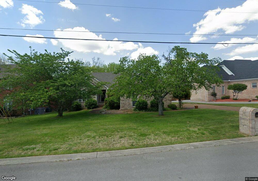
262 Page Dr Mount Juliet, TN 37122
Estimated Value: $446,846 - $608,000
--
Bed
3
Baths
2,260
Sq Ft
$244/Sq Ft
Est. Value
About This Home
This home is located at 262 Page Dr, Mount Juliet, TN 37122 and is currently estimated at $552,212, approximately $244 per square foot. 262 Page Dr is a home located in Wilson County with nearby schools including Mt. Juliet Elementary School, Mt. Juliet Middle School, and Green Hill High School.
Ownership History
Date
Name
Owned For
Owner Type
Purchase Details
Closed on
Jul 2, 2003
Sold by
Stephenson Joel S and Stephenson Kathy J
Bought by
Mccoy Robyn L
Current Estimated Value
Home Financials for this Owner
Home Financials are based on the most recent Mortgage that was taken out on this home.
Original Mortgage
$50,000
Interest Rate
5.29%
Purchase Details
Closed on
Sep 11, 2001
Sold by
Tim Polston Homes Inc
Bought by
Stephenson Joel S
Purchase Details
Closed on
Sep 25, 2000
Sold by
Brookstone Development Llc
Bought by
Tim Polston Homes Inc
Create a Home Valuation Report for This Property
The Home Valuation Report is an in-depth analysis detailing your home's value as well as a comparison with similar homes in the area
Home Values in the Area
Average Home Value in this Area
Purchase History
| Date | Buyer | Sale Price | Title Company |
|---|---|---|---|
| Mccoy Robyn L | $192,900 | -- | |
| Stephenson Joel S | $171,500 | -- | |
| Tim Polston Homes Inc | $32,900 | -- |
Source: Public Records
Mortgage History
| Date | Status | Borrower | Loan Amount |
|---|---|---|---|
| Closed | Tim Polston Homes Inc | $50,000 |
Source: Public Records
Tax History Compared to Growth
Tax History
| Year | Tax Paid | Tax Assessment Tax Assessment Total Assessment is a certain percentage of the fair market value that is determined by local assessors to be the total taxable value of land and additions on the property. | Land | Improvement |
|---|---|---|---|---|
| 2024 | $1,622 | $84,975 | $21,250 | $63,725 |
| 2022 | $1,611 | $84,375 | $21,250 | $63,125 |
| 2021 | $1,703 | $84,375 | $21,250 | $63,125 |
| 2020 | $1,756 | $84,375 | $21,250 | $63,125 |
| 2019 | $216 | $65,400 | $18,750 | $46,650 |
| 2018 | $1,748 | $65,100 | $18,750 | $46,350 |
| 2017 | $1,748 | $65,100 | $18,750 | $46,350 |
| 2016 | $1,748 | $65,100 | $18,750 | $46,350 |
| 2015 | $1,804 | $65,100 | $18,750 | $46,350 |
| 2014 | $1,570 | $56,669 | $0 | $0 |
Source: Public Records
Map
Nearby Homes
- 1120 Brookstone Blvd
- 271 Page Dr
- 288 Page Dr
- 1013 Brookstone Blvd
- 1520 Brookstone Cir
- 1105 Camden Cir
- 222 Jackson Trail
- 493 Page Dr
- 212 Jackson Trail
- 3107 Oxford Dr
- 506 Page Dr
- 144 W Division St
- 4014 Ethan Ave
- 700 Castle Rd
- 1733 Hartford Ln
- 2001 Lynnhaven Ct
- 2202 Dinah Ct
- 1617 Southhampton Way
- 2002 Lynnhaven Ct
- 5041 Winslow Dr
- 264 Page Dr
- 260 Page Dr
- 2105 Thoreau Place
- 2103 Thoreau Place
- 266 Page Dr
- 401 Page Place
- 400 Page Place
- 1118 Brookstone Blvd
- 1122 Brookstone Blvd
- 2106 Thoreau Place
- 268 Page Dr
- 403 Page Place
- 1124 Brookstone Blvd
- 263 Page Dr
- 402 Page Place
- 2104 Thoreau Place
- 1116 Brookstone Blvd
- 270 Page Dr
- 2107 Thoreau Place
- 1123 Brookstone Blvd