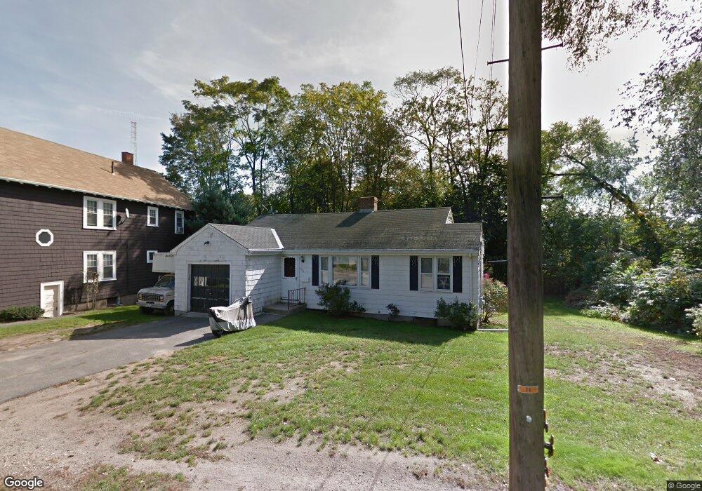
262 Webster St Auburndale, MA 02466
Auburndale NeighborhoodEstimated Value: $947,996 - $979,000
3
Beds
1
Bath
1,193
Sq Ft
$808/Sq Ft
Est. Value
About This Home
This home is located at 262 Webster St, Auburndale, MA 02466 and is currently estimated at $963,999, approximately $808 per square foot. 262 Webster St is a home located in Middlesex County with nearby schools including C.C. Burr, F.A. Day Middle School, and Newton North High School.
Ownership History
Date
Name
Owned For
Owner Type
Purchase Details
Closed on
Jul 15, 2002
Sold by
Leone John J and Headley Roberta C
Bought by
Murphy Robert P
Current Estimated Value
Home Financials for this Owner
Home Financials are based on the most recent Mortgage that was taken out on this home.
Original Mortgage
$277,500
Outstanding Balance
$118,305
Interest Rate
6.79%
Mortgage Type
Purchase Money Mortgage
Estimated Equity
$845,694
Create a Home Valuation Report for This Property
The Home Valuation Report is an in-depth analysis detailing your home's value as well as a comparison with similar homes in the area
Home Values in the Area
Average Home Value in this Area
Purchase History
| Date | Buyer | Sale Price | Title Company |
|---|---|---|---|
| Murphy Robert P | $370,000 | -- |
Source: Public Records
Mortgage History
| Date | Status | Borrower | Loan Amount |
|---|---|---|---|
| Open | Murphy Robert P | $277,500 |
Source: Public Records
Tax History Compared to Growth
Tax History
| Year | Tax Paid | Tax Assessment Tax Assessment Total Assessment is a certain percentage of the fair market value that is determined by local assessors to be the total taxable value of land and additions on the property. | Land | Improvement |
|---|---|---|---|---|
| 2025 | $6,836 | $697,500 | $0 | $0 |
| 2024 | $6,609 | $0 | $0 | $0 |
| 2023 | $6,182 | $607,300 | $551,200 | $56,100 |
| 2022 | $5,915 | $562,300 | $510,400 | $51,900 |
| 2021 | $5,664 | $526,400 | $481,500 | $44,900 |
| 2020 | $5,496 | $526,400 | $481,500 | $44,900 |
| 2019 | $5,341 | $511,100 | $467,500 | $43,600 |
| 2018 | $5,068 | $468,400 | $423,800 | $44,600 |
| 2017 | $4,914 | $441,900 | $399,800 | $42,100 |
| 2016 | $4,700 | $413,000 | $373,600 | $39,400 |
| 2015 | $4,481 | $386,000 | $349,200 | $36,800 |
Source: Public Records
Map
Nearby Homes
- 17 Crescent St
- 10 Crescent St Unit 1
- 10 Crescent St Unit 2
- 62-64 Rowe St Unit B
- 13 Weir St
- 160 Pine St Unit 12
- 0 Duncan Rd Unit 72925240
- 90 Auburndale Ave
- 51 Bourne St
- 17 Gilbert St
- 42 Evergreen Cir
- 1488 Washington St Unit 1488
- 33 Lill Ave
- 226 Auburn St Unit 226
- 224 Auburn St Unit 224
- 224 Auburn St Unit A
- 212 River St Unit 2
- 1639 Washington St
- 2 Elm St Unit 6
- 2 Elm St Unit 8
- 254 Webster St Unit 256
- 254 Webster St Unit 1
- 256 Webster St Unit 2
- 259 Webster St Unit 1
- 250 Webster St
- 261 Webster St
- 270 Webster St Unit 272
- 270 Webster St Unit 2
- 257 Webster St Unit 259
- 263 Webster St
- 263 Webster St
- 269 Webster St
- 251 Webster St
- 251 Webster St Unit 1
- 251 Webster St Unit 2
- 13 Crescent St
- 273 Webster St Unit 275
- 57 Murray Rd
- 245 Webster St
- 3 Crescent St