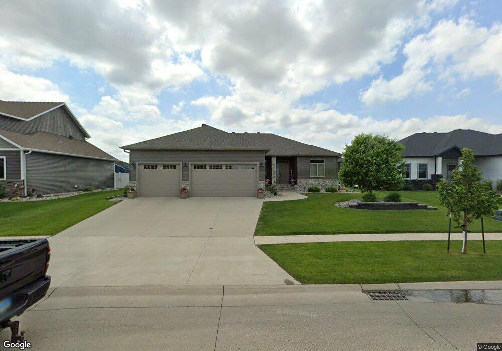
2620 Mcleod Dr E West Fargo, ND 58078
The Preserve NeighborhoodEstimated Value: $694,606 - $850,000
5
Beds
3
Baths
3,810
Sq Ft
$202/Sq Ft
Est. Value
About This Home
This home is located at 2620 Mcleod Dr E, West Fargo, ND 58078 and is currently estimated at $769,902, approximately $202 per square foot. 2620 Mcleod Dr E is a home located in Cass County with nearby schools including Freedom Elementary School, Liberty Middle School, and West Fargo Sheyenne High School.
Ownership History
Date
Name
Owned For
Owner Type
Purchase Details
Closed on
Jun 14, 2019
Sold by
Ysteboe John and Ysteboe Shannon
Bought by
Boeddeker Gerald H and Boeddeker Ann L
Current Estimated Value
Purchase Details
Closed on
Feb 23, 2017
Sold by
Bachmeier Custom Homes Inc
Bought by
Ysteboe John and Ysteboe Shannon
Home Financials for this Owner
Home Financials are based on the most recent Mortgage that was taken out on this home.
Original Mortgage
$399,400
Interest Rate
4.12%
Mortgage Type
New Conventional
Create a Home Valuation Report for This Property
The Home Valuation Report is an in-depth analysis detailing your home's value as well as a comparison with similar homes in the area
Home Values in the Area
Average Home Value in this Area
Purchase History
| Date | Buyer | Sale Price | Title Company |
|---|---|---|---|
| Boeddeker Gerald H | $299,000 | Title Co | |
| Ysteboe John | $499,250 | None Available | |
| Bachmeier Custom Homes Inc | $74,100 | Title Co |
Source: Public Records
Mortgage History
| Date | Status | Borrower | Loan Amount |
|---|---|---|---|
| Previous Owner | Ysteboe John | $399,400 |
Source: Public Records
Tax History Compared to Growth
Tax History
| Year | Tax Paid | Tax Assessment Tax Assessment Total Assessment is a certain percentage of the fair market value that is determined by local assessors to be the total taxable value of land and additions on the property. | Land | Improvement |
|---|---|---|---|---|
| 2024 | $12,637 | $331,800 | $58,000 | $273,800 |
| 2023 | $12,334 | $316,350 | $58,000 | $258,350 |
| 2022 | $12,054 | $295,100 | $58,000 | $237,100 |
| 2021 | $11,830 | $278,350 | $53,550 | $224,800 |
| 2020 | $11,713 | $276,950 | $53,550 | $223,400 |
| 2019 | $10,569 | $228,900 | $53,550 | $175,350 |
| 2018 | $9,374 | $187,250 | $53,550 | $133,700 |
| 2017 | $11,295 | $269,750 | $53,550 | $216,200 |
| 2016 | $5,244 | $37,450 | $37,450 | $0 |
| 2015 | $4,763 | $28,050 | $28,050 | $0 |
| 2014 | $3,426 | $18,950 | $18,950 | $0 |
| 2013 | $798 | $250 | $250 | $0 |
Source: Public Records
Map
Nearby Homes
- 2607 Mcleod Dr E
- 2630 2nd St E
- 2865 Mcleod Dr E
- 2836 River's Bend Dr E
- 3037 Claire Dr E
- 433 Foxtail Dr
- 445 E Foxtail Dr
- 820 26th Ave E
- 501 Foxtail Dr
- 3371 1st St
- 503 33rd Way E Unit B
- 3405 4th St E
- 360 32nd Ave W Unit 608
- 360 32nd Ave W Unit 508
- 154 W Beaton Dr
- 436 35th Ave E
- 713 23rd Ave W
- 3502 8th St E
- 517 18th Ave E
- 3463 Loberg Dr
- 2614 Mcleod Dr E
- 2626 Mcleod Dr E
- 2635 Pyle Ln E
- 2632 Mcleod Dr E
- 2608 Mcleod Dr E
- 2623 Pyle Ln E
- 2713 Pyle Ln E
- 2617 Pyle Ln E
- 2613 Mcleod Dr E
- 2704 Mcleod Dr E
- 2619 Mcleod Dr E
- 2719 Pyle Ln E
- 2611 Pyle Ln E
- 2625 Mcleod Dr E
- 2628 Pyle Ln E
- 2622 Pyle Ln E
- 2710 Mcleod Dr E
- 2706 Pyle Ln E
- 2725 Pyle Ln E
- 2709 Mcleod Dr E