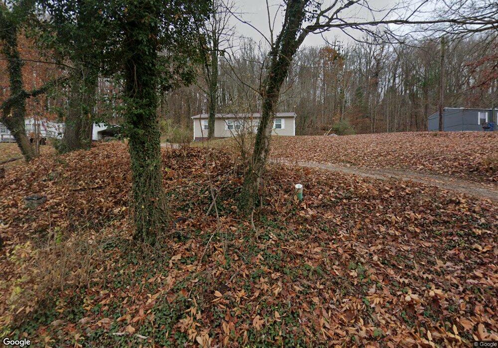
2620 Rifle Range Rd Knoxville, TN 37918
Uptown Knoxville NeighborhoodEstimated Value: $31,730 - $281,000
2
Beds
1
Bath
1,080
Sq Ft
$178/Sq Ft
Est. Value
About This Home
This home is located at 2620 Rifle Range Rd, Knoxville, TN 37918 and is currently estimated at $191,933, approximately $177 per square foot. 2620 Rifle Range Rd is a home located in Knox County with nearby schools including Adrian Burnett Elementary School, Halls High School, and Halls Middle School.
Ownership History
Date
Name
Owned For
Owner Type
Purchase Details
Closed on
Jul 23, 2020
Sold by
Allen Andrew Austin
Bought by
Lee Allen K and Lee Rhonda J
Current Estimated Value
Purchase Details
Closed on
Dec 12, 2019
Sold by
Allen Kevin James and Allen Charme
Bought by
Allen Andrew Austin
Purchase Details
Closed on
Aug 21, 2019
Sold by
Knox County
Bought by
Allen Kevin
Purchase Details
Closed on
Nov 30, 2018
Sold by
Baker Johnnie Ray
Bought by
Knox County
Create a Home Valuation Report for This Property
The Home Valuation Report is an in-depth analysis detailing your home's value as well as a comparison with similar homes in the area
Home Values in the Area
Average Home Value in this Area
Purchase History
| Date | Buyer | Sale Price | Title Company |
|---|---|---|---|
| Lee Allen K | $18,700 | None Available | |
| Allen Andrew Austin | $12,600 | None Available | |
| Allen Kevin | $12,025 | None Available | |
| Knox County | $11,208 | None Available |
Source: Public Records
Tax History Compared to Growth
Tax History
| Year | Tax Paid | Tax Assessment Tax Assessment Total Assessment is a certain percentage of the fair market value that is determined by local assessors to be the total taxable value of land and additions on the property. | Land | Improvement |
|---|---|---|---|---|
| 2024 | $360 | $23,150 | $0 | $0 |
| 2023 | $360 | $23,150 | $0 | $0 |
| 2022 | $360 | $23,150 | $0 | $0 |
| 2021 | $287 | $13,525 | $0 | $0 |
| 2020 | $287 | $13,525 | $0 | $0 |
| 2019 | $104 | $13,525 | $0 | $0 |
| 2018 | $287 | $13,525 | $0 | $0 |
| 2017 | $287 | $13,525 | $0 | $0 |
| 2016 | $411 | $0 | $0 | $0 |
| 2015 | $411 | $0 | $0 | $0 |
| 2014 | $411 | $0 | $0 | $0 |
Source: Public Records
Map
Nearby Homes
- 2705 Rifle Range Dr
- 2601 Rifle Range Rd
- 2839 Rifle Range Dr
- 826 Gresham Rd
- 2833 Ithaca Dr
- 5913 Ridgewood Rd
- 6025 Medlin Heights Rd
- 6009 Medlin Heights Rd
- 6553 E Garwood Cir
- 6112 Northcrest Cir NE
- 6524 E Garwood Cir
- 5828 Eldridge Rd
- 2928 Mynatt Rd
- 5821 Fountain Rd
- 5855 Fairhill Ln
- 0 NE Snowood Dr Unit 1303936
- 5511 Colonial Cir
- 5616 N Broadway St
- 5728 N Broadway St
- 3415 Harvey Rd
- 2700 Rifle Range Rd
- 2612 Rifle Range Rd
- 2617 Rifle Range Dr
- 2608 Rifle Range Rd
- 2927 Walkup Dr NE
- 2704 Rifle Range Dr
- 2704 Rifle Range Rd
- 2927 Walkup Dr
- 2927 Walkup Dr
- 2927 Walkup Dr Unit 2
- 2927 Walkup Dr Unit 1
- 2990 Rifle Range Rd
- 2606 Rifle Range Rd
- 2931 Walkup Dr
- 2931 Walkup Dr Unit 1
- 2606 Rifle Range Dr
- 6414 Hubert Bean Rd
- 2923 Walkup Dr
- 2708 Rifle Range Dr
- 2708 Rifle Range Rd
