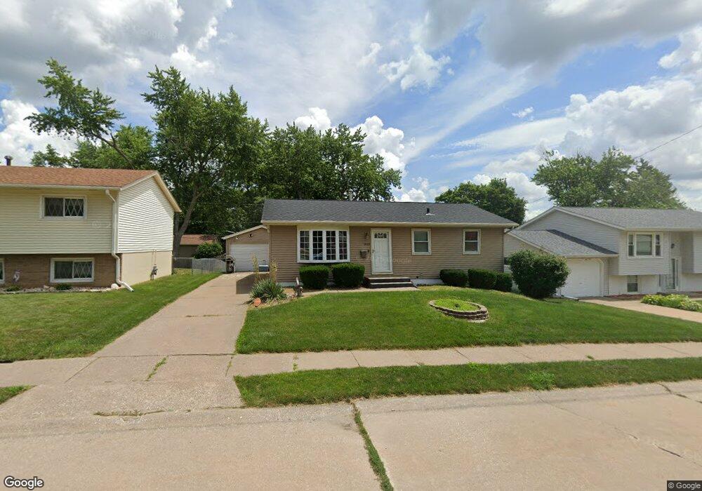
2623 N Elsie Ave Davenport, IA 52804
Northwest Davenport NeighborhoodEstimated Value: $164,000 - $190,000
3
Beds
2
Baths
1,040
Sq Ft
$169/Sq Ft
Est. Value
About This Home
This home is located at 2623 N Elsie Ave, Davenport, IA 52804 and is currently estimated at $175,880, approximately $169 per square foot. 2623 N Elsie Ave is a home located in Scott County with nearby schools including Wilson Elementary School, Williams Intermediate School, and West High School.
Ownership History
Date
Name
Owned For
Owner Type
Purchase Details
Closed on
Oct 30, 2008
Sold by
Habel Mark W
Bought by
Quijas Anthony J
Current Estimated Value
Home Financials for this Owner
Home Financials are based on the most recent Mortgage that was taken out on this home.
Original Mortgage
$103,171
Outstanding Balance
$66,542
Interest Rate
5.73%
Mortgage Type
VA
Estimated Equity
$109,338
Create a Home Valuation Report for This Property
The Home Valuation Report is an in-depth analysis detailing your home's value as well as a comparison with similar homes in the area
Home Values in the Area
Average Home Value in this Area
Purchase History
| Date | Buyer | Sale Price | Title Company |
|---|---|---|---|
| Quijas Anthony J | $104,000 | None Available |
Source: Public Records
Mortgage History
| Date | Status | Borrower | Loan Amount |
|---|---|---|---|
| Open | Quijas Anthony J | $103,171 |
Source: Public Records
Tax History Compared to Growth
Tax History
| Year | Tax Paid | Tax Assessment Tax Assessment Total Assessment is a certain percentage of the fair market value that is determined by local assessors to be the total taxable value of land and additions on the property. | Land | Improvement |
|---|---|---|---|---|
| 2024 | $2,194 | $144,950 | $27,090 | $117,860 |
| 2023 | $2,500 | $144,950 | $27,090 | $117,860 |
| 2022 | $2,406 | $129,290 | $20,640 | $108,650 |
| 2021 | $2,406 | $124,480 | $20,640 | $103,840 |
| 2020 | $2,272 | $116,790 | $20,640 | $96,150 |
| 2019 | $2,356 | $116,790 | $20,640 | $96,150 |
| 2018 | $2,194 | $116,790 | $20,640 | $96,150 |
| 2017 | $604 | $111,980 | $20,640 | $91,340 |
| 2016 | $1,978 | $102,370 | $0 | $0 |
| 2015 | $1,978 | $100,500 | $0 | $0 |
| 2014 | $1,964 | $100,500 | $0 | $0 |
| 2013 | $1,924 | $0 | $0 | $0 |
| 2012 | -- | $104,990 | $22,750 | $82,240 |
Source: Public Records
Map
Nearby Homes
- 2653 N Elsie Ave
- 3240 Heatherton Dr
- 3234 Heatherton Unit 6
- 2827 N Elsie Ave Unit 6
- 3518 W Garfield St
- 2225 N Ohio Ave
- 3549 W Garfield St
- 3536 Heatherton Dr
- 3805 W Garfield St
- 2109 N Michigan Ave
- 2325 N Zenith Ave
- 2012 N Ohio Ave
- 2110 N Fairmount St
- lots 1-10 Hidden Valley Cir
- 3823 W Lombard St
- 2035 N Gayman Ave
- 3430 W Locust St
- 2705 N Lincoln Ave
- 2015 N Zenith Ave
- 3117 W 34th St
- 2617 N Elsie Ave
- 2629 N Elsie Ave
- 2624 Wooddale Ave
- 2618 Wooddale Ave
- 2611 N Elsie Ave
- 2635 N Elsie Ave
- 2630 Wooddale Ave
- 2624 N Elsie Ave
- 2612 Wooddale Ave
- 2630 N Elsie Ave
- 2618 N Elsie Ave
- 2636 Wooddale Ave
- 3316 W Central Park Ave
- 2612 N Elsie Ave
- 2638 N Elsie Ave
- 3306 W Central Park Ave
- 2644 Wooddale Ave
- 3336 W Central Park Ave
- 2647 N Elsie Ave
- 2623 Wooddale Ave