
Seller's Agent in 2025
Jennifer McCrystal
Stellar Realty Northwest
(541) 420-4347
53 Total Sales
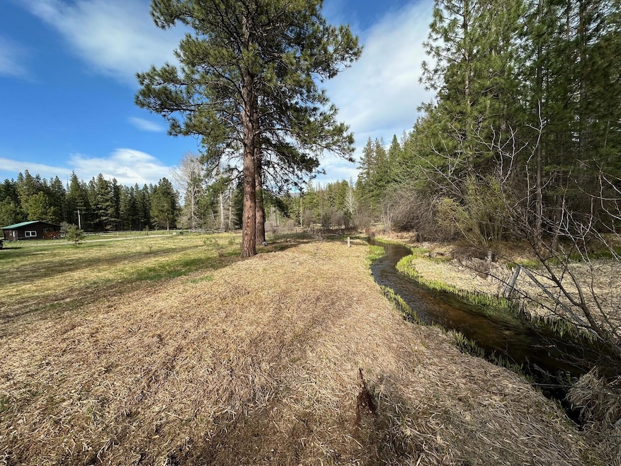
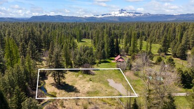
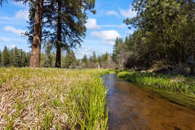
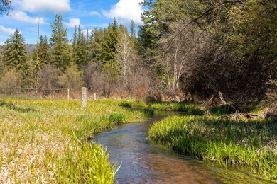
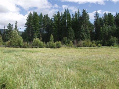
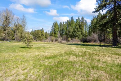
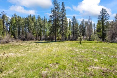
A beautiful meadow setting on the North Fork of Lake Creek located in the Heart of the Metolius Basin. This rare property offers natural meadow, water views, southern exposure and a variety of mature trees. It has direct access to National Forest and miles of trails for hiking, biking or cross country skiing. It is a great spot for a getaway cabin retreat or new custom home. A gravel driveway and underground power serve the lot. Buyer to be responsible for new septic system and private well. Close to the Metolius River, Black Butte Ranch Golf, Hoodoo Ski Area and the ''Old West'' town of Sisters.
Property Type
Est. Annual Taxes
Lot Details
Property Views
Schools
Farming
Mobile Home
Utilities
Listing and Financial Details
Overview
Recreation
| Date | Type | Sale Price | Title Company |
|---|---|---|---|
| Warranty Deed | $370,000 | Western Title | |
| Personal Reps Deed | $219,000 | Jefferson County Title Compa |
| Date | Event | Price | Change | Sq Ft Price |
|---|---|---|---|---|
| 05/13/2025 05/13/25 | For Sale | $399,000 | +7.8% | -- |
| 07/31/2024 07/31/24 | Sold | $370,000 | -7.4% | -- |
| 07/05/2024 07/05/24 | Pending | -- | -- | -- |
| 04/25/2024 04/25/24 | For Sale | $399,500 | +71.5% | -- |
| 08/03/2020 08/03/20 | Sold | $233,000 | -6.8% | -- |
| 07/03/2020 07/03/20 | Pending | -- | -- | -- |
| 05/07/2020 05/07/20 | For Sale | $249,900 | -- | -- |
| Year | Tax Paid | Tax Assessment Tax Assessment Total Assessment is a certain percentage of the fair market value that is determined by local assessors to be the total taxable value of land and additions on the property. | Land | Improvement |
|---|---|---|---|---|
| 2024 | $1,758 | $122,810 | -- | -- |
| 2023 | $1,717 | $119,240 | $0 | $0 |
| 2022 | $1,533 | $115,770 | $0 | $0 |
| 2021 | $1,459 | $112,400 | $0 | $0 |
| 2020 | $1,418 | $109,130 | $0 | $0 |
| 2019 | $1,377 | $105,960 | $0 | $0 |
| 2018 | $1,314 | $102,880 | $0 | $0 |
| 2017 | $1,285 | $99,890 | $0 | $0 |
| 2016 | $1,251 | $96,990 | $0 | $0 |
| 2015 | $1,153 | $94,170 | $0 | $0 |
| 2014 | $1,153 | $91,430 | $0 | $0 |
| 2013 | $1,159 | $88,770 | $0 | $0 |
Seller's Agent in 2025
Jennifer McCrystal
Stellar Realty Northwest
(541) 420-4347
53 Total Sales
R
Seller's Agent in 2024
Rad Dyer
Ponderosa Properties
(541) 549-2002
79 Total Sales
E
Seller's Agent in 2020
Ellen Wood
Cascade Hasson SIR
(541) 588-0033
40 Total Sales
Source: Oregon Datashare
MLS Number: 220181213
APN: 130916-AA-01200
Disclaimer: Certain information contained herein is derived from information provided by parties other than Homes.com. All information provided is deemed reliable, but is not guaranteed to be accurate and should be independently verified.
![]() © 2025 Oregon Datashare (KCAR | MLSCO | SOMLS). All rights reserved. The data relating to real estate for sale on this web site comes in part from the Internet Data Exchange Program of the Oregon Datashare. Real estate listings held by IDX Brokerage firms other than Ten-X are marked with the Internet Data Exchange logo or the Internet Data Exchange thumbnail logo and detailed information about them includes the name of the listing Brokers. Information provided is for consumers' personal, non-commercial use and may not be used for any purpose other than to identify prospective properties the viewer may be interested in purchasing. The consumer will not copy, retransmit nor redistribute any of the content from this website. Information provided is deemed reliable, but not guaranteed.
© 2025 Oregon Datashare (KCAR | MLSCO | SOMLS). All rights reserved. The data relating to real estate for sale on this web site comes in part from the Internet Data Exchange Program of the Oregon Datashare. Real estate listings held by IDX Brokerage firms other than Ten-X are marked with the Internet Data Exchange logo or the Internet Data Exchange thumbnail logo and detailed information about them includes the name of the listing Brokers. Information provided is for consumers' personal, non-commercial use and may not be used for any purpose other than to identify prospective properties the viewer may be interested in purchasing. The consumer will not copy, retransmit nor redistribute any of the content from this website. Information provided is deemed reliable, but not guaranteed.