Estimated Value: $233,000 - $248,000
2
Beds
2
Baths
1,857
Sq Ft
$128/Sq Ft
Est. Value
About This Home
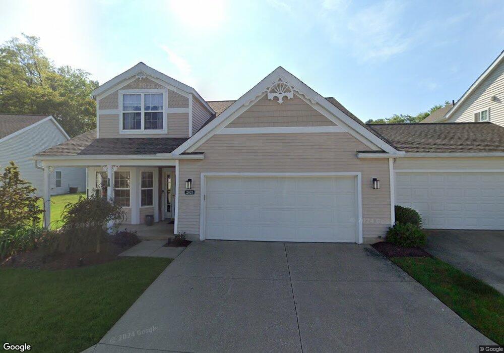
This home is located at 2624 Canvasback Cir, Akron, OH 44319 and is currently estimated at $238,583, approximately $128 per square foot. 2624 Canvasback Cir is a home located in Summit County with nearby schools including St. Francis de Sales School and Academy of the Immaculate Heart of Mary.
Ownership History
Date
Name
Owned For
Owner Type
Purchase Details
Closed on
Jun 11, 2003
Sold by
Brighton Bay
Bought by
Hannig Michael P and Hannig Denise M
Current Estimated Value
Home Financials for this Owner
Home Financials are based on the most recent Mortgage that was taken out on this home.
Original Mortgage
$128,300
Interest Rate
3.37%
Mortgage Type
Purchase Money Mortgage
Create a Home Valuation Report for This Property
The Home Valuation Report is an in-depth analysis detailing your home's value as well as a comparison with similar homes in the area
Home Values in the Area
Average Home Value in this Area
Purchase History
| Date | Buyer | Sale Price | Title Company |
|---|---|---|---|
| Hannig Michael P | $160,375 | U S Title Agency Inc |
Source: Public Records
Mortgage History
| Date | Status | Borrower | Loan Amount |
|---|---|---|---|
| Closed | Hannig Michael P | $128,300 | |
| Closed | Hannig Michael P | $32,075 |
Source: Public Records
Tax History Compared to Growth
Tax History
| Year | Tax Paid | Tax Assessment Tax Assessment Total Assessment is a certain percentage of the fair market value that is determined by local assessors to be the total taxable value of land and additions on the property. | Land | Improvement |
|---|---|---|---|---|
| 2025 | $3,955 | $67,572 | $12,926 | $54,646 |
| 2024 | $3,955 | $67,572 | $12,926 | $54,646 |
| 2023 | $3,955 | $67,572 | $12,926 | $54,646 |
| 2022 | $3,380 | $47,587 | $9,104 | $38,483 |
| 2021 | $3,185 | $47,587 | $9,104 | $38,483 |
| 2020 | $3,092 | $47,580 | $9,100 | $38,480 |
| 2019 | $2,908 | $40,740 | $9,100 | $31,640 |
| 2018 | $2,880 | $40,740 | $9,100 | $31,640 |
| 2017 | $3,060 | $40,740 | $9,100 | $31,640 |
| 2016 | $2,910 | $40,740 | $9,100 | $31,640 |
| 2015 | $3,060 | $40,740 | $9,100 | $31,640 |
| 2014 | $2,837 | $40,740 | $9,100 | $31,640 |
| 2013 | $3,584 | $43,730 | $9,100 | $34,630 |
Source: Public Records
Map
Nearby Homes
- 0 W Warner Rd
- 202 W Warner Rd
- 262 Teal Cir
- 336 Teal Cir
- 75 Delora Dr
- 2925 Greenwing Ct
- 2972 N Turkeyfoot Rd
- 61 Leicester Dr
- 3101 Wagoner St
- 449 W Long Lake Blvd
- 206 Lakota Ave
- 72 Weil Ave
- 2069 Penguin Ave
- 0 S Main St
- 428 Canova Dr
- 584 Apple Dr
- 796 Portage Lakes Dr
- 580 Colchester Ct
- 55 W Ralston Ave
- 2171 Canterbury Cir
- 2620 Canvasback Cir
- 2632 Canvasback Cir
- 75 Mallard Point Dr
- 2625 Canvasback Cir
- 65 Mallard Point Dr
- 79 Mallard Point Dr
- 2629 Canvasback Cir
- 2621 Canvasback Cir
- 2640 Canvasback Cir
- 57 Mallard Point Dr
- 2613 Canvasback Cir
- 2648 Canvasback Cir
- 2611 Canvasback Cir
- 2663 Canvasback Cir
- 2652 Canvasback Cir
- 74 Mallard Point Dr
- 47 Mallard Point Dr
- 70 Mallard Point Dr
- 82 Mallard Point Dr
- 2656 Canvasback Cir