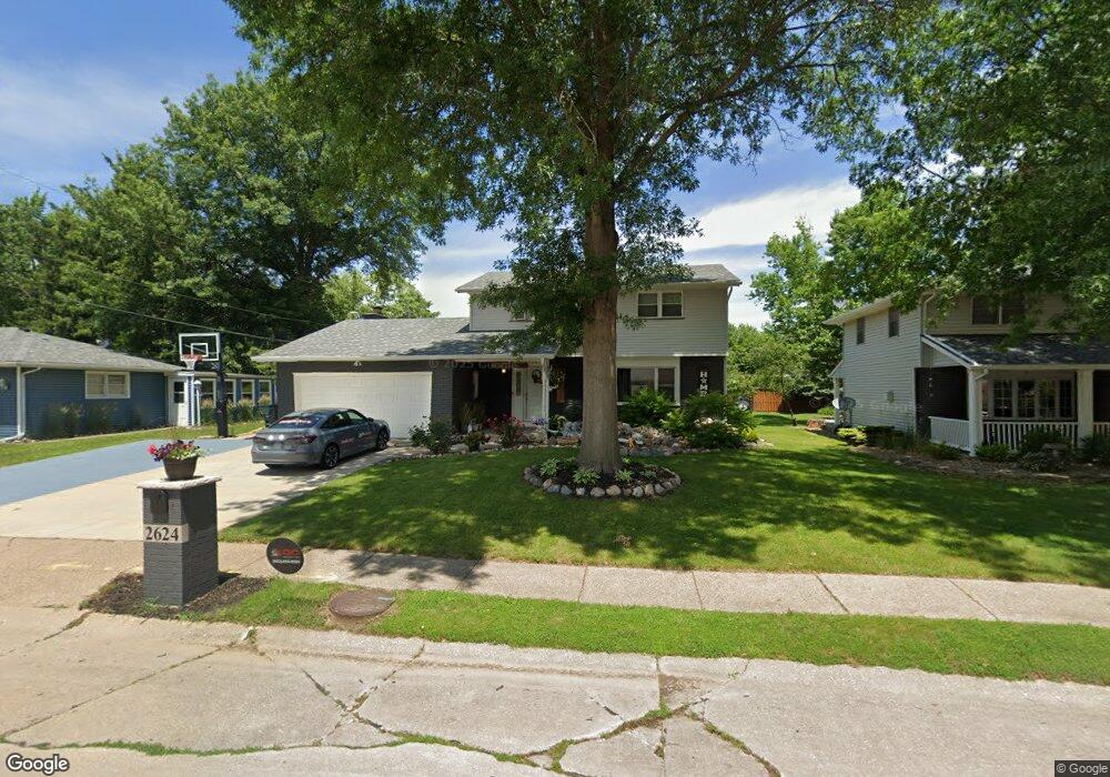
2624 E 39th St Davenport, IA 52807
North Side NeighborhoodEstimated Value: $300,390 - $321,000
4
Beds
2
Baths
2,290
Sq Ft
$135/Sq Ft
Est. Value
About This Home
This home is located at 2624 E 39th St, Davenport, IA 52807 and is currently estimated at $310,098, approximately $135 per square foot. 2624 E 39th St is a home located in Scott County with nearby schools including Jones Park Elementary School, Eisenhower Elementary School, and Casey County Middle School.
Ownership History
Date
Name
Owned For
Owner Type
Purchase Details
Closed on
Feb 2, 2018
Sold by
Vanhecke Donna L and Vanhecke Joseph H
Bought by
First Financial Group Lc
Current Estimated Value
Purchase Details
Closed on
Apr 26, 2006
Sold by
Dueker Alwin C and Dueker Donna R
Bought by
Vanhecke Donna L and Vanhecke Joseph H
Home Financials for this Owner
Home Financials are based on the most recent Mortgage that was taken out on this home.
Original Mortgage
$152,000
Interest Rate
6.39%
Mortgage Type
New Conventional
Create a Home Valuation Report for This Property
The Home Valuation Report is an in-depth analysis detailing your home's value as well as a comparison with similar homes in the area
Home Values in the Area
Average Home Value in this Area
Purchase History
| Date | Buyer | Sale Price | Title Company |
|---|---|---|---|
| First Financial Group Lc | $217,750 | -- | |
| Vanhecke Donna L | $190,000 | None Available |
Source: Public Records
Mortgage History
| Date | Status | Borrower | Loan Amount |
|---|---|---|---|
| Previous Owner | Vanhecke Donna L | $152,000 |
Source: Public Records
Tax History Compared to Growth
Tax History
| Year | Tax Paid | Tax Assessment Tax Assessment Total Assessment is a certain percentage of the fair market value that is determined by local assessors to be the total taxable value of land and additions on the property. | Land | Improvement |
|---|---|---|---|---|
| 2025 | $4,844 | $286,060 | $45,080 | $240,980 |
| 2024 | $4,726 | $271,000 | $45,080 | $225,920 |
| 2023 | $5,322 | $271,000 | $45,080 | $225,920 |
| 2022 | $5,154 | $249,160 | $41,160 | $208,000 |
| 2021 | $5,154 | $240,190 | $41,160 | $199,030 |
| 2020 | $4,868 | $224,060 | $41,160 | $182,900 |
| 2019 | $4,746 | $211,510 | $41,160 | $170,350 |
| 2018 | $4,374 | $211,510 | $41,160 | $170,350 |
| 2017 | $4,412 | $207,920 | $41,160 | $166,760 |
| 2016 | $4,244 | $202,540 | $0 | $0 |
| 2015 | $4,244 | $199,050 | $0 | $0 |
| 2014 | $4,228 | $199,050 | $0 | $0 |
| 2013 | $4,150 | $0 | $0 | $0 |
| 2012 | -- | $191,320 | $39,870 | $151,450 |
Source: Public Records
Map
Nearby Homes
- 4005 Forest Rd
- 2506 E 35th Street Ct
- 2501 E 34th Street Ct
- 4230 Jersey Ridge Rd
- 3315 Fairhaven Rd
- 2919 E 44th Ct
- 3000 E 32nd St Unit 14
- 2805 Carriage Hill Dr
- 2318 E 46th St
- 2916 E 45th Ct
- 2924 E 45th Ct
- 3044 Jersey Ridge Rd
- 4406 Belle Ave
- 2203 E 46th St
- 2586 E George Washington Blvd
- 2321 E 47th St
- 4324 Spring St
- 4919 Lorton Ave
- 1804 E 31st St
- 3324 Eastern Ave
- 2616 E 39th St
- 2632 E 39th St
- 3907 Lorton Ave
- 2638 E 39th St
- 2603 E 40th St
- 2625 E 39th St
- 2601 E 40th St
- 3821 Lorton Ave
- 3828 Kenwood Ave
- 3833 Kenwood Ave
- 3811 Lorton Ave
- 3910 Lorton Ave
- 3904 Lorton Ave
- 3820 Kenwood Ave
- 3922 Forest Rd
- 3920 Forest Rd
- 3824 Lorton Ave
- 3910 Forest Rd
- 2511 E 40th St
- 3821 Kenwood Ave