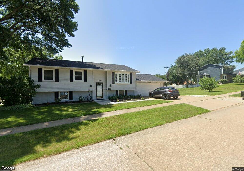
2625 E 35th St Davenport, IA 52807
North Side NeighborhoodEstimated Value: $244,000 - $263,000
3
Beds
2
Baths
1,212
Sq Ft
$207/Sq Ft
Est. Value
About This Home
This home is located at 2625 E 35th St, Davenport, IA 52807 and is currently estimated at $251,473, approximately $207 per square foot. 2625 E 35th St is a home located in Scott County with nearby schools including Jones Park Elementary School, Eisenhower Elementary School, and Casey County Middle School.
Ownership History
Date
Name
Owned For
Owner Type
Purchase Details
Closed on
Nov 19, 2014
Sold by
Simons Stephen M and Simons Doreen K
Bought by
Oysti Timothy D and Oysti Allyson Lee
Current Estimated Value
Home Financials for this Owner
Home Financials are based on the most recent Mortgage that was taken out on this home.
Original Mortgage
$115,200
Outstanding Balance
$87,953
Interest Rate
3.91%
Mortgage Type
New Conventional
Estimated Equity
$163,520
Purchase Details
Closed on
Nov 6, 2013
Sold by
Simons Stephen M
Bought by
Simons Stephen M
Create a Home Valuation Report for This Property
The Home Valuation Report is an in-depth analysis detailing your home's value as well as a comparison with similar homes in the area
Home Values in the Area
Average Home Value in this Area
Purchase History
| Date | Buyer | Sale Price | Title Company |
|---|---|---|---|
| Oysti Timothy D | $72,000 | None Available | |
| Oysti Timothy D | $72,000 | None Available | |
| Simons Stephen M | -- | None Available |
Source: Public Records
Mortgage History
| Date | Status | Borrower | Loan Amount |
|---|---|---|---|
| Open | Oysti Timothy D | $115,200 |
Source: Public Records
Tax History Compared to Growth
Tax History
| Year | Tax Paid | Tax Assessment Tax Assessment Total Assessment is a certain percentage of the fair market value that is determined by local assessors to be the total taxable value of land and additions on the property. | Land | Improvement |
|---|---|---|---|---|
| 2025 | $3,218 | $220,530 | $46,300 | $174,230 |
| 2024 | $3,134 | $198,750 | $46,300 | $152,450 |
| 2023 | $3,650 | $198,750 | $46,300 | $152,450 |
| 2022 | $3,630 | $183,160 | $41,890 | $141,270 |
| 2021 | $3,630 | $181,520 | $41,890 | $139,630 |
| 2020 | $3,442 | $170,590 | $41,890 | $128,700 |
| 2019 | $3,400 | $163,300 | $41,890 | $121,410 |
| 2018 | $3,242 | $163,300 | $41,890 | $121,410 |
| 2017 | $3,170 | $159,660 | $41,890 | $117,770 |
| 2016 | $2,914 | $145,090 | $0 | $0 |
| 2015 | $2,914 | $142,790 | $0 | $0 |
| 2014 | $2,904 | $142,790 | $0 | $0 |
| 2013 | $2,848 | $0 | $0 | $0 |
| 2012 | -- | $140,880 | $39,870 | $101,010 |
Source: Public Records
Map
Nearby Homes
- 2506 E 35th Street Ct
- 2501 E 34th Street Ct
- 3315 Fairhaven Rd
- 3806 Lorton Ave
- 2805 Carriage Hill Dr
- 3000 E 32nd St Unit 14
- 2586 E George Washington Blvd
- 3044 Jersey Ridge Rd
- 4005 Forest Rd
- 2130 E 38th St
- 2946 Jersey Ridge Rd
- 4230 Jersey Ridge Rd
- 2919 E 44th Ct
- 2706 Ridgewood Ave
- 1804 E 31st St
- 2429 E Central Park Ave
- 9 Parkwood Dr
- 4406 Belle Ave
- 2924 E 45th Ct
- 2916 E 45th Ct
- 3426 Kenwood Ave
- 2611 E 35th Street Ct
- 2611 E 35th St
- 3418 Kenwood Ave
- 2628 E 35th St
- 2620 E 35th St
- 2705 E 35th St
- 2636 E 35th St
- 2603 E 35th Street Ct
- 3427 Kenwood Ave
- 2612 E 35th Street Ct
- 2604 E 34th Street Ct
- 2602 E 34th Street Ct
- 3410 Kenwood Ave
- 3419 Kenwood Ave
- 2706 E 35th St
- 2604 E 35th Street Ct
- 3337 Lorton Ave
- 2515 E 35th Street Ct
- 3411 Kenwood Ave