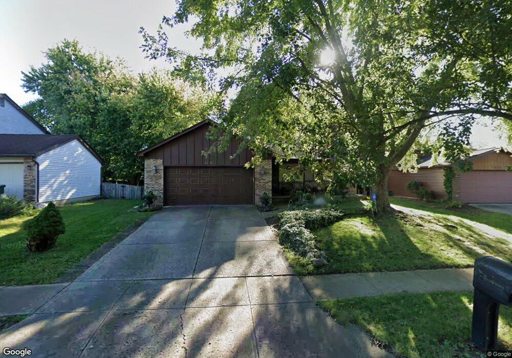
2625 Lynnmore Dr Columbus, OH 43235
Misty Meadows NeighborhoodEstimated Value: $359,000 - $392,000
3
Beds
2
Baths
1,791
Sq Ft
$210/Sq Ft
Est. Value
About This Home
This home is located at 2625 Lynnmore Dr, Columbus, OH 43235 and is currently estimated at $376,119, approximately $210 per square foot. 2625 Lynnmore Dr is a home located in Franklin County with nearby schools including Daniel Wright Elementary School, Ann Simpson Davis Middle School, and Dublin Scioto High School.
Ownership History
Date
Name
Owned For
Owner Type
Purchase Details
Closed on
Nov 30, 1999
Sold by
Bickerstaff Donna L and Sarver Louise A
Bought by
Yost Mary Helen and Bowling Michele Anne
Current Estimated Value
Home Financials for this Owner
Home Financials are based on the most recent Mortgage that was taken out on this home.
Original Mortgage
$131,621
Outstanding Balance
$41,546
Interest Rate
7.97%
Mortgage Type
FHA
Estimated Equity
$334,573
Purchase Details
Closed on
Oct 18, 1991
Bought by
Bickerstaff Donna L
Purchase Details
Closed on
May 1, 1985
Create a Home Valuation Report for This Property
The Home Valuation Report is an in-depth analysis detailing your home's value as well as a comparison with similar homes in the area
Home Values in the Area
Average Home Value in this Area
Purchase History
| Date | Buyer | Sale Price | Title Company |
|---|---|---|---|
| Yost Mary Helen | $135,500 | Stewart Title Agency Of Ohio | |
| Bickerstaff Donna L | $93,000 | -- | |
| -- | $73,500 | -- |
Source: Public Records
Mortgage History
| Date | Status | Borrower | Loan Amount |
|---|---|---|---|
| Open | Yost Mary Helen | $131,621 |
Source: Public Records
Tax History Compared to Growth
Tax History
| Year | Tax Paid | Tax Assessment Tax Assessment Total Assessment is a certain percentage of the fair market value that is determined by local assessors to be the total taxable value of land and additions on the property. | Land | Improvement |
|---|---|---|---|---|
| 2024 | $5,100 | $94,120 | $29,750 | $64,370 |
| 2023 | $5,066 | $94,115 | $29,750 | $64,365 |
| 2022 | $4,173 | $73,780 | $24,570 | $49,210 |
| 2021 | $4,240 | $73,780 | $24,570 | $49,210 |
| 2020 | $4,215 | $73,780 | $24,570 | $49,210 |
| 2019 | $3,516 | $56,770 | $18,900 | $37,870 |
| 2018 | $3,564 | $56,770 | $18,900 | $37,870 |
| 2017 | $3,411 | $56,770 | $18,900 | $37,870 |
| 2016 | $3,576 | $58,450 | $14,560 | $43,890 |
| 2015 | $3,599 | $58,450 | $14,560 | $43,890 |
| 2014 | $3,602 | $58,450 | $14,560 | $43,890 |
| 2013 | $1,726 | $55,650 | $13,860 | $41,790 |
Source: Public Records
Map
Nearby Homes
- 5646 Dorsey Dr
- 2560 Trotterslane Dr
- 2579 Trotterslane Dr
- 2622 Trottersway Dr
- 2585 Trottersway Dr Unit 2585
- 2540 Dahlia Way Unit 26D
- 2260 Lila Way Unit 62D
- 5624 Wigmore Dr Unit 50B
- 2491 Calais Way
- 2229 Teardrop Ave Unit 35E
- 2970 Black Kettle Trail
- 2744 Greystone Dr Unit E
- 5850 Meadowhurst Way
- 5322 Darlington Rd Unit E
- 5294 Brandy Oaks Ln
- 5672 Barry Trace Unit 5672
- 5273 Brandy Oaks Ln
- 5657 Barry Trace
- 5283 Ruthton Rd Unit 19
- 3087 Strathaven Ct
- 2631 Lynnmore Dr
- 2619 Lynnmore Dr
- 2637 Lynnmore Dr
- 2639 West Case Rd
- 2640 Lynnmore Dr
- 5730 Brinkley Ct
- 2647 West Case Rd
- 2647 W Case Rd
- 5722 Brinkley Ct
- 2648 Lynnmore Dr
- 2655 West Case Rd
- 2655 W Case Rd
- 5727 Brinkley Ct
- 5714 Brinkley Ct
- 2656 Lynnmore Dr
- 5719 Brinkley Ct
- 2663 W Case Rd
- 2663 West Case Rd
- 5706 Brinkley Ct
- 2664 Lynnmore Dr