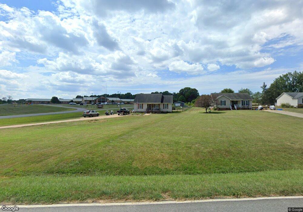
2625 Rock Dam Rd Lincolnton, NC 28092
Estimated Value: $255,000 - $269,000
3
Beds
2
Baths
1,215
Sq Ft
$217/Sq Ft
Est. Value
About This Home
This home is located at 2625 Rock Dam Rd, Lincolnton, NC 28092 and is currently estimated at $263,636, approximately $216 per square foot. 2625 Rock Dam Rd is a home located in Lincoln County with nearby schools including Norris S. Childers Elementary School, West Lincoln Middle, and West Lincoln High School.
Ownership History
Date
Name
Owned For
Owner Type
Purchase Details
Closed on
May 27, 2016
Sold by
Hovis M Chad and Hovis Audrey M
Bought by
Headrick Ii Donald R and Headrick Tonya L
Current Estimated Value
Home Financials for this Owner
Home Financials are based on the most recent Mortgage that was taken out on this home.
Original Mortgage
$112,000
Outstanding Balance
$91,062
Interest Rate
4.25%
Mortgage Type
Adjustable Rate Mortgage/ARM
Estimated Equity
$172,574
Purchase Details
Closed on
Jul 25, 2005
Sold by
Ross Forest E and Ross Nancy B
Bought by
Mitchell Audrey
Home Financials for this Owner
Home Financials are based on the most recent Mortgage that was taken out on this home.
Original Mortgage
$19,800
Interest Rate
5.59%
Mortgage Type
Construction
Purchase Details
Closed on
Apr 26, 2004
Bought by
Ross Gene Michael T Ross Forest T R
Create a Home Valuation Report for This Property
The Home Valuation Report is an in-depth analysis detailing your home's value as well as a comparison with similar homes in the area
Home Values in the Area
Average Home Value in this Area
Purchase History
| Date | Buyer | Sale Price | Title Company |
|---|---|---|---|
| Headrick Ii Donald R | $110,000 | None Available | |
| Mitchell Audrey | $99,000 | None Available | |
| Ross Gene Michael T Ross Forest T R | $120,000 | -- |
Source: Public Records
Mortgage History
| Date | Status | Borrower | Loan Amount |
|---|---|---|---|
| Open | Headrick Ii Donald R | $112,000 | |
| Previous Owner | Mitchell Audrey | $19,800 |
Source: Public Records
Tax History Compared to Growth
Tax History
| Year | Tax Paid | Tax Assessment Tax Assessment Total Assessment is a certain percentage of the fair market value that is determined by local assessors to be the total taxable value of land and additions on the property. | Land | Improvement |
|---|---|---|---|---|
| 2025 | $1,358 | $192,010 | $32,020 | $159,990 |
| 2024 | $1,338 | $192,010 | $32,020 | $159,990 |
| 2023 | $1,333 | $192,010 | $32,020 | $159,990 |
| 2022 | $1,067 | $126,131 | $25,826 | $100,305 |
| 2021 | $1,067 | $126,131 | $25,826 | $100,305 |
| 2020 | $926 | $126,131 | $25,826 | $100,305 |
| 2019 | $926 | $126,131 | $25,826 | $100,305 |
| 2018 | $857 | $103,110 | $22,761 | $80,349 |
| 2017 | $745 | $80,349 | $0 | $80,349 |
| 2016 | $745 | $101,610 | $21,261 | $80,349 |
| 2015 | $814 | $101,610 | $21,261 | $80,349 |
| 2014 | $841 | $107,850 | $22,310 | $85,540 |
Source: Public Records
Map
Nearby Homes
- 2508 Rock Dam Rd
- 3300 Paul Heavner Ln
- 1259 Haywood Ct
- 142 Alf Hoover Rd
- 00 Pleasant Grove Church Rd
- 1865 Rockdam Creek Ct
- 0 Hillard Ln
- 1712 Cline Farm Rd
- 958 Hillard Ln
- 000 Blossom Hill Rd Unit 138
- 00 George Brown Rd Unit 10
- 00 George Brown Rd Unit 9
- 00 George Brown Rd Unit 8
- 00 George Brown Rd Unit 7
- 00 George Brown Rd Unit 6
- 00 George Brown Rd Unit 5
- 00 George Brown Rd Unit 4
- 00 George Brown Rd Unit 3
- 00 George Brown Rd Unit 2
- 217 Blossom Hill Rd
- 2635 Rock Dam Rd
- 2635 Rock Dam Rd Unit 6
- 2645 Rock Dam Rd
- 2634 Rock Dam Rd
- 2673 Rock Dam Rd
- 2673 Rock Dam Rd Unit 4
- 2620 Rock Dam Rd
- 2575 Ellys St
- 2561 Ellys St
- 2610 Rock Dam Rd
- 2557 Ellys St
- 2596 Rock Dam Rd
- 2578 Ellys St
- 2684 Rock Dam Rd
- 2693 Rock Dam Rd
- 2564 Ellys St
- 2575 Rock Dam Rd
- 2558 Ellys St
- 2590 Rock Dam Rd
- 2580 Rock Dam Rd