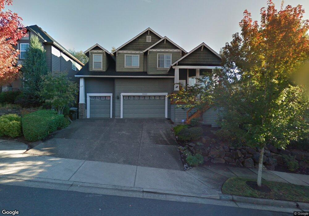
2625 Umpqua Ln West Linn, OR 97068
Tanner Basin NeighborhoodEstimated Value: $822,280 - $1,191,000
3
Beds
7
Baths
2,394
Sq Ft
$398/Sq Ft
Est. Value
About This Home
This home is located at 2625 Umpqua Ln, West Linn, OR 97068 and is currently estimated at $952,820, approximately $398 per square foot. 2625 Umpqua Ln is a home located in Clackamas County with nearby schools including Trillium Creek Primary School, Rosemont Ridge Middle School, and West Linn High School.
Ownership History
Date
Name
Owned For
Owner Type
Purchase Details
Closed on
Dec 11, 2020
Sold by
Pene Steven J and Pene Misty M
Bought by
Pene Steven J and Pene Misty M
Current Estimated Value
Purchase Details
Closed on
Mar 15, 2001
Sold by
Renaissance Development Corp
Bought by
Pene Steve J and Pene Misty M
Home Financials for this Owner
Home Financials are based on the most recent Mortgage that was taken out on this home.
Original Mortgage
$220,000
Outstanding Balance
$79,645
Interest Rate
7.11%
Estimated Equity
$873,175
Create a Home Valuation Report for This Property
The Home Valuation Report is an in-depth analysis detailing your home's value as well as a comparison with similar homes in the area
Home Values in the Area
Average Home Value in this Area
Purchase History
| Date | Buyer | Sale Price | Title Company |
|---|---|---|---|
| Pene Steven J | -- | None Available | |
| Pene Steve J | $335,000 | -- |
Source: Public Records
Mortgage History
| Date | Status | Borrower | Loan Amount |
|---|---|---|---|
| Open | Pene Steve J | $220,000 |
Source: Public Records
Tax History Compared to Growth
Tax History
| Year | Tax Paid | Tax Assessment Tax Assessment Total Assessment is a certain percentage of the fair market value that is determined by local assessors to be the total taxable value of land and additions on the property. | Land | Improvement |
|---|---|---|---|---|
| 2025 | $10,110 | $524,623 | -- | -- |
| 2024 | $9,732 | $509,343 | -- | -- |
| 2023 | $9,732 | $494,508 | $0 | $0 |
| 2022 | $9,186 | $480,105 | $0 | $0 |
| 2021 | $8,720 | $466,122 | $0 | $0 |
| 2020 | $8,779 | $452,546 | $0 | $0 |
| 2019 | $8,372 | $439,366 | $0 | $0 |
| 2018 | $7,998 | $426,569 | $0 | $0 |
| 2017 | $7,614 | $414,145 | $0 | $0 |
| 2016 | $7,389 | $402,083 | $0 | $0 |
| 2015 | $6,856 | $390,372 | $0 | $0 |
| 2014 | $6,538 | $379,002 | $0 | $0 |
Source: Public Records
Map
Nearby Homes
- 23136 Bland Cir
- 2762 Dahlia Dr
- 2037 De Vries Way
- 23073 Bland Cir
- 23019 Bland Cir
- 2025 De Vries Way
- 2311 Falcon Dr
- 22872 Weatherhill Rd
- 3486 Chaparrel Loop
- 2378 Falcon Dr
- 3496 Chaparrel Loop
- 2285 Satter St
- 2258 Satter St
- 2201 Satter St
- 2155 Alpine Dr
- 1808 Hall Ct
- Allstone Plan at Savannah Summit
- Milton Plan at Savannah Summit
- 23000 Bland Cir
- 2134 Eleanor Rd
- 2613 Umpqua Ln
- 2637 Umpqua Ln
- 2607 Umpqua Ln
- 3094 Kensington Ct
- 2601 Umpqua Ln
- 2605 Umpqua Ln
- 2624 Umpqua Ln
- 2636 Umpqua Ln
- 3056 Kensington Ct
- 2612 Umpqua Ln
- 2640 Umpqua Ln
- 3098 Kensington Ct
- 3025 Kensington Ct
- 3037 Kensington Ct
- 2586 Kensington Ct
- 3013 Kensington Ct
- 3049 Kensington Ct
- 3099 Kensington Ct
- 3085 Sunbreak Ln
- 23162 Bland Cir