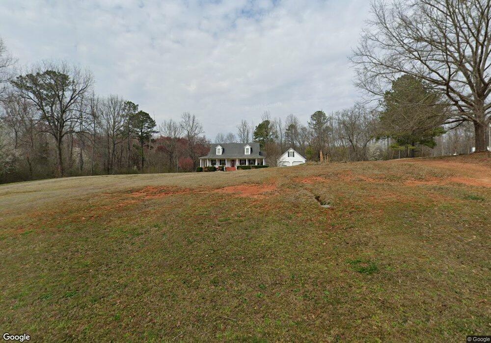
2627 Hancock Rd Social Circle, GA 30025
Estimated Value: $461,000 - $670,000
--
Bed
--
Bath
2,259
Sq Ft
$247/Sq Ft
Est. Value
About This Home
This home is located at 2627 Hancock Rd, Social Circle, GA 30025 and is currently estimated at $558,566, approximately $247 per square foot. 2627 Hancock Rd is a home located in Walton County with nearby schools including Harmony Elementary School, Carver Middle School, and Monroe Area High School.
Ownership History
Date
Name
Owned For
Owner Type
Purchase Details
Closed on
Oct 19, 2007
Sold by
Morris Tracy
Bought by
Schiavoni John L and Schiavoni Karen J
Current Estimated Value
Home Financials for this Owner
Home Financials are based on the most recent Mortgage that was taken out on this home.
Original Mortgage
$228,000
Outstanding Balance
$142,704
Interest Rate
6.26%
Mortgage Type
New Conventional
Estimated Equity
$415,862
Purchase Details
Closed on
Dec 17, 2002
Sold by
Rickard Heidi
Bought by
Bryan Norris
Purchase Details
Closed on
Jan 5, 1987
Bought by
Dunn George L and Dunn Elaine B
Create a Home Valuation Report for This Property
The Home Valuation Report is an in-depth analysis detailing your home's value as well as a comparison with similar homes in the area
Home Values in the Area
Average Home Value in this Area
Purchase History
| Date | Buyer | Sale Price | Title Company |
|---|---|---|---|
| Schiavoni John L | $269,400 | -- | |
| Bryan Norris | $44,705 | -- | |
| Dunn George L | -- | -- |
Source: Public Records
Mortgage History
| Date | Status | Borrower | Loan Amount |
|---|---|---|---|
| Open | Schiavoni John L | $228,000 |
Source: Public Records
Tax History Compared to Growth
Tax History
| Year | Tax Paid | Tax Assessment Tax Assessment Total Assessment is a certain percentage of the fair market value that is determined by local assessors to be the total taxable value of land and additions on the property. | Land | Improvement |
|---|---|---|---|---|
| 2024 | $4,408 | $181,136 | $63,720 | $117,416 |
| 2023 | $4,339 | $168,536 | $60,640 | $107,896 |
| 2022 | $4,242 | $152,216 | $56,560 | $95,656 |
| 2021 | $3,839 | $128,496 | $44,080 | $84,416 |
| 2020 | $3,722 | $119,616 | $38,160 | $81,456 |
| 2019 | $3,557 | $108,668 | $33,920 | $74,748 |
| 2018 | $3,475 | $108,668 | $33,920 | $74,748 |
| 2017 | $3,672 | $106,588 | $33,920 | $72,668 |
| 2016 | $2,914 | $88,332 | $26,480 | $61,852 |
| 2015 | $2,861 | $85,412 | $26,480 | $58,932 |
| 2014 | $2,813 | $81,996 | $0 | $0 |
Source: Public Records
Map
Nearby Homes
- 2389 Pond Ln
- 5761 Hancock Dr
- 1249 Social Circle Pkwy
- 271 Orwell Dr Unit 49
- 271 Orwell Dr
- 257 Orwell Dr Unit 48
- 245 Orwell Dr
- 178 Elder Dr SE
- 178 Elder Dr SE Unit 103
- 217 Orwell Dr
- 330 Orwell Dr
- 330 Orwell Dr Unit 96
- 246 Orwell Dr
- 177 Orwell Dr
- 232 Orwell Dr
- 232 Orwell Dr Unit 99
- 218 Orwell Dr
- 218 Orwell Dr Unit 100
- 204 Orwell Dr
- 345 Woodfin Way
- 0 Hancock Rd
- 0 Hancock Rd Unit CM957071
- 0 Hancock Rd Unit 7225353
- 0 Hancock Rd Unit 7024754
- 0 Hancock Rd Unit 8305503
- 0 Hancock Rd Unit 7635548
- 0 Hancock Rd Unit 8668468
- 0 Hancock Rd Unit 8053695
- 0 Hancock Rd Unit 8067537
- 75E Hancock Rd
- 75A Hancock Rd
- 75F Hancock Rd
- 365 Hancock Rd
- 2587 Hancock Rd
- 2566 Hancock Rd
- 00000 Cannon Dr SE
- 0 Cannon Dr SE Unit 8066474
- 0 Cannon Dr SE Unit 3207760
- 0 Cannon Dr SE Unit 7426891
- 0 Cannon Dr SE Unit 7520399