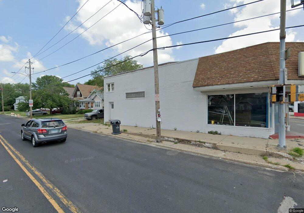
2627 N Sheridan Rd Peoria, IL 61604
West Bluff NeighborhoodEstimated Value: $157,246
--
Bed
--
Bath
4,535
Sq Ft
$35/Sq Ft
Est. Value
About This Home
This home is located at 2627 N Sheridan Rd, Peoria, IL 61604 and is currently priced at $157,246, approximately $34 per square foot. 2627 N Sheridan Rd is a home located in Peoria County with nearby schools including Dr. C. T. Vivian Primary School, Sterling Middle School, and Peoria High School.
Ownership History
Date
Name
Owned For
Owner Type
Purchase Details
Closed on
May 9, 2025
Sold by
Hollie Tameka
Bought by
Kattom Rashad
Current Estimated Value
Purchase Details
Closed on
Jan 16, 2024
Sold by
Hollie Tameka
Bought by
Hollie Tameka
Purchase Details
Closed on
Jan 5, 2024
Sold by
Fjr Realty Llc
Bought by
Tillman Christopher
Purchase Details
Closed on
Dec 20, 2023
Sold by
Fjr Realty Llc
Bought by
Tillman Christopher
Purchase Details
Closed on
Jan 12, 2022
Sold by
Rashid Floyd J
Bought by
Fjr Realty Llc
Purchase Details
Closed on
Dec 10, 2021
Sold by
Floyd J Rashid Pension Plan
Bought by
Rashid Floyd J
Purchase Details
Closed on
Nov 1, 2018
Sold by
Vance Andrew J and Vance Yvonne A
Bought by
Plan Floyd J R P Trust
Create a Home Valuation Report for This Property
The Home Valuation Report is an in-depth analysis detailing your home's value as well as a comparison with similar homes in the area
Home Values in the Area
Average Home Value in this Area
Purchase History
| Date | Buyer | Sale Price | Title Company |
|---|---|---|---|
| Kattom Rashad | $25,000 | None Listed On Document | |
| Hollie Tameka | -- | None Listed On Document | |
| Tillman Christopher | $75,000 | None Listed On Document | |
| Tillman Christopher | $75,000 | None Listed On Document | |
| Fjr Realty Llc | -- | None Listed On Document | |
| Rashid Floyd J | -- | None Listed On Document | |
| Plan Floyd J R P Trust | $30,100 | -- |
Source: Public Records
Tax History Compared to Growth
Tax History
| Year | Tax Paid | Tax Assessment Tax Assessment Total Assessment is a certain percentage of the fair market value that is determined by local assessors to be the total taxable value of land and additions on the property. | Land | Improvement |
|---|---|---|---|---|
| 2024 | $1,926 | $21,290 | $5,760 | $15,530 |
| 2023 | $900 | $9,570 | $5,280 | $4,290 |
| 2022 | $945 | $9,800 | $5,230 | $4,570 |
| 2021 | $974 | $9,800 | $5,230 | $4,570 |
| 2020 | $982 | $9,800 | $5,230 | $4,570 |
| 2019 | $996 | $13,970 | $5,340 | $8,630 |
| 2018 | $2,822 | $28,980 | $5,350 | $23,630 |
| 2017 | $2,822 | $29,270 | $5,400 | $23,870 |
| 2016 | $3,483 | $37,170 | $5,400 | $31,770 |
| 2015 | $3,326 | $36,440 | $5,290 | $31,150 |
| 2014 | $3,286 | $36,130 | $5,340 | $30,790 |
| 2013 | -- | $36,130 | $5,340 | $30,790 |
Source: Public Records
Map
Nearby Homes
- 617 W Hanssler Place
- 810 W Hanssler Place
- 718 W Corrington Ave
- 720 W Corrington Ave
- 518 W Willcox Ave
- 807 W Mcclure Ave
- 512 W Willcox Ave
- 812 W Macqueen Ave
- 2315 N Ellis St
- 3007 N Sheridan Rd
- 1013 W Hanssler Place
- 823 W Nowland Ave
- 2309 N Flora Ave
- 723 W Melbourne Ave
- 1017 W Willcox Ave
- 502 W Melbourne Ave
- 2302 N Flora Ave
- 604 W Forrest Hill Ave
- 2624 N Bigelow St
- 2215 N Flora Ave
- 709 W Loucks Ave
- 711 W Loucks Ave
- 713 W Loucks Ave
- 2628 N Sheridan Rd
- 715 W Loucks Ave
- 620 W Hanssler Place
- 717 W Loucks Ave
- 614 W Hanssler Place
- 702 W Gift Ave
- 719 W Loucks Ave
- 714 W Loucks Ave
- 613 W Gift Ave
- 721 W Loucks Ave
- 612 W Hanssler Place
- 703 W Hanssler Place
- 701 W Hanssler Place
- 716 W Loucks Ave
- 611 W Gift Ave
- 718 W Loucks Ave
- 705 W Hanssler Place