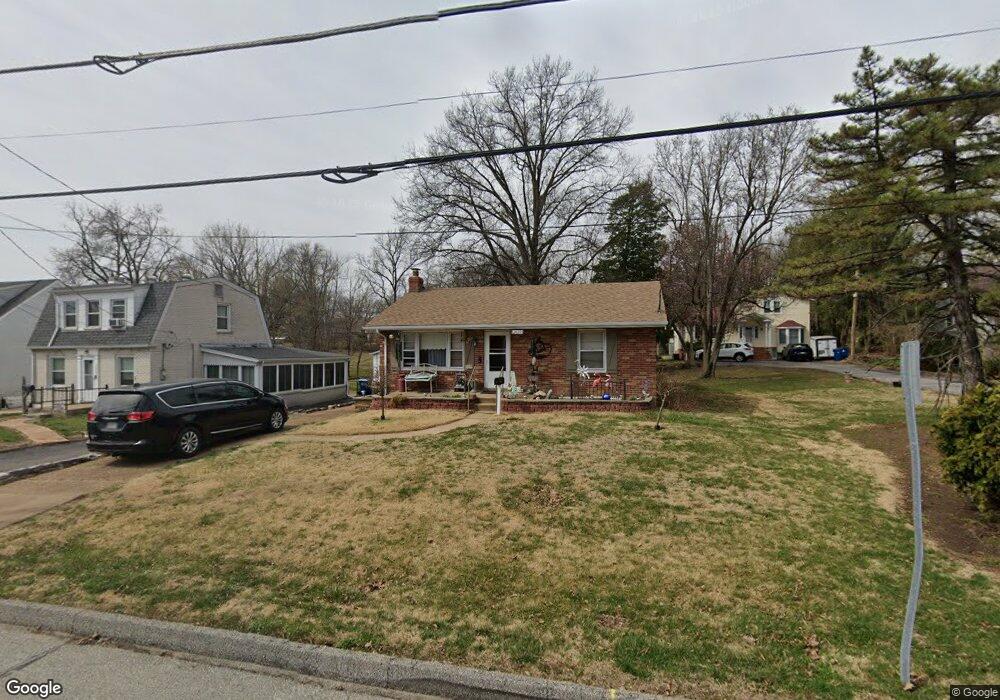
2629 Sims Ave Saint Louis, MO 63114
Estimated Value: $124,000 - $147,000
2
Beds
1
Bath
984
Sq Ft
$136/Sq Ft
Est. Value
About This Home
This home is located at 2629 Sims Ave, Saint Louis, MO 63114 and is currently estimated at $134,309, approximately $136 per square foot. 2629 Sims Ave is a home located in St. Louis County with nearby schools including Marion Elementary School, Ritenour Middle School, and Ritenour Senior High School.
Ownership History
Date
Name
Owned For
Owner Type
Purchase Details
Closed on
Jul 12, 2017
Sold by
Rehm Bruce J
Bought by
Rehm Ronald P and Rehm Marcia E
Current Estimated Value
Purchase Details
Closed on
Apr 2, 2004
Sold by
Rehm Lou B and Rehm Lulu Belle
Bought by
Rehm Bruce J and Lou B Rehm Trust
Purchase Details
Closed on
Sep 18, 2000
Sold by
Rehm Lou B and Belle Rehmand Lulu
Bought by
Rehm Bruce J and Rehm Ronald P
Create a Home Valuation Report for This Property
The Home Valuation Report is an in-depth analysis detailing your home's value as well as a comparison with similar homes in the area
Home Values in the Area
Average Home Value in this Area
Purchase History
| Date | Buyer | Sale Price | Title Company |
|---|---|---|---|
| Rehm Ronald P | -- | Title Partners Agency Llc | |
| Rehm Bruce J | -- | -- | |
| Rehm Bruce J | -- | -- |
Source: Public Records
Tax History Compared to Growth
Tax History
| Year | Tax Paid | Tax Assessment Tax Assessment Total Assessment is a certain percentage of the fair market value that is determined by local assessors to be the total taxable value of land and additions on the property. | Land | Improvement |
|---|---|---|---|---|
| 2025 | $1,685 | $28,850 | $6,560 | $22,290 |
| 2024 | $1,685 | $19,590 | $4,370 | $15,220 |
| 2023 | $1,648 | $19,590 | $4,370 | $15,220 |
| 2022 | $1,946 | $20,350 | $4,370 | $15,980 |
| 2021 | $1,945 | $20,350 | $4,370 | $15,980 |
| 2020 | $2,013 | $19,440 | $4,240 | $15,200 |
| 2019 | $1,991 | $19,440 | $4,240 | $15,200 |
| 2018 | $1,725 | $15,130 | $3,840 | $11,290 |
| 2017 | $1,645 | $15,130 | $3,840 | $11,290 |
| 2016 | $1,300 | $12,130 | $1,960 | $10,170 |
| 2015 | $1,330 | $12,130 | $1,960 | $10,170 |
| 2014 | $1,498 | $13,930 | $3,190 | $10,740 |
Source: Public Records
Map
Nearby Homes
- 9911 Dennison Ave
- 2529 Leslie Ave
- 9922 Carlyle Ave
- 2528 Leslie Ave
- 9640 Tennyson Ave
- 2412 Wallis Ave
- 10235 Midland Blvd
- 10222 Saint Dennis Ln
- 10228 Saint Arsene Ln
- 10027 Breckenridge Rd
- 3113 Pearl Harbor Dr
- 10107 Niblic Dr
- 10111 Niblic Dr
- 3222 W Tennyson Ave
- 9515 Marlowe Ave
- 3239 Chaucer Ave
- 3244 Chaucer Ave
- 3205 Airway Ave
- 3219 Royalton Ave
- 10300 Breckenridge Rd
- 2627 Sims Ave
- 2631 Sims Ave
- 2623 Sims Ave
- 2635 Sims Ave
- 2619 Sims Ave
- 2605 Sims Ave
- 2641 Sims Ave
- 2634 Chaucer Ave
- 2603 Sims Ave
- 9905 Midland Blvd
- 2601 Sims Ave
- 2640 Chaucer Ave
- 2642 Chaucer Ave
- 2651 Sims Ave
- 2646 Chaucer Ave
- 9907 Midland Blvd
- 2636 Chaucer Ave
- 2628 Chaucer Ave
- 2654 Sims Ave
- 2632 Chaucer Ave