
Seller's Agent in 2025
Diana Whyte
BHHS New England Properties
(203) 570-6125
1 in this area
5 Total Sales
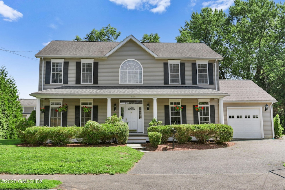
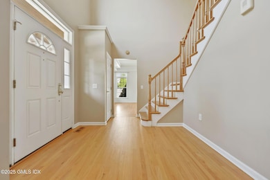
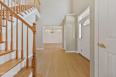
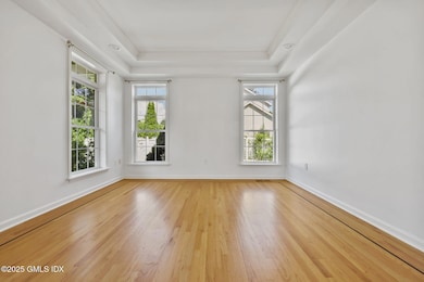

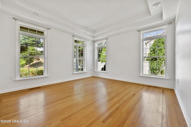
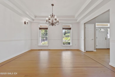
A welcoming front porch invites you to this bright and sunny four bedroom, two and a half bath Center Hall Colonial. The inviting entryway leads to a bright and airy main level, where you can enjoy family gatherings. There is 2347 square feet of living space with plenty of storage in the partially finished basement and garage. Conveniently located, this home is just minutes away from Byram Beach, pool and marina making it easy to enjoy the best of waterfront living. Additionally, you're close to town for shopping and dining, with easy access to transit and Metro North for commuters.
Last Agent to Sell the Property
BHHS New England Properties License #RES.0751592 Listed on: 07/21/2025
Last Buyer's Agent
OUT-OF-TOWN BROKER
FOREIGN LISTING
| Date | Event | Price | List to Sale | Price per Sq Ft |
|---|---|---|---|---|
| 10/06/2025 10/06/25 | Sold | $1,255,000 | +14.1% | $535 / Sq Ft |
| 08/05/2025 08/05/25 | Pending | -- | -- | -- |
| 07/21/2025 07/21/25 | For Sale | $1,100,000 | -- | $469 / Sq Ft |
| Year | Tax Paid | Tax Assessment Tax Assessment Total Assessment is a certain percentage of the fair market value that is determined by local assessors to be the total taxable value of land and additions on the property. | Land | Improvement |
|---|---|---|---|---|
| 2025 | -- | $680,400 | $325,990 | $354,410 |
| 2024 | -- | $680,400 | $325,990 | $354,410 |
| 2023 | $0 | $680,400 | $325,990 | $354,410 |
| 2022 | $0 | $680,400 | $325,990 | $354,410 |
| 2021 | $0 | $579,110 | $213,290 | $365,820 |
| 2020 | $0 | $579,110 | $213,290 | $365,820 |
| 2019 | $0 | $579,110 | $213,290 | $365,820 |
| 2018 | $0 | $579,110 | $213,290 | $365,820 |
| 2017 | $0 | $579,110 | $213,290 | $365,820 |
| 2016 | -- | $579,110 | $213,290 | $365,820 |
| 2015 | -- | $532,140 | $223,090 | $309,050 |
| 2014 | $6,186 | $532,140 | $223,090 | $309,050 |
Seller's Agent in 2025
Diana Whyte
BHHS New England Properties
(203) 570-6125
1 in this area
5 Total Sales
O
Buyer's Agent in 2025
OUT-OF-TOWN BROKER
FOREIGN LISTING
Source: Greenwich Association of REALTORS®
MLS Number: 123286
APN: GREE M:04 B:4027/S
Disclaimer: Certain information contained herein is derived from information provided by parties other than Homes.com. All information provided is deemed reliable, but is not guaranteed to be accurate and should be independently verified.
![]() Listing data courtesy of Greenwich MLS. IDX information is provided exclusively for consumers’ personal, non-commercial use, that it may not be used for any purpose other than to
Listing data courtesy of Greenwich MLS. IDX information is provided exclusively for consumers’ personal, non-commercial use, that it may not be used for any purpose other than to
identify prospective properties consumers may be interested in purchasing. Data is deemed reliable but is not guaranteed accurate by the MLS.
Ask me questions while you tour the home.