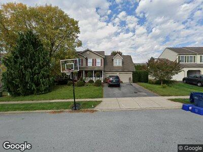
263 Fencepost Ln Palmyra, PA 17078
Estimated Value: $448,983 - $498,000
4
Beds
3
Baths
2,232
Sq Ft
$212/Sq Ft
Est. Value
About This Home
This home is located at 263 Fencepost Ln, Palmyra, PA 17078 and is currently estimated at $472,746, approximately $211 per square foot. 263 Fencepost Ln is a home located in Lebanon County with nearby schools including Palmyra Area Senior High School and Milton Hershey School.
Ownership History
Date
Name
Owned For
Owner Type
Purchase Details
Closed on
Sep 30, 2005
Sold by
Shepherd Russell A and Shepherd Mary Margaret
Bought by
Eldridge John P and Eldridge Monica R
Current Estimated Value
Home Financials for this Owner
Home Financials are based on the most recent Mortgage that was taken out on this home.
Original Mortgage
$25,000
Interest Rate
5.72%
Mortgage Type
Credit Line Revolving
Create a Home Valuation Report for This Property
The Home Valuation Report is an in-depth analysis detailing your home's value as well as a comparison with similar homes in the area
Home Values in the Area
Average Home Value in this Area
Purchase History
| Date | Buyer | Sale Price | Title Company |
|---|---|---|---|
| Eldridge John P | $249,500 | None Available |
Source: Public Records
Mortgage History
| Date | Status | Borrower | Loan Amount |
|---|---|---|---|
| Open | Eldridge John P | $165,000 | |
| Closed | Eldridge John P | $180,000 | |
| Closed | Eldridge John P | $50,000 | |
| Closed | Eldridge John P | $25,000 | |
| Previous Owner | Shepherd Russell A | $175,000 |
Source: Public Records
Tax History Compared to Growth
Tax History
| Year | Tax Paid | Tax Assessment Tax Assessment Total Assessment is a certain percentage of the fair market value that is determined by local assessors to be the total taxable value of land and additions on the property. | Land | Improvement |
|---|---|---|---|---|
| 2025 | $5,919 | $245,400 | $50,100 | $195,300 |
| 2024 | $5,477 | $245,400 | $50,100 | $195,300 |
| 2023 | $5,477 | $245,400 | $50,100 | $195,300 |
| 2022 | $5,334 | $245,400 | $50,100 | $195,300 |
| 2021 | $5,033 | $245,400 | $50,100 | $195,300 |
| 2020 | $4,964 | $245,400 | $50,100 | $195,300 |
| 2019 | $4,812 | $245,400 | $50,100 | $195,300 |
| 2018 | $4,766 | $245,400 | $50,100 | $195,300 |
| 2017 | $1,260 | $245,400 | $50,100 | $195,300 |
| 2016 | $4,452 | $245,400 | $50,100 | $195,300 |
| 2015 | -- | $245,400 | $50,100 | $195,300 |
| 2014 | -- | $245,400 | $50,100 | $195,300 |
Source: Public Records
Map
Nearby Homes
- 52 Springhaven Ct Unit 235
- 4 Springhaven Ct Unit 241
- 8 Springhaven Ct Unit 242
- 2812 Horseshoe Pike
- 94 S Village Cir Unit 239
- 90 S Village Cir Unit 240
- 82 S Village Cir Unit 238
- 573 Old Farm Rd
- 95 Springhaven Ct
- 91 Springhaven Ct
- 252 Forest Cir
- 11 Stafford Dr
- 33 Forest Cir
- 36 Kingston Dr
- 37 Westbrook Ct
- 173 Schoolhouse Rd
- 67 Rye Ln
- 43 Cottonwood Ct
- 1050 E Governor Rd
- 1944 S Forge Rd
- 263 Fencepost Ln
- 255 Fencepost Ln
- 271 Fencepost Ln
- 513 Springbrook Dr
- 52 Springhaven Ct
- 513 Springbrook Dr Unit 4
- 247 Fencepost Ln
- 276 Stone Harvest Way
- 264 Fencepost Ln
- 294 Stone Harvest Way
- 256 Fencepost Ln
- 262 Stone Harvest Way
- 272 Fencepost Ln
- 248 Fencepost Ln
- 239 Fencepost Ln
- 248 Stone Harvest Way
- 311 Fencepost Ln
- 308 Stone Harvest Way
- 241 Homestead Ln
- 229 Homestead Ln