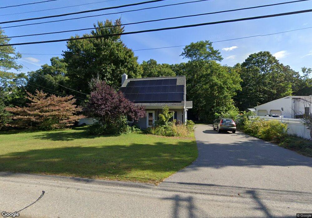
263 Thurston St Wrentham, MA 02093
Estimated Value: $515,000 - $588,000
3
Beds
2
Baths
1,337
Sq Ft
$404/Sq Ft
Est. Value
About This Home
This home is located at 263 Thurston St, Wrentham, MA 02093 and is currently estimated at $540,094, approximately $403 per square foot. 263 Thurston St is a home located in Norfolk County with nearby schools including Delaney Elementary School, Charles E Roderick, and Foxborough Regional Charter School.
Ownership History
Date
Name
Owned For
Owner Type
Purchase Details
Closed on
Dec 23, 2021
Sold by
Fogerty Craig
Bought by
Fogerty Craig and Fogerty Dawn M
Current Estimated Value
Home Financials for this Owner
Home Financials are based on the most recent Mortgage that was taken out on this home.
Original Mortgage
$300,000
Interest Rate
2.88%
Mortgage Type
Purchase Money Mortgage
Purchase Details
Closed on
Nov 5, 2021
Sold by
Fogerty Dawn E and Cloutier Paul M
Bought by
Fogerty Craig
Home Financials for this Owner
Home Financials are based on the most recent Mortgage that was taken out on this home.
Original Mortgage
$300,000
Interest Rate
2.88%
Mortgage Type
Purchase Money Mortgage
Purchase Details
Closed on
Nov 6, 1998
Sold by
Tullock Peter J and Tullock Elen A
Bought by
Cloutier Paul M and Cloutier Dawn E
Home Financials for this Owner
Home Financials are based on the most recent Mortgage that was taken out on this home.
Original Mortgage
$127,500
Interest Rate
6.64%
Mortgage Type
Purchase Money Mortgage
Purchase Details
Closed on
Feb 5, 1993
Sold by
Cruthers David C and Cruthers Josephine
Bought by
Tullock Peter J and Tullock Elen A
Home Financials for this Owner
Home Financials are based on the most recent Mortgage that was taken out on this home.
Original Mortgage
$107,300
Interest Rate
8.1%
Mortgage Type
Purchase Money Mortgage
Create a Home Valuation Report for This Property
The Home Valuation Report is an in-depth analysis detailing your home's value as well as a comparison with similar homes in the area
Home Values in the Area
Average Home Value in this Area
Purchase History
| Date | Buyer | Sale Price | Title Company |
|---|---|---|---|
| Fogerty Craig | -- | None Available | |
| Fogerty Craig | $400,000 | None Available | |
| Cloutier Paul M | $159,400 | -- | |
| Tullock Peter J | $113,000 | -- |
Source: Public Records
Mortgage History
| Date | Status | Borrower | Loan Amount |
|---|---|---|---|
| Previous Owner | Fogerty Craig | $300,000 | |
| Previous Owner | Tullock Peter J | $50,000 | |
| Previous Owner | Tullock Peter J | $190,000 | |
| Previous Owner | Tullock Peter J | $127,500 | |
| Previous Owner | Tullock Peter J | $107,300 |
Source: Public Records
Tax History Compared to Growth
Tax History
| Year | Tax Paid | Tax Assessment Tax Assessment Total Assessment is a certain percentage of the fair market value that is determined by local assessors to be the total taxable value of land and additions on the property. | Land | Improvement |
|---|---|---|---|---|
| 2025 | $5,435 | $468,900 | $243,800 | $225,100 |
| 2024 | $5,184 | $432,000 | $243,800 | $188,200 |
| 2023 | $4,909 | $389,000 | $221,600 | $167,400 |
| 2022 | $4,620 | $338,000 | $199,600 | $138,400 |
| 2021 | $4,359 | $309,800 | $178,300 | $131,500 |
| 2020 | $4,483 | $314,600 | $162,700 | $151,900 |
| 2019 | $4,122 | $291,900 | $147,900 | $144,000 |
| 2018 | $4,071 | $285,900 | $147,900 | $138,000 |
| 2017 | $3,828 | $268,600 | $145,000 | $123,600 |
| 2016 | $3,743 | $262,100 | $140,800 | $121,300 |
| 2015 | $3,648 | $243,500 | $135,400 | $108,100 |
| 2014 | $3,589 | $234,400 | $130,200 | $104,200 |
Source: Public Records
Map
Nearby Homes
- 120 Hawes St
- 483 Thurston St
- 65 Pond St
- 362 East St
- 319 Taunton St
- 1 Lorraine Metcalf Dr
- 270 Dedham St
- 10 Nature View Dr
- 15 Nature View Dr
- 25 Foxboro Rd
- 11 Goodwin Dr
- 11 Earle Stewart Ln
- Lot 1 - Blueberry 2 Car Plan at King Philip Estates
- Lot 8 - Blueberry 2 Car Plan at King Philip Estates
- Lot 6 - Blueberry 3 Car Plan at King Philip Estates
- Lot 2 - Camden 2 Car Plan at King Philip Estates
- Lot 7 - Cedar Plan at King Philip Estates
- Lot 4 - Hemingway 2 Car Plan at King Philip Estates
- Lot 3 - Blueberry 2 Car Plan at King Philip Estates
- 131 Creek St Unit 7