
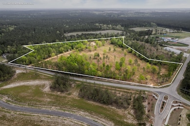
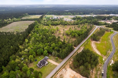
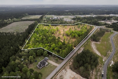

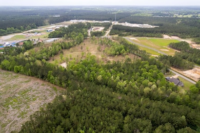
263 Todd Rd Sumrall, MS 39482
Estimated payment $1,759/month
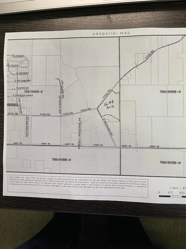
About This Lot
GREAT INVESTMENT PROPERTY TO DEVELOP COMMERCIALLY OR RESIDENTAILLY, LOCATED INSIDE CITY LIMITS OF SUMRALL !!!! LOCATION - LOCATION - LOCATION !!!! 16.44 Acres located on the SEC of the Intersection at Todd Rd & N Rayburn Rd. Across the street from Magnolia Station Subdivision ( the newest development in Sumrall with 200+ lots ). Also just a few hundred yards from The Oaks Subdivision & from the New Sumrall Elementary School and the Sumrall Youth Baseball & Soccer Complex.
Property Details
Property Type
- Land
Est. Annual Taxes
- $284
Lot Details
- 16.44 Acre Lot
- Level Lot
- Open Lot
Map
Tax History
| Year | Tax Paid | Tax Assessment Tax Assessment Total Assessment is a certain percentage of the fair market value that is determined by local assessors to be the total taxable value of land and additions on the property. | Land | Improvement |
|---|---|---|---|---|
| 2022 | $261 | $1,694 | $0 | $0 |
| 2021 | $284 | $1,850 | $0 | $0 |
| 2020 | $1,961 | $12,834 | $0 | $0 |
| 2019 | $1,980 | $12,958 | $0 | $0 |
| 2018 | $1,952 | $12,777 | $0 | $0 |
| 2017 | $1,920 | $12,569 | $0 | $0 |
| 2015 | -- | $12,829 | $0 | $0 |
| 2014 | -- | $12,752 | $0 | $0 |
| 2013 | -- | $12,192 | $0 | $0 |
Property History
| Date | Event | Price | List to Sale | Price per Sq Ft |
|---|---|---|---|---|
| 08/11/2023 08/11/23 | For Sale | $325,000 | 0.0% | -- |
| 06/16/2023 06/16/23 | Pending | -- | -- | -- |
| 01/01/2023 01/01/23 | For Sale | $325,000 | 0.0% | -- |
| 12/31/2022 12/31/22 | Off Market | -- | -- | -- |
| 04/29/2022 04/29/22 | For Sale | $325,000 | -- | -- |
Source: Hattiesburg Area Association of REALTORS®
MLS Number: 127950
APN: 113-05-009.000
Disclaimer: Certain information contained herein is derived from information provided by parties other than Homes.com. All information provided is deemed reliable, but is not guaranteed to be accurate and should be independently verified.
![]() IDX information is provided exclusively for personal, non-commercial use, and may not be used for any purpose other than to identify prospective properties consumers may be interested in purchasing. Information is deemed reliable but not guaranteed.
IDX information is provided exclusively for personal, non-commercial use, and may not be used for any purpose other than to identify prospective properties consumers may be interested in purchasing. Information is deemed reliable but not guaranteed.
- 6.45 Acres Todd Rd
- 22 Acres Mol Todd Rd
- 12 Southdown Rd
- 30 W Sycamore
- 0 Ms-589
- 4 Front Ave
- 0000 Mississippi 42
- 322 Mississippi 42
- 00 Mississippi 42
- 33 Will Brown Ln
- 9 Sanctuary Ln
- 76 Meadow Breeze Dr
- 00 Center Ave
- 4837 Mississippi 589
- 4837 Highway 589
- 0 Mississippi 589
- 150 Latigo Loop
- 171 Latigo Loop
- 95.3 ac Rocky Branch Rd
- 000 Rocky Branch Rd
- 10 Moss Point Rd
- 3 Courtland Dr
- 147 Place Blvd
- 154 Hawthorne Dr
- 155 Cross Creek Pkwy
- 75 Cross Creek
- 27 Lake Forgetful
- 8 Eagles Trail
- 100 Breckenridge Dr
- 16 Hillcrest Dr
- 109-109 Shemper Dr
- 239 Hartfield Rd
- 29 Park Place
- 12 Park Place
- 29 Hillcrest Dr
- 216 Westover Dr
- 4124 W 4th St
- 900 Beverly Hills Rd
- 22 Campbell Scenic Dr
- 3901 W 4th St

Ask me questions while you tour the home.