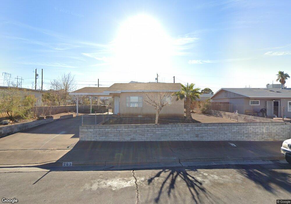
263 Tungsten St Henderson, NV 89015
Downtown Henderson NeighborhoodEstimated Value: $273,000 - $306,000
2
Beds
1
Bath
702
Sq Ft
$410/Sq Ft
Est. Value
About This Home
This home is located at 263 Tungsten St, Henderson, NV 89015 and is currently estimated at $287,633, approximately $409 per square foot. 263 Tungsten St is a home located in Clark County with nearby schools including Robert L Taylor Elementary School, B Mahlon Brown Academy of International Studies, and Foothill High School.
Ownership History
Date
Name
Owned For
Owner Type
Purchase Details
Closed on
Oct 4, 2016
Sold by
Fierro Rudolph
Bought by
Fierro Rudolph and Fierro Rudy Rodela
Current Estimated Value
Home Financials for this Owner
Home Financials are based on the most recent Mortgage that was taken out on this home.
Original Mortgage
$44,500
Outstanding Balance
$19,800
Interest Rate
3.43%
Mortgage Type
New Conventional
Estimated Equity
$267,833
Purchase Details
Closed on
Dec 22, 2004
Sold by
Fierro Rudy Rodela and Fierro Sylvia
Bought by
Fierro Rudolph
Create a Home Valuation Report for This Property
The Home Valuation Report is an in-depth analysis detailing your home's value as well as a comparison with similar homes in the area
Home Values in the Area
Average Home Value in this Area
Purchase History
| Date | Buyer | Sale Price | Title Company |
|---|---|---|---|
| Fierro Rudolph | -- | Wfg Title Co | |
| Fierro Rachel | -- | Wfg National Title Co | |
| Fierro Rudolph | -- | -- |
Source: Public Records
Mortgage History
| Date | Status | Borrower | Loan Amount |
|---|---|---|---|
| Open | Fierro Rudolph | $44,500 |
Source: Public Records
Tax History
| Year | Tax Paid | Tax Assessment Tax Assessment Total Assessment is a certain percentage of the fair market value that is determined by local assessors to be the total taxable value of land and additions on the property. | Land | Improvement |
|---|---|---|---|---|
| 2026 | $494 | $37,600 | $27,563 | $10,037 |
| 2025 | $457 | $32,069 | $22,050 | $10,019 |
| 2024 | $424 | $32,069 | $22,050 | $10,019 |
| 2023 | $424 | $32,462 | $23,450 | $9,012 |
| 2022 | $393 | $28,358 | $20,300 | $8,058 |
| 2021 | $364 | $27,806 | $20,300 | $7,506 |
| 2020 | $335 | $25,511 | $18,200 | $7,311 |
| 2019 | $314 | $20,327 | $13,300 | $7,027 |
| 2018 | $300 | $19,900 | $13,300 | $6,600 |
| 2017 | $494 | $17,044 | $10,500 | $6,544 |
| 2016 | $282 | $13,679 | $7,350 | $6,329 |
| 2015 | $280 | $11,046 | $4,900 | $6,146 |
| 2014 | $271 | $9,080 | $4,900 | $4,180 |
Source: Public Records
Map
Nearby Homes
- 254 W Basic Rd
- 247 Tungsten St
- 234 W Basic Rd
- 211 W Atlantic Ave
- 206 W Atlantic Ave
- 203 W Pacific Ave
- 119 Manganese St
- 126 Magnesium St
- 23 Magnesium St
- 111 Copper St
- 119 E van Wagenen St
- 211 Viewmont Dr
- 1 S Water St
- 228 E van Wagenen St
- 3 Wyoming Ave
- 405 Box Elder Way
- 15 Washington Way
- 39 E Pacific Ave
- 434 Crestway Rd
- 230 W Rochell Dr
- 267 Tungsten St
- 259 Tungsten St
- 271 Tungsten St
- 271 Tungsten St
- 255 Tungsten St
- 262 W Basic Rd
- 266 W Basic Rd
- 258 W Basic Rd
- 262 Tungsten St
- 262 Tungsten St
- 275 Tungsten St
- 251 Tungsten St
- 258 Tungsten St
- 270 W Basic Rd
- 270 Tungsten St Unit Front
- 270 Tungsten St Unit none
- 270 Tungsten St
- 270 Tungsten St Unit D
- 270 Tungsten St Unit C
- 270 Tungsten St Unit A
Your Personal Tour Guide
Ask me questions while you tour the home.